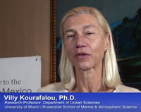
The Influence of river induced fronts on hydrocarbon transport project is lead by P.I. Villy Kourafalou, University of Miami.
The overarching study objective is to understand, quantify and be able to predict the role of river plume induced fronts and circulation regimes in enhancing, modifying or altering the transport pathways of hydrocarbons, in the presence of complex topography, shelf flows and strong oceanic currents. Strong evidence has emerged that such fronts and currents played a crucial, but poorly understood, role controlling oil pathways in the Gulf of Mexico (GoM) during the Deepwater Horizon (DwH) incident. The study area will cover the entire GoM, including the Florida Straits.
Two major hypotheses will be examined: a) large river plumes create distinct circulation regimes, separated with strong fronts that are of fundamental importance for hydrocarbon transport; b) accurate estimates of hydrocarbon pathways need to take into account the thickness of oil. This study will show under what conditions river plumes may help entrain oil and guide it toward the coastline (prevailing case west of the Mississippi Delta) or may help push oil offshore, acting as a barrier for onshore pathways (prevailing case east of the Mississippi Delta). The latter is also connected to river plume interaction with offshore flows, specifically the Loop Current (LC) system.
This project proposes to employ novel analyses of satellite data, targeted field surveys, and data-guided, high resolution physical, biochemical and oil spill simulations to explore details on hydrocarbon transport, with updated methodologies to estimate and model oil thickness. Both the true conditions of the DwH incident and a variety of relevant alternative scenarios will be studied. A known active leakage site, the Taylor Energy platform near the Mississippi Delta (leaking oil since 2004) will be used for in situ estimates of oil spreading and thickness under different conditions in the surrounding environment, which is dominated by Mississippi influence and LC intrusions. These in situ data will then be used to calibrate oil thickness estimation from remote sensing, allowing a more accurate initialization of the proposed oil spill simulations. This approach will fill important knowledge gaps and result in advanced understanding of the conditions controlling the complex hydrocarbon pathways in the GoM.
Expected outcomes are to:
• Understand how fronts and circulation due to river plumes influence hydrocarbon transport
• Derive methodology to: a) measure oil spill extent and thickness, combining satellite products and in situ measurements; b) perform oil spill simulations that accommodate data-derived oil thickness.
This project is well focused on: a) understanding specific processes impacting hydrocarbon transport in the GoM, which are currently not well understood; b) accommodating a specific oil parameter (thickness) that has been challenging to estimate and, therefore, largely missing in oil spill prediction. Results will thus be of fundamental importance both scientifically and for resource management and disaster response.
Click for access to GoMRI’s YouTube videos of RFP-V Projects…
************
This project was funded by the Gulf of Mexico Research Initiative (GoMRI) in the RFP-V funding program.
The Gulf of Mexico Research Initiative (GoMRI) is a 10-year independent research program established to study the effect, and the potential associated impact, of hydrocarbon releases on the environment and public health, as well as to develop improved spill mitigation, oil detection, characterization and remediation technologies. An independent and academic 20-member Research Board makes the funding and research direction decisions to ensure the intellectual quality, effectiveness and academic independence of the GoMRI research. All research data, findings and publications will be made publicly available. The program was established through a $500 million financial commitment from BP. For more information, visit http://gulfresearchinitiative.org/.

