Gary Finch Outdoors produced a series of videos highlighting various aspects of the Ecosystem Impacts of Oil and Gas Inputs to the Gulf (ECOGIG) program, its science, and the important partnerships necessary to make ECOGIG successful. Many of these videos were used by local PBS affiliates in Gulf coast states and were available through the ECOGIG website and YouTube. All videos listed below were developed and produced by Finch Productions, LLC.
What Does ECOGIG Do? (PBS Part 1) (2:20)
Scientists aboard the research vessels R/V Endeavor and E/V Nautilus briefly describe the nature of ECOGIG research.
Collaboration Between Nautilus and Endeavor Tour (PBS Part 2) (2:06)
ECOGIG scientists discuss the research they are conducting on a recent cruise aboard the R/V Nautilus and E/V Endeavor.
ECOGIG R/V Atlantis/ALVIN Cruise: March 30-April 23, 2014 (2:00)
Researchers describe the crucial importance of ALVIN dives in assessing the ecosystem impacts of the Deepwater Horizon explosion.
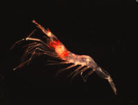
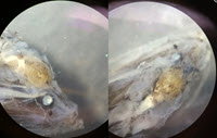
Deep Sea Life: Corals, Fish, and Invertebrates (4:30)
Dr. Chuck Fisher describes his research examining the fascinating and long-lived deep sea corals impacted by effects of the Deepwater Horizon explosion.
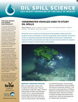
The Eagle Ray Autonomous Underwater Vehicle (AUV) News Piece (5:12)
ECOGIG scientists use the Eagle Ray AUV (autonomous underwater vehicle) to map the seafloor and get visuals so they can better target their sample collecting for study. The National Institute for Undersea Science and Technology (NIUST) provides the submersible.
(Full Length)
(Shortened News Piece)
Food Webs in the Gulf of Mexico (4:30)
ECOGIG scientists Jeff Chanton and Ian MacDonald, both of Florida State University, explain their complementary work exploring the possibility that hydrocarbons from oil have moved into the Gulf food web. Chanton, a chemical oceanographer, tells of a small but statistically significant rise in fossil carbon, a petrochemical byproduct of oil, showing up in marine organisms sampled from Louisiana to Florida. In addition to the hypothesis that Deepwater Horizon oil might be the culprit, biological oceanographer MacDonald discusses other factors that could also be at play, including coastal marsh erosion, natural oil seeps, and chronic oil industry pollution. This is a Finch Productions, LLC video. For more information, visit ECOGIG.ORG. https://ecogig.org/
Landers Technology Development (4:30)
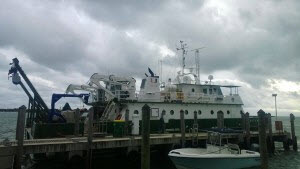
Most of the area around the Deepwater Horizon spill ranges from 900 – 2000 meters below the surface of the Gulf of Mexico. ECOGIG scientists Dr. Chris Martens and Dr. Geoff Wheat talk about Landers, a new technology developed at the University of Mississippi that allows scientists to study the ocean floor at great depths. Landers are platforms custom-equipped with research instruments that can be dropped to the exact site scientists want to study and left for weeks, months, or even years to collect ongoing data.
Marine Snow (4:30)
Dr. Uta Passow describes research she and her colleagues Dr. Arne Dierks and Dr. Vernon Asper conduct on Marine Snow in the Gulf of Mexico. Oil released in 2010 from the Deepwater Horizon explosion floated upwards. Some of this oil then sank towards the seafloor as part of marine snow. When marine snow sinks, it transports microscopic algae and other particles from the sunlit surface ocean to the dark deep ocean, where animals rely on marine snow for food.
Natural Seeps – Geology of the Gulf (4:30)
ECOGIG Scientists Dr. Joe Montoya, Dr. Andreas Teske, Dr. Samantha Joye, and Dr. Ian McDonald describe their collaborative research approach while preparing for the Spring 2014 cruise aboard the R/V Atlantis with research sub ALVIN. Long-term sampling and monitoring of natural oil seeps in the Gulf of Mexico, a global hot spot for these seeps, is crucial for understanding the impacts of oil and gas from explosions like Deepwater Horizon.
Remote Sensing & Modeling (4:30)
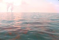
ECOGIG scientists Dr. Ian MacDonald and Dr. Ajit Subramaniam describe their work monitoring the health of the Gulf of Mexico via remote sensing. Using images from satellites and small aircraft flown by volunteers, MacDonald looks for signs of surface oil, which could be the result of a natural seep, anthropogenic seeps (chronic oil leaks from ongoing drilling operations), or a larger spill like Deepwater Horizon. Subramaniam uses the changes in light in these images to help him understand what is happening below the sea surface, with particular focus on the health of phytoplankton populations that make up the base of the marine food web. This is a Finch Productions, LLC video with additional footage provided by Wings of Care, a nonprofit that assists with volunteer filming operations.
ROVs in STEM Education News Piece (4:30)
ECOGIG’s Dr. Chuck Fisher describes the use of ROVs in researching deep -sea corals in the Gulf of Mexico, and Ocean Exploration Trust’s Dr. Bob Ballard explains the powerful impacts of ROVs in STEM education, as shown during a recent visit onboard the EV Nautilus by members of the Girls and Boys Club of the Gulf region.
(Full Length)
(Shortened News Piece)
 In honor of Teacher Appreciation Week, the consortium highlighted the efforts of Gulf Coast teachers who have accompanied Mud & Blood expeditions, gaining hands-on experience dissecting fish and processing sediment cores.
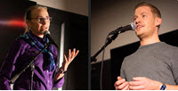
 The webinar, titled “The Benefits and Challenges of Interdisciplinary Research,” features Drs. Rajeev Ramchand and Michael Blum as they discuss their experiences collaborating with researchers from other disciplines.
 Scientists completed
 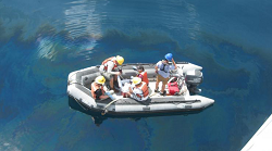 Two Georgia middle school teachers recently joined a consortium research cruise through the AMP-IT-UP (Advanced Manufacturing and Prototyping Integrated to Unlock Potential) program, a multi-year grant focused on cultivating the next generation of STEM innovators. The research was relevant not only for the teachers but also for their students, who have been studying AMP-IT-UP curriculum modules on the Gulf ecosystems.
 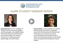 Graduate students Jacqueline Fiore and Vanessa Parks recently discussed their graduate school experiences and working on a transdisciplinary research team in a recent webinar for the Student Spotlight Series.
  Experts at the Consortium for Resilient Gulf Communities (CRGC) come from from diverse fields. Working directly with experts outside their own fields of study enhances students’ insights about disaster, recovery, and resilience, while improving their problem solving skills and passion for their work.
 Matt Firneno recently completed Bachelor’s degrees in physics and mathematics at the University of New Orleans. He participated in LADC-GEMM’s recent research cruise aboard R/V Pelican, where he assisted learned about different forms of data acquisition and real-time data analysis.
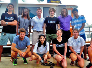
 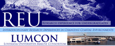 Since 2011, LUMCON has been host to groups of undergraduate students taking part in the Research Experience for Undergraduates (REU) Program. The REU Program helps student interns interested in scientific careers gain experience conducting research in the field. CWC will profile these students and their research through a series of blog and social media posts.
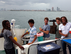
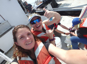
 The clip invites viewers to tour the research vessel alongside Board of Regents members and learn about the research that scientists conduct during cruises.


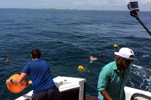
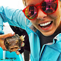
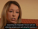 Watch how these high school students work alongside Woods Hole Oceanographic Institution experts conducting oil spill science.