Tag Archives: Pollution

Videos: Gary Finch Highlights ECOGIG Research

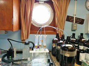
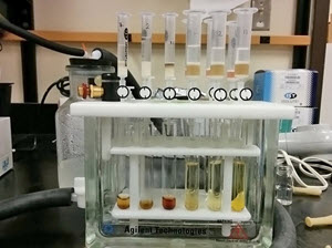
Gary Finch Outdoors produced a series of videos highlighting various aspects of the Ecosystem Impacts of Oil and Gas Inputs to the Gulf (ECOGIG) program, its science, and the important partnerships necessary to make ECOGIG successful. Many of these videos were used by local PBS affiliates in Gulf coast states and were available through the ECOGIG website and YouTube. All videos listed below were developed and produced by Finch Productions, LLC.

What Does ECOGIG Do? (PBS Part 1) (2:20)

Scientists aboard the research vessels R/V Endeavor and E/V Nautilus briefly describe the nature of ECOGIG research.

Collaboration Between Nautilus and Endeavor Tour (PBS Part 2) (2:06)

ECOGIG scientists discuss the research they are conducting on a recent cruise aboard the R/V Nautilus and E/V Endeavor.

ECOGIG R/V Atlantis/ALVIN Cruise: March 30-April 23, 2014 (2:00)

Researchers describe the crucial importance of ALVIN dives in assessing the ecosystem impacts of the Deepwater Horizon explosion.

Deep Sea Life: Corals, Fish, and Invertebrates (4:30)

Dr. Chuck Fisher describes his research examining the fascinating and long-lived deep sea corals impacted by effects of the Deepwater Horizon explosion.

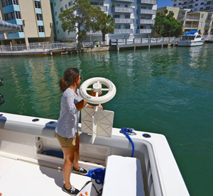
The Eagle Ray Autonomous Underwater Vehicle (AUV) News Piece (5:12)

ECOGIG scientists use the Eagle Ray AUV (autonomous underwater vehicle) to map the seafloor and get visuals so they can better target their sample collecting for study. The National Institute for Undersea Science and Technology (NIUST) provides the submersible.

(Full Length)

(Shortened News Piece)

Food Webs in the Gulf of Mexico (4:30)

ECOGIG scientists Jeff Chanton and Ian MacDonald, both of Florida State University, explain their complementary work exploring the possibility that hydrocarbons from oil have moved into the Gulf food web. Chanton, a chemical oceanographer, tells of a small but statistically significant rise in fossil carbon, a petrochemical byproduct of oil, showing up in marine organisms sampled from Louisiana to Florida. In addition to the hypothesis that Deepwater Horizon oil might be the culprit, biological oceanographer MacDonald discusses other factors that could also be at play, including coastal marsh erosion, natural oil seeps, and chronic oil industry pollution. This is a Finch Productions, LLC video. For more information, visit ECOGIG.ORG. https://ecogig.org/

Landers Technology Development (4:30)

Most of the area around the Deepwater Horizon spill ranges from 900 – 2000 meters below the surface of the Gulf of Mexico. ECOGIG scientists Dr. Chris Martens and Dr. Geoff Wheat talk about Landers, a new technology developed at the University of Mississippi that allows scientists to study the ocean floor at great depths. Landers are platforms custom-equipped with research instruments that can be dropped to the exact site scientists want to study and left for weeks, months, or even years to collect ongoing data.

Marine Snow (4:30)

Dr. Uta Passow describes research she and her colleagues Dr. Arne Dierks and Dr. Vernon Asper conduct on Marine Snow in the Gulf of Mexico. Oil released in 2010 from the Deepwater Horizon explosion floated upwards. Some of this oil then sank towards the seafloor as part of marine snow. When marine snow sinks, it transports microscopic algae and other particles from the sunlit surface ocean to the dark deep ocean, where animals rely on marine snow for food.

Natural Seeps – Geology of the Gulf (4:30)

ECOGIG Scientists Dr. Joe Montoya, Dr. Andreas Teske, Dr. Samantha Joye, and Dr. Ian McDonald describe their collaborative research approach while preparing for the Spring 2014 cruise aboard the R/V Atlantis with research sub ALVIN. Long-term sampling and monitoring of natural oil seeps in the Gulf of Mexico, a global hot spot for these seeps, is crucial for understanding the impacts of oil and gas from explosions like Deepwater Horizon.

Remote Sensing & Modeling (4:30)

ECOGIG scientists Dr. Ian MacDonald and Dr. Ajit Subramaniam describe their work monitoring the health of the Gulf of Mexico via remote sensing. Using images from satellites and small aircraft flown by volunteers, MacDonald looks for signs of surface oil, which could be the result of a natural seep, anthropogenic seeps (chronic oil leaks from ongoing drilling operations), or a larger spill like Deepwater Horizon. Subramaniam uses the changes in light in these images to help him understand what is happening below the sea surface, with particular focus on the health of phytoplankton populations that make up the base of the marine food web. This is a Finch Productions, LLC video with additional footage provided by Wings of Care, a nonprofit that assists with volunteer filming operations.

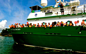
ROVs in STEM Education News Piece (4:30)

ECOGIG’s Dr. Chuck Fisher describes the use of ROVs in researching deep -sea corals in the Gulf of Mexico, and Ocean Exploration Trust’s Dr. Bob Ballard explains the powerful impacts of ROVs in STEM education, as shown during a recent visit onboard the EV Nautilus by members of the Girls and Boys Club of the Gulf region.

(Full Length)

(Shortened News Piece)

Lesson Plan (Grades 6-12): Bay Drift – Tracking Ocean Pollution

This lesson plan teaches middle and high school students how ocean currents transport debris, spilled oil, and other pollutants through the ocean environment.

The lesson uses real data collected during the Biscayne Bay Drift Card Study (Bay Drift), a citizen science study that used Consortium for Advanced Research on Transport of Hydrocarbon in the Environment (CARTHE) GPS drifters and small wooden drift cards to observe local currents and pollutant transport.

Bay Drift: Tracking Ocean Pollution” can be completed in a single class period and provides teachers with background information on ocean pollution transport as well as step-by-step instructions for introducing students to the study. Students will learn how to: (1) analyze drifter data; (2) describe, compare, and contrast both types of drifters used in the study; and (3) use local currents to predict where drifters and pollutants will go. A Story Map of the Bay Drift study was developed to compliment the lesson: https://arcg.is/1e0T40.

A free downloadable copy of “Bay Drift: Tracking Ocean Pollution” is available here.

Visit the dedicated Bay Drift page on the CARTHE website to learn more about the study behind the lesson.

Fact Sheet: Ten Ways to Protect the Gulf/Ocean

These small, educational brochures each highlight ten practical lifestyle practices that individuals can adopt to take better care of the world’s ocean. They can act as hand-outs for people visiting a table, educational booth, or public event.

These files can be printed on card stock, cut, and folded into wallet-sized cards:

There is also a 5×7 postcard version available:

A Spanish-language poster is available for “Ten Ways You Can Help Protect the World’s Ocean”:

Scientists Use Oil Spill Research to Track Pollution in Biscayne Bay

The CARTHE team is receiving data from 15 biodegradable, GPS-equipped drifters. This image shows the tracks after 24 hours. (Image by CARTHE)

The CARTHE team is receiving data from 15 biodegradable, GPS-equipped drifters. This image shows the tracks after 24 hours. (Image by CARTHE)

It’s almost like a game of tug-of-war. There are growing numbers of residents, tourists, and industry at one end and the environment where people live, work, and play at the other. When the former increases, the latter is stressed. This scenario plays out all over the world, especially in coastal areas.

Biscayne Bay near Miami, Florida, is one of these areas. Its population, visitors, and businesses are booming, and its main harbor is expanding to accommodate large vessels in response to the widening of the Panama Canal. This growth has come with increased trash, wastewater runoff, and pollution that end up in the Bay, on beaches, and in mangrove forests. However, scientists are tugging on the same side of the rope as local citizens, pulling resources together to address this environmental concern.

Families worked with Vizcaya Museum and Gardens, Miami Science Barge, and Patricia and Phillip Frost Museum of Science to beautifully paint cards for the Bay Drift study. (Photo by Laura Bracken)

Families worked with Vizcaya Museum and Gardens, Miami Science Barge, and Patricia and Phillip Frost Museum of Science to beautifully paint cards for the Bay Drift study. (Photo by Laura Bracken)

Recently, members of the Vizcaya Museum and Gardens noticed that a lot of debris was accumulating at their waterfront, and they wanted to know why. Vizcaya contacted the Patricia and Phillip Frost Museum of Science  who in turn contacted the Consortium for Advanced Research on Transport of Hydrocarbon in the Environment II (CARTHE II) based at the University of Miami. Other local groups joined the conversation: The International SeaKeepers Society, Insetta Boatworks, Miami Waterkeeper, Miami Science Barge, Surfrider Foundation Miami Chapter, and Biscayne Bay Aquatic Preserves. Conversations turned into action which resulted in the Bay Drift Study.

Drifter cards

Each yellow card is coded and has information that introduces the project and instructs the finder how to report its location. Tracking the location where drift cards are released and found helps researchers to learn how the currents distribute debris in Biscayne Bay (Photo by Laura Bracken)

“This project is an enormous collaborative effort,” said CARTHE Outreach Lead Laura Bracken. “The groups we have partnered with and the many people who have heard about the project want to get involved because they feel so passionately about the issue.”

CARTHE, funded by the Gulf of Mexico Research Initiative, has developed the scientific expertise that is perfect for learning about how particles move in water. They have been conducting research since 2012 to improve our understanding about how ocean currents affected the movement of Deepwater Horizon oil.

“Large oil spills like the Deepwater Horizon event don’t happen very often, but there are continuous pollution events that occur near coastal cities that can take an economic toll,” said Rosenstiel School of Marine and Atmospheric Science oceanographer and CARTHE Director Tamay Özgökmen. “We can use the same technologies we developed to study the oil spill and apply them to address this problem.”

Graduate student releases drifter.

Graduate student Simge Bilgen, a CARTHE team member, deploys a drifter at a water discharge location in the Miami Beach area. The drifters measure currents at the water’s surface, where wind and waves can whip around much faster than deeper currents. The drifters’ GPS trackers lets the team calculate the speed and path of currents. (Photo by Tamay Ozgokmen)

The project uses technology and techniques developed for the CARTHE LASER experiment, such as bamboo drift plates and custom-made GPS-equipped biodegradable drifters, to study how trash, sewage, oil, and harmful algae blooms are transported through South Florida waters. From September 2016 to June 2017, the team will coordinate quarterly drift card deployments from eight locations with scientists, students, families, and members of the community across northern Biscayne Bay.

The project team has several goals: use science to advance understanding of the area’s flow patterns, provide students with a hands-on STEAM (STEM + Art) activity, develop a computer model to visualize how debris moves, and make information publicly available to help sustain local shorelines.

Maritime and Science Technology (MAST) Academy students prepare to release drift cards

Maritime and Science Technology (MAST) Academy students prepare to release drift cards and plates that they painted into Bear Cut. (depends on where you got this photo. (Photo by Diana Udel)

Özgökmen explains what they have learned so far, “The flow trajectories indicate a lot of stop-and-go near the shores due to coastal structures such as marinas, followed by episodic flushing of material into the Florida Current. Understanding how long pollution stays in the Bay is very important, and we can quantify this by using our drifters.”

It’s knowledge like this that could inform future decisions. “If we don’t tackle this from the root, it’s not a real solution,” said Vizcaya Museum & Garden schools program manager Diana Pena. “We’re hoping this information gives us enough to reach out to the public and realize how important they are to environmental stewardship.”

Özgökmen expressed that he and the CARTHE team are excited that the tools and experience that they developed with GoMRI support are addressing a serious coastal pollution problem that is important to local community.

Bay Drift drifter tracks Sept 12-20 from CARTHE on Vimeo.

************

The Gulf of Mexico Research Initiative (GoMRI) is an independent research program established to study the effect, and the potential associated impact, of hydrocarbon releases on the environment and public health, as well as to develop improved spill mitigation, oil detection, characterization and remediation technologies.  An independent and academic 20-member Research Board makes the funding and research direction decisions to ensure the intellectual quality, effectiveness and academic independence of the GoMRI research.  All research data, findings and publications will be made publicly available.  The program was established through a $500 million financial commitment from BP.

Grad Student Jaggi Seeks Solution to World’s Clean Water Shortage

3031a

Aprami Jaggi conducts bench top oil-water partitioning experiments. (photo credit: Kim Nightingale)

As a child in India, Aprami Jaggi witnessed firsthand how polluted water sources impact society.

Her desire to make water remediation her life’s work has led her from Delhi to Calgary, Canada, to study oil mitigation. There she combines geochemistry and geophysics to hunt for scientific answers and practical solutions to the worldwide water pollution problem.

Pursuing a Ph.D. in geosciences at the University of Calgary, Aprami is a GoMRI Scholar with the C-IMAGE consortium. She talks about her journey around the world to gain the knowledge required to help her homeland.

Her Path

“I believe that my very first trip to the National Science Museum resulted in my initiation into science,” Aprami said of her first childhood visit to India’s flagship science museum. “This was followed with ‘100 science experiments for kids’ and lots of exhibitions.” She recalled spending weeks filling buckets from a tanker to cope with a clean water shortage. Getting water this way gave Aprami direction to her growing passion for science. “The abysmal condition of the rivers in the city and the continuing pollution inspired me to work towards water remediation.”

3031b

Aprami stands with the customised partition device used to experimentally simulate oil spill conditions. (photo credit: Kim Nightingale)

Aprami studied environmental engineering at the University of Delhi, where she worked on natural water bioremediation projects and sampled the Yamuna River to identify industrial input hotspots. An internship and subsequent job at Nalco-Champion, an Ecolab Company, introduced her to the industrial capabilities of water treatment. There she helped develop chemistries tailor-made to the respective problem, a direction she decided to pursue further academically.

“At my time in Nalco-Champion, I had heard about the game-changing ideas of Dr. Steve Larter and Dr. Thomas Oldenburg’s group,” she said, adding that their ideology of applied sciences supported her vision of change through research.

3031c

Aprami saw the ocean for the first time in July 2015 when she boarded the Justo Sierra on a cruise she organized. (photo credit: Sara Lincoln)

Larter’s TEDx talk about rethinking the world’s need for fossil fuels inspired her to contact the two researchers and see if their program would be a good fit with her academic studies and water remediation experience. They offered her a position on the C-IMAGE project to study Deepwater Horizon oil spill impacts on the Gulf of Mexico.  She travelled halfway across the globe and began her Ph.D. in September 2014.

Her Work

Aprami is looking at how low molecular-weight, toxic oil compounds such as benzene and toluene enter and travel through the water column. Because traditional measurement methods cannot account for high pressure and low temperature extremes in deep sea conditions, her team built a specialized instrument to measure these compounds’ distribution trends under deepwater blowout conditions. They customized the device using methane-charged oil or ‘live’ oil to simulate dissolved gases’ release during a spill. Initial results, which she presented at the 2016 Gulf of Mexico Oil Spill & Ecosystem Science Conference, indicated methane’s inclusion greatly influences the amount of toxic oil elements that enter the marine environment. The data the device generated will help create future distribution models of toxic pollutants migration through water. She is preparing her first paper for an international peer-reviewed journal about how oil components partition into the water column under various temperature and pressure conditions.

3031d

The all-female science party, Aprami in center, aboard the R/V Weatherbird II in August 2015. (photo courtesy of C-IMAGE)

Aprami also is investigating the fate of oil compounds from the 1979 Ixtocand 2010 Deepwater Horizon oil spills. She collected water samples last summer in areas these spills impacted and is analyzing the molecular structure of dissolved organic matter to understand long term oil fate. “I was onboard the Justo Sierra and Weatherbird-II a week apart,” she recalled. “I covered over 20 different sampling sites and collected samples at different depths using Niskin bottles, while measuring the temperature, conductivity and oxygen profile of the water column.”

Aprami, who had never before seen the ocean, organized the sampling trip to Mexico. Her first expedition lasted 17 days, sampling 12-16 hours per day and helping other research groups on board. She arrived in St. Petersburg, Florida, and began a 5-day sampling effort in the northern Gulf. Afterwards, she organized shipping of the equipment to Sachs Harbour, Northwest Territories, Canada, where another research group took Arctic water samples for comparison studies.

3031e

Aprami transferred and extruded core sediments on board the Weatherbird II in August 2015. (photo courtesy of C-IMAGE)

She shipped the Gulf samples to Calgary and analyzed them using Fourier transform ion cyclotron resonance- mass spectrometry (FTICR-MS). FTICR-MS can resolve complex molecular mixtures and provide the elemental composition of individual compounds, making it ideal for molecular fingerprinting the extremely complex makeup of the oceans’ dissolved organic matter (DOM). The comprehensive DOM screening helps researchers analyze compounds that are poorly understood in terms of environmental and human health impacts and enables tracing of contamination sources. For example, DOM in natural waters near oil seeps and spill sites may represent near terminal degradation petroleum products.

Her Learning

Aprami learned the importance of the research process, which gives scientists tools to persevere, particularly when developing new experimental protocols: “The execution of every big idea starts small. For example, before you take on the big fancy equipment, you have to perfect the art of washing glass ware. Each step along the way is important to reach the end goal.”

She feels fortunate to be part of the GoMRI community, saying the close knit research group working towards a common goal provides a unique opportunity for interdisciplinary and interinstitutional collaboration. “Being a part of C-IMAGE, I get to work alongside people from 19 institutions and 5 different countries,” Aprami explained. “Without GoMRI, such collaboration wouldn’t have been possible.”

Her Future

3031f

The science party on board the Justo Sierra, July-August 2015. (photo courtesy of C-IMAGE)

Aprami plans to complete her Ph.D. in 2018 and pursue a corporate research and development position to help find practical answers to worldwide water pollution problems

“Having been a part of the R&D section in the industry, I realize that although the prospect of ‘blue sky research’ is exciting, we need more and more scientists working on providing real world solutions to existing problems,” she explained.

Praise for Aprami

Aprami’s advisors Steve Larter and Thomas Oldenburg described her as a key team member, both scientifically and socially. She immediately impressed the C-IMAGE administration, who named Aprami their Student of the Month shortly after she arrived in Calgary. She has won additional awards and accolades since, including being asked to give an oral presentation at the 2016 Gulf of Mexico Oil Spill & Ecosystem Science Conference.

3031g

Aprami’s lab equipment for extracting dissolved organic matter from water samples on board the Justo Sierra. (photo credit: Aprami Jaggi)

“Considering that Aprami’s previous studies and experience were not geology or geochemistry related, it is remarkable how deep her technical knowledge is already at this stage,” said Oldenburg. He and Larter acknowledged her exceptional speaking and writing skills, but said her deep scientific knowledge makes her a rising star, “She not only developed special extraction methods usable under limited lab conditions such as cruise ships but also learned in this short time how to operate the unique partition device, GC-MS, LC-MS, and FTICR-MS and how to interpret these diverse data sets.”

Aprami especially impressed her advisors when she organized the research mission into Ixtoc-impacted Gulf waters, overcoming the language barrier with the Mexican crew among other challenges. They reported that many other cruise members expressed how enthusiastically she helped the team in addition to tending to her own sampling.  “Aprami has excellent interpersonal skills, works very hard, is very organized, joins and partially organizes many social events within our research group,” Larter summed up.  “Aprami is an all A+ student!”

3031h

Aprami’s more elaborate lab set up at her lab in Calgary. (photo credit: Aprami Jaggi)

The GoMRI community embraces bright and dedicated students like Aprami Jaggi and their important contributions. The GoMRI Scholars Program recognizes graduate students whose work focuses on GoMRI-funded projects and builds community for the next generation of ocean science professionals. Visit the C-IMAGE website to learn more about their work.

************

This research was made possible in part by a grant from The Gulf of Mexico Research Initiative (GoMRI). The GoMRI is a 10-year independent research program established to study the effect, and the potential associated impact, of hydrocarbon releases on the environment and public health, as well as to develop improved spill mitigation, oil detection, characterization and remediation technologies. An independent and academic 20-member Research Board makes the funding and research direction decisions to ensure the intellectual quality, effectiveness and academic independence of the GoMRI research. All research data, findings and publications will be made publicly available. The program was established through a $500 million financial commitment from BP. For more information, visit http://gulfresearchinitiative.org/.

Young Scientist Visualizes Risk to Whales in an Oil Spill Scenario

Alek with map of his research area

Alek stands next to a map of his research area, holding the drift cards he used in his oil spill study in front of a nautical chart of the Salish Sea. (Provided by Alek)

Fueled by a passion for science and endangered species, Alek designed and executed a research project that involved scientists from eight institutions, four-hundred drift cards, and over a year’s work. A substantial undertaking for any scientist, this is even more impressive because Alek is seven years old.

Alek Finds a Calling

Alek lives in Washington near the coast where he has spent much time watching and learning about orca whales, specifically the Southern Resident Killer Whale of which there are about eighty known remaining.

“I really like the white eye patches they have,” he said. Scientists at the Center for Whale Research near Alek’s home are working hard to track and protect these orcas. “Dr. Ken Balcomb is the main whale researcher there,” said Alek. “He inspires me because he stands up for these whales’ freedom and protection.”

Alek’s hand-written letters asking for donations

A copy of the first two pages of Alek’s hand-written letters asking for donations to fund his research in the form of an “Adopt a Drift Card” campaign. (Provided by Alek)

When Alek was five, he read a book that discussed the environmental impacts of the Deepwater Horizon and Exxon Valdez oil spills, which drove his desire to help protect the ocean ecosystem near his home. “My heart broke because it was so sad,” he recalled. “The whole ocean ecosystem was contaminated for hundreds of miles, and lots of ocean animals died.” Every year, thousands of oil tankers cross the Salish Sea, an intricate network of coastal waterways near the United States-Canadian border where many of these whales live. Alek became concerned that the Southern Resident Killer Whales could encounter and be affected by large amounts of oil if a spill occurred.

A Little Help From His Friends

Alek began gathering books on oil spills and visiting university research websites when he was six, focusing on oceanography departments that study spills.

A hand-drawn map that Alek included in his fundraising letter

A hand-drawn map that Alek included in his fundraising letter shows oil tanker routes in the Salish Sea. (Provided by Alek)

He emailed scientists around the country, including Piers Chapman and Tamay Özgökmen – the directors of the GISR and CARTHE consortia, respectively – for input on how to proceed. More than ten prominent researchers agreed to sit on Alek’s science committee and advise his research.

Alek chose to conduct a drift card study after finding out it would take more than a year to obtain a permit to deploy GPS-enabled drifters, an ocean current tracking method that he wanted to pursue like Özgökmen has done. Drift cards, made of wood or other lightweight materials that float on the water’s surface, are another tool that can show how currents move through an area. Chapman has used drift cards, deploying them at a fixed location and plotting times and points on a map where people report cards they discover (the cards have printed explanations about their purpose and reporting instructions). As Alek’s project developed, Chapman and Özgökmen answered his questions and reviewed his reports.

“Alek is an incredibly motivated young man,” said Chapman. “I was very happy to suggest possible ways that he could analyze his data while putting his report together and make suggestions to help give the video he made about his research more impact. He’s a great kid and deserves every encouragement.”

Alek paints his drift cards

Alek paints his drift cards bright yellow using a non-toxic, biodegradable paint mixture. (Provided by Alek)

Alek’s family was supportive and helped him with the things he couldn’t do himself, such as traveling to various sites and using an electric saw to cut wood into drift cards. However, they encouraged Alek to raise the money needed for the project himself so that he would get a broader experience of being a scientist.

Alek sent letters asking people to sponsor a drift card for one dollar per card. He collected $460 from donors across the country, including many scientists, and even received a letter from President Obama thanking him for his work. He used this money to purchase biodegradable and nontoxic materials to build the cards.

If You Build Them, They Will Drift

Alek releases his finished cards in Rosario Strait

Alek releases his finished cards in Rosario Strait between Peapod Rocks and Buckeye Shoals—one of the busiest oil tanker routes in the Salish Sea. (Provided by Alek)

Alek made two batches of 200 cards, each batch labeled either “A” or “B.” He deployed the cards at Rosario Strait, a dangerous channel that many ships pass through on their way south. He released the first set on September 6, 2014, as the tide was going out and the second set as the tide was coming in on September 21. Days and weeks went by, and one-by-one people in the area returned 181 drift cards. He even received information about one that had floated all the way to Alaska! He calculated the GPS coordinates where each card was found, logged them into a spreadsheet, and used this information to populate maps on Google Earth.

Some people who found drift cards sent Alek a photo

Some people who found drift cards sent Alek a photo of the card they found. Within four months, 45% of Alek’s drift cards had been found and reported. (Provided by Alek)

Alek then mapped the probable path oil would take through the Salish Sea should a spill occur in the Rosario Strait. He compared these paths to reports of orca migrations to show where their paths might encounter oil. “The orcas don’t know how to avoid oil in water, so they would swim right through it,” said Alek. “It is sad to find out that, if my oil spill simulations were real, every single one of the endangered orcas here would be at risk of oil contamination.”

When he completed his study, Alek created a website about the project. The site contains an overview of his work with maps, charts, and graphs showing his findings and suggestions for what the public and lawmakers can do to reduce our dependence on oil and protect endangered species. No one from congress has responded yet, but many others have, including Jane Goodall who sent an email praising his efforts to call attention to these whales’ potential risk. Alek also created a short video summarizing his study, a one hour video detailing his project, and a 154-page scientific report.

This person sent Alek a picture of himself and the drift card he found.

This person sent Alek a picture of himself and the drift card he found. (Provided by Alek)

“I was so impressed by Alek’s one-hour movie of his year-long study—the level of detail was amazing,” reflected Özgökmen. “We are looking at a hardworking, brilliant young mind here. I can only hope that he gets the best education this country can offer, as he will have much to contribute to our society in the future.”

Alek’s Perseverance

Alek admitted that creating the spreadsheets and maps was more work than he expected. After several months of data entry and analysis, there were times when he felt like giving up because of the work volume.

Alek proudly shows off his data spreadsheets.

Alek proudly shows off his data spreadsheets. He has promised to share his data, analysis, and maps with other scientists and research groups to help support their environmental studies. (Provided by Alek)

However, he said that instead of quitting, he looked to the great scientists of history to remind himself to keep going, “I thought: What if they gave up? If Copernicus gave up, we might never know the sun was the center of the solar system. If Charles Darwin gave up, we might not know about evolution. If Crick and Watson gave up, we might not know how genetics and DNA work. I learned I couldn’t give up, because everything that is important in life takes hard work!”

Map showing the estimated contamination areas

This Google Earth map shows the differences in estimated contamination areas one week after oil is released under an outgoing tide (red) and an incoming tide (yellow). (Provided by Alek)

What’s next on Alek’s radar? He sees “endless possibilities” for more science in his future. “Some of the things I am thinking about are chemistry, building an underwater ROV, and 3D printing,” he said. He also stated that, although still many years in the future, he hopes to study marine science in college. One thing is certain: whatever direction he eventually pursues, Alek has already proved himself a precocious scientific thinker in the world of oil spill research.

Map showing the estimated area at risk of oil contamination four months after the simulated spill

This Google Earth map shows the estimated area at risk of oil contamination four months after the simulated spill. (Provided by Alek)

************

The Gulf of Mexico Research Initiative (GoMRI) is a 10-year independent research program established to study the effect, and the potential associated impact, of hydrocarbon releases on the environment and public health, as well as to develop improved spill mitigation, oil detection, characterization and remediation technologies. An independent and academic 20-member Research Board makes the funding and research direction decisions to ensure the intellectual quality, effectiveness and academic independence of the GoMRI research. All research data, findings and publications will be made publicly available. The program was established through a $500 million financial commitment from BP. For more information, visit http://gulfresearchinitiative.org/.