Tag Archives: Modeling

Videos: Deepsea Research Technology

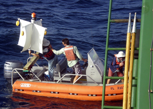
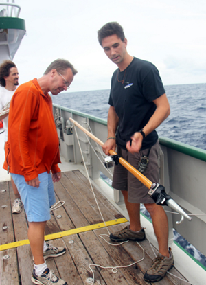
LBL Beacon Recovery Release

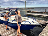
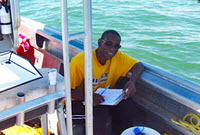
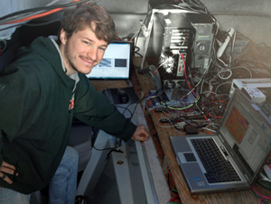
Middle School Student Anja Diercks learns about acoustic release operation to recover a Long Base Line (LBL) acoustic beacon after a successful AUV dive. These LBL beacons are necessary in aiding the Inertial Navigation System of the AUV while on survey on the ocean floor, sometimes at depths of 1600 m or more.

LBL Beacon Recovery

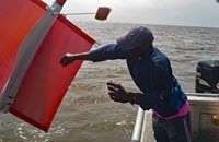
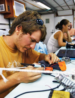
Middle School Student Anja Diercks helps recover the acoustic LBL (Long Base Line) beacon she had released from the ocean floor using an acoustic telemetry system minutes before. The Gulf of Mexico had a surprise for her too.

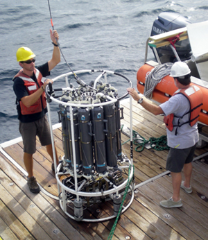
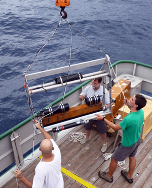
Fiberoptic Multicorer

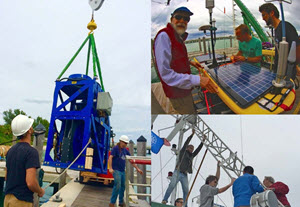
Watch this successful collection of deep sea sediment cores during 7+ foot waves on a recent research cruise in the Gulf of Mexico. The Science team from National Institute for Undersea Science and Technology and Mississippi Mineral Resources Institute deployed a deep sea multicoring device in 1200 meters of water depth, attached to a fiberoptic winch cable. On the coring rig, they mounted several cameras and light sources. This spectacular mission was accomplished aboard the RV Pelican, during a recent research conducted for ECOGIG.

Credits: Diercks, A.; National Institute for Undersea Science and Technology (NIUST), Mississippi Mineral Resources Institute (MMRI) Ecosystem Impacts of Oil & Gas Inputs to the Gulf (ECOGIG) and Gulf of Mexico Research Institute (GOMRI).

Videos: Gary Finch Highlights ECOGIG Research

Gary Finch Outdoors produced a series of videos highlighting various aspects of the Ecosystem Impacts of Oil and Gas Inputs to the Gulf (ECOGIG) program, its science, and the important partnerships necessary to make ECOGIG successful. Many of these videos were used by local PBS affiliates in Gulf coast states and were available through the ECOGIG website and YouTube. All videos listed below were developed and produced by Finch Productions, LLC.

What Does ECOGIG Do? (PBS Part 1) (2:20)

Scientists aboard the research vessels R/V Endeavor and E/V Nautilus briefly describe the nature of ECOGIG research.

Collaboration Between Nautilus and Endeavor Tour (PBS Part 2) (2:06)

ECOGIG scientists discuss the research they are conducting on a recent cruise aboard the R/V Nautilus and E/V Endeavor.

ECOGIG R/V Atlantis/ALVIN Cruise: March 30-April 23, 2014 (2:00)

Researchers describe the crucial importance of ALVIN dives in assessing the ecosystem impacts of the Deepwater Horizon explosion.

Deep Sea Life: Corals, Fish, and Invertebrates (4:30)

Dr. Chuck Fisher describes his research examining the fascinating and long-lived deep sea corals impacted by effects of the Deepwater Horizon explosion.

The Eagle Ray Autonomous Underwater Vehicle (AUV) News Piece (5:12)

ECOGIG scientists use the Eagle Ray AUV (autonomous underwater vehicle) to map the seafloor and get visuals so they can better target their sample collecting for study. The National Institute for Undersea Science and Technology (NIUST) provides the submersible.

(Full Length)

(Shortened News Piece)

Food Webs in the Gulf of Mexico (4:30)

ECOGIG scientists Jeff Chanton and Ian MacDonald, both of Florida State University, explain their complementary work exploring the possibility that hydrocarbons from oil have moved into the Gulf food web. Chanton, a chemical oceanographer, tells of a small but statistically significant rise in fossil carbon, a petrochemical byproduct of oil, showing up in marine organisms sampled from Louisiana to Florida. In addition to the hypothesis that Deepwater Horizon oil might be the culprit, biological oceanographer MacDonald discusses other factors that could also be at play, including coastal marsh erosion, natural oil seeps, and chronic oil industry pollution. This is a Finch Productions, LLC video. For more information, visit ECOGIG.ORG. https://ecogig.org/

Landers Technology Development (4:30)

Most of the area around the Deepwater Horizon spill ranges from 900 – 2000 meters below the surface of the Gulf of Mexico. ECOGIG scientists Dr. Chris Martens and Dr. Geoff Wheat talk about Landers, a new technology developed at the University of Mississippi that allows scientists to study the ocean floor at great depths. Landers are platforms custom-equipped with research instruments that can be dropped to the exact site scientists want to study and left for weeks, months, or even years to collect ongoing data.

Marine Snow (4:30)

Dr. Uta Passow describes research she and her colleagues Dr. Arne Dierks and Dr. Vernon Asper conduct on Marine Snow in the Gulf of Mexico. Oil released in 2010 from the Deepwater Horizon explosion floated upwards. Some of this oil then sank towards the seafloor as part of marine snow. When marine snow sinks, it transports microscopic algae and other particles from the sunlit surface ocean to the dark deep ocean, where animals rely on marine snow for food.

Natural Seeps – Geology of the Gulf (4:30)

ECOGIG Scientists Dr. Joe Montoya, Dr. Andreas Teske, Dr. Samantha Joye, and Dr. Ian McDonald describe their collaborative research approach while preparing for the Spring 2014 cruise aboard the R/V Atlantis with research sub ALVIN. Long-term sampling and monitoring of natural oil seeps in the Gulf of Mexico, a global hot spot for these seeps, is crucial for understanding the impacts of oil and gas from explosions like Deepwater Horizon.

Remote Sensing & Modeling (4:30)

ECOGIG scientists Dr. Ian MacDonald and Dr. Ajit Subramaniam describe their work monitoring the health of the Gulf of Mexico via remote sensing. Using images from satellites and small aircraft flown by volunteers, MacDonald looks for signs of surface oil, which could be the result of a natural seep, anthropogenic seeps (chronic oil leaks from ongoing drilling operations), or a larger spill like Deepwater Horizon. Subramaniam uses the changes in light in these images to help him understand what is happening below the sea surface, with particular focus on the health of phytoplankton populations that make up the base of the marine food web. This is a Finch Productions, LLC video with additional footage provided by Wings of Care, a nonprofit that assists with volunteer filming operations.

ROVs in STEM Education News Piece (4:30)

ECOGIG’s Dr. Chuck Fisher describes the use of ROVs in researching deep -sea corals in the Gulf of Mexico, and Ocean Exploration Trust’s Dr. Bob Ballard explains the powerful impacts of ROVs in STEM education, as shown during a recent visit onboard the EV Nautilus by members of the Girls and Boys Club of the Gulf region.

(Full Length)

(Shortened News Piece)

Grad Student Pandya Investigates How Wind and Waves Influence Airborne Transport of Oil

6748a
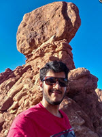
University of Texas at Dallas Ph.D. student Yajat Pandya visits Arches National Park, Utah, after an experimental LiDAR campaign in summer 2019. (Provided by Yajat Pandya)

Hydrocarbons from oil slicks floating on the ocean’s surface can be aerosolized by evaporation, breaking waves and bursting bubbles. Variations in sea, wave, and atmospheric conditions can significantly influence the transport and dynamics of these aerosolized oil droplets. Accurate predictions of where and how far aerosolized oil pollutants will go can help us better understand potential human health impacts from oil spills, which was a concern during Deepwater Horizon.

Yajat Pandya collects and analyzes in situ wind, wave, and atmospheric data to help improve our understanding of how the marine atmospheric boundary layer, where the atmosphere meets and interacts with the ocean, affects how aerosolized oil droplets travel. His findings will help improve numerical Large-Eddy Simulation (LES) predictions of aerosolized oil droplets’ evolution from sea to coast, especially how different atmospheric and sea-wave conditions drive aerosols’ distribution and concentration as they travel.

Yajat is a Ph.D. student with the University of Texas at Dallas’s School of Engineering & Computer Science and a GoMRI Scholar with the project Transport of Aerosolized Oil Droplets in Marine Atmospheric Boundary Layer: Coupling Wind LiDAR Measurements and Large-Eddy Simulations.

His Path

6748b
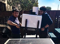
University of Texas at Dallas Ph.D. students Lu Zhan (left) and Yajat Pandya (right) deploy a Halo Photonics Doppler Wind LiDAR. (Photo credit: Matteo Puccioni)

Yajat’s interest in fluid flows and mathematics as a teenager led him to pursue a bachelor’s degree in aerospace engineering at the Indian Institute of Technology Kharagpur. As an undergraduate, he gained experience working with experimental fluid flows and focused his thesis project on small-scale wind turbines, which introduced him to complex atmospheric boundary layer flows. While exploring potential doctoral programs, he discovered that Dr. Giacomo Valerio Iungo was leading the Wind, Fluids, and Experiments (WindFluX) laboratory at the University of Texas at Dallas and had received a GoMRI-funded grant to investigate aerosolized oil transport. Yajat was excited to join Dr. Iungo’s lab team as a doctoral student.

“From a fluid dynamics perspective, anthropogenic large-scale atmospheric events are not understood well enough to develop confidence in predicting the harmful effects,” said Yajat. “The unfortunate Deepwater Horizon spill event provided me an opportunity to learn and share my understanding of oil droplets emerging from the coastal regions into the air and their transport via atmospheric motions.”

His Work

6748c
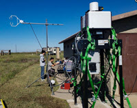
Graduate student researchers from the University of Texas at Dallas and the University of Houston deploy a Doppler wind LiDAR and a sonic anemometer at the shore of Galveston Island State Park. They conducted extensive instrumentation testing and monitoring before the experiment to confirm satellite connectivity for remote access and data transfer. (Photo credit: Yajat Pandya)

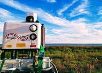
Yajat uses Doppler Wind LiDAR (Light Detection and Ranging) to measure wind speed and aerosol backscatter within 2 km of its deployment location to determine aerosol transport by turbulent atmospheric flows. He participated in a five-month deployment of his team’s Halo Photonics LiDAR and a sonic anemometer (an instrument that measures instantaneous wind speed) from the coast of Galveston, Texas. Collaborating with Galveston Island State Park, their team set up an experimental site 100 m from shore that allowed them to remotely access and monitor the equipment from their Dallas laboratory. They collected measurements of wind speeds, wave conditions, atmospheric stability, and weather conditions from November 2018 to April 2019. Multiple LiDAR scanning procedures provided an overview of local wind and aerosol trends, which helped the team design specific scans to capture turbulent flow in the marine atmospheric boundary layer. These scans included determining the vertical and horizontal spatial distribution of aerosol plumes, characterizing the variability of wind speed and aerosol concentration with high-frequency resolution, and characterizing features of the boundary layer profile.

Yajat observed that winds moving from sea to land exhibited significantly higher backscatter than winds moving from land to sea, suggesting that marine aerosols travel mainly toward the coastline. In winds from sea to land with speeds greater than 10 meters per second, aerosol plumes in the surf zone rose as high as 50 m above sea level, indicating the occurrence of unexpected aerosol buoyancy and turbulent diffusion (the mixing and dispersion of aerosol plumes emerging from the sea surface). Yajat applied fundamental flow theories to the data and found that the total aerodynamic roughness length (a parameter quantifying sea surface perturbation based on wind activity) that the instruments measured was significantly higher than existing open-sea aerodynamic roughness models predicted. The aerodynamic roughness regime significantly affects predictions of the turbulent scales of a boundary layer flow. In this case, the model’s underestimation of roughness may explain the inaccuracy in predicting how aerosols disperse in the coastal zone.

6748d
A Doppler wind LiDAR and sonic anemometer measure atmospheric turbulence and marine aerosol distribution in the Gulf of Mexico surf zone. (Photo credit: Yajat Pandya)

“This observation has led us to believe that there might be a dominant drag related to the roughness component, which is in turn dependent on implicit wind-wave processes,” explained Yajat. “Characterizing aerodynamic roughness length will help to provide more-efficient turbulent flow parameters for LES predictions of aerosol-particle transport.”

Next, Yajat will examine the correlation between atmospheric turbulence (small-scale, chaotic wind motions that vary in speed and direction) and aerosol backscatter. Based on a preliminary assessment of the data, he expects to find an inverse correlation between elevated wind turbulence and elevated aerosol concentrations. If confirmed by the research, he can use this correlation to create a model that can predict real-time aerosol structures in the marine boundary layer under varying wind speeds, wave heights, and atmospheric stratification.

His Learning

6748e
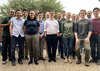
Members of the University of Texas at Dallas Wind, Fluids, and Experiments (WindFluX) research lab. (L-R) Dr. Giacomo Valerio Iungo, Mortaza Pirouz , Yajat Pandya, Kori Harlan, Matteo Puccioni, Thomas Bennett, Jamie Eriksson, Jacob Perkins, Stefano Letizia, Benjamin William Weldon, Sara Frances Hartke, Samir Ahmedyari, Lu Zhan, Tristan Charles, Wasi Ahmed, and Brian Wei. (Provided by Yajat Pandya)

Dr. Iungo helped familiarize Yajat with the functionality and experimental procedures of the LiDAR and other analytical instruments and taught him data analysis techniques that focus on finding new insights. “One highlight of my research experience so far was realizing the deviation of my dataset from the known open-sea models and how much more we have to learn and solve,” said Yajat. While Dr. Iungo taught Yajat that scientific research often reveals valuable questions, whose answers can help strengthen one’s findings, he also emphasized the importance of not allowing new questions to distract from the main research goal.

“I feel special and blessed to be a part of a noble initiative aimed at minimizing the effects of devastating anthropogenic events like oil spills and marine pollution,” said Yajat. “The research has a unique purpose because everyone in the GoMRI community is motivated to save and preserve the ecosystem. As an experimentalist, it is particularly uplifting to see the incredible experimental efforts put forth by GoMRI researchers.”

Yajat hopes to find a research career where he can continue contributing to our understanding of aerosol turbulence under large-scale environmental events. He feels that successful scientific research results from training the curious part of your mind to be more focused and disciplined. “Many supplementary skills like problem solving and critical thinking are developed in the pursuit of your research goal,” he said. “Pushing the limits of human knowledge in your own unique way is fun and oddly satisfying!”

Praise for Yajat

Dr. Iungo reflected on Yajat’s research achievements, highlighting his significant contributions to the team’s LiDAR experiment in Galveston Island State Park. Yajat’s collaboration with his WindFluX lab mates resulted in a successful deployment of the mobile LiDAR station and the completely remote operation of their instruments. “I am very confident that his work will lead to new modeling strategies for predictions of marine aerosol concentration in the marine atmospheric boundary layer,” said Dr. Iungo.

The GoMRI community embraces bright and dedicated students like Yajat Pandya and their important contributions. The GoMRI Scholars Program recognizes graduate students whose work focuses on GoMRI-funded projects and builds community for the next generation of ocean science professionals.

By Stephanie Ellis and Nilde Maggie Dannreuther. Contact sellis@ngi.msstate.edu for questions or comments.

************

The Gulf of Mexico Research Initiative (GoMRI) is a 10-year independent research program established to study the effect, and the potential associated impact, of hydrocarbon releases on the environment and public health, as well as to develop improved spill mitigation, oil detection, characterization and remediation technologies. An independent and academic 20-member Research Board makes the funding and research direction decisions to ensure the intellectual quality, effectiveness and academic independence of the GoMRI research. All research data, findings and publications will be made publicly available. The program was established through a $500 million financial commitment from BP. For more information, visit http://gulfresearchinitiative.org/.

© Copyright 2010-2020 Gulf of Mexico Research Initiative (GoMRI) – All Rights Reserved. Redistribution is encouraged with acknowledgment to the Gulf of Mexico Research Initiative (GoMRI). Please credit images and/or videos as done in each article. Questions? Contact web-content editor Nilde “Maggie” Dannreuther, Northern Gulf Institute, Mississippi State University (maggied@ngi.msstate.edu).

Grad Student Jacketti Enhances Modeling Capability to Track Sunken Oil

6720a
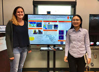
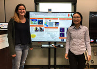
Ph.D. students Mary Jacketti (left) and Chao Ji (right) present their research at the University of Miami College of Engineering Research Day. (Provided by Chao Ji)

Oil spilled in the ocean can sink to the seafloor due to its high density or by attaching to floating particulate matter, as happened during the Marine Oil Snow Sedimentation and Flocculent Accumulation (MOSSFA) event following Deepwater Horizon. Oil that reaches the seafloor can smother benthic organisms or the organisms can ingest it, causing long-term negative effects, as happened to some deep-water coral and foraminifera.

Advanced tools are needed to predict oil transport to shorelines or if it will sink to the seafloor and affect sensitive ecosystems. The Subsurface Oil Simulator (SOSim) model, originally developed by the NOAA Response and Restoration’s Emergency Response Division during Deepwater Horizon, uses statistics to infer the velocity and dispersion of oil spilled in the water column and predict oil’s transport. The model was initially developed to track only sunken oil (oil that has reached the seafloor) on flat bay bottoms following an instantaneous spill, conditions that represent only a portion of the Gulf of Mexico environment.

6720b
University of Miami Ph.D. student Mary Jacketti presents her research at the 2020 Gulf of Mexico Oil Spill and Ecosystem Research Conference. (Provided by Mary Jacketti)

Mary Jacketti is using field data and bathymetric data to develop computational codes that will expand the capabilities of the SOSim model so that it can track sunken oil from instantaneous and continuous spills in bay, river, coastal, and continental shelf environments. Simulations that incorporate these areas can help responders locate sunken oil during emergency spill response.

Mary is a Ph.D. student with the University of Miami’s Department of Civil, Architectural and Environmental Engineering and a GoMRI Scholar with the project Inferential/Parametric Forecasting of Subsurface Oil Trajectory Integrating Limited Reconnaissance Data with Flow Field Information for Emergency Response.

Her Path

Mary developed a love for science through her middle school’s annual science fair. She enjoyed identifying a scientific problem, developing methods to solve the problem, and analyzing results. During high school, she often participated in outdoor adventures and became passionate about the environment. While preparing for college, she realized that environmental engineering would allow her to use science and mathematics to develop new ways to lessen human impacts on the environments.

6720c
University of Miami Ph.D. students Mary Jacketti (left) and Chao Ji (right) and project co-PI Dr. CJ Beegle-Krause (middle) at the 2020 Gulf of Mexico Oil Spill and Ecosystem Research Conference in Tampa, Florida. (Provided by Mary Jacketti)

As an environmental engineering undergraduate student at the University of Miami, Mary served as the treasurer for the Society of Women Engineers. She participated in the group’s annual Introduce a Girl to Engineering Day, which taught elementary school girls about diverse STEM careers. She also participated in a research internship documenting whale and dolphin behavior for the Cape May Whale Watch and Research Center. During her internship, she conducted her own research project assessing water quality of waterbodies in Southern New Jersey. Mary later volunteered for an EPA-funded project using nanoparticles to filter antibiotic resistant contaminants out of drinking water.

“My undergraduate experiences showed me that I am passionate about conducting research that will better the environment and public health. I also found a great passion advocating for women in STEM fields to help narrow the gender gap in classrooms and the workplace,” said Mary. “I hope to be able to conduct research that will stand the test of time, while also motivating and illuminating the path for young women to conduct research in STEM.”

After completing her bachelor’s degree, University of Mami professor Dr. James Englehardt asked Mary if would join his GoMRI-funded research team developing a model that helps minimize how oil spills impact the environment. Mary knew she could directly apply skills she learned as an undergraduate student to improve the way scientists approach emergency oil spill response. She joined Dr. Englehardt’s lab as a Ph.D. student and is helping develop code that will allow the SOSim model to more accurately track sunken oil.

Her Work

6720d
This graph depicts Subsurface Oil Simulator (SOSim) model predictions of sunken oil locations across various depths (dashed lines) 14 days after the initial spill (black cross). The model used field data (red dots) to identify areas with the highest relative conditional probability of finding submerged oil (yellow shades) and 95% confidence bounds (solid green lines). University of Miami Ph.D. student Mary Jacketti said the model successfully predicted sunken oil in the same location the field data was collected. (Provided by Mary Jacketti)

Mary explained that her research adds a new component to the team’s efforts to expand the SOSim model capability to track submerged oil (oil suspended in the water column). While the submerged oil model uses output from existing trajectory models (such as the SINTEF Oil Spill Contingency and Response, or OSCAR model) to identify which ocean layers will likely contain oil, the sunken oil model she’s working on uses bathymetric data to simulate a selected area’s seafloor depth. If submerged oil in the area’s water column eventually sinks, the sunken oil model can predict where it will settle.

Mary dedicated her initial efforts to learning about the Python coding language and Bayesian statistical theory, which quantitatively updates predictions as new information becomes available. She began developing simple modeling code to simulate pollutant location and concentration and then expanded the code to include sunken oil. Together, she and Dr. Englehardt developed a strategy to incorporate bathymetry data into the model with existing field data to inform the Bayesian statistical methods that infer unknown model parameters, including oil diffusion and velocity and how many oil patches are on the seafloor.

“Bathymetry plays a significant role in how the sunken oil will be transported, since oil will generally follow contours of constant depth, travelling to and residing in the deeper areas,” Mary said. “Including bathymetry into the SOSim model will help improve spatial and temporal maps of relative sunken oil concentrations for use during emergency response operations.”

Mary validates the new code using available synthetic data (data generated to help simulate certain conditions not seen in the field data) and field data from past spills. She generates SOSim hindcasts to determine if the model can correctly predict the location of the sunken oil and conducts future simulations to see if the model can provide reasonable results. Preliminary results showed that the inclusion of bathymetric data increased the model’s accuracy when predicting sunken oil’s location and transport. Despite relatively sparse sampling of sunken oil concentrations, the SOSim model can make viable predictions using available prior oil spill data to infer oil’s location. Mary acknowledged that having several days of sampled field data improves the model’s prediction accuracy.

“We hope that this model will aid responders in locating and tracking sunken oil [in future spills], resulting in quicker recovery of the oil from the bottom and minimizing the negative impacts the oil may have,” she said. “If SOSim is used during emergency response in the future, field data collected by oil spill responders can be used to further inform the model.”

Her Learning

Dr. Englehardt’s mentorship taught Mary to approach problems in increasingly critical ways and appreciate the power of asking questions. While he encouraged Mary to conduct her research independently and create her own solutions, he was always available to guide and assist. She learned that regardless of the research being conducted, scientists attempt to solve questions and discover new solutions to address problems.

When the team visited SINTEF Ocean in Trondheim, Norway, Mary was excited about the opportunity to work alongside researchers from international institutions. Presenting her research to these scientists improved her presentation skills and hearing their reports improved her knowledge about oil spill modeling. She utilized these skills when presenting her research at the 2020 Gulf of Mexico Oil Spill and Ecosystem Science (GoMOSES) Conference. “At the GoMOSES conference, I was able to attend a graduate student luncheon, where I discussed my research and future career endeavors with other scholars and experts in the field,” she said. “I will forever be grateful for the opportunity GoMRI gave me to conduct research on a topic I am passionate about, while showcasing my research to others in the field.”

As GoMRI comes to a close, Mary will continue her graduate student career through new projects. She plans to find an industry position in risk analysis and environmental modeling that will help her leave a lasting, positive impact on the environment, something she feels passionately about.

Praise for Mary

Dr. Englehardt first noticed Mary when she was a student in his senior-level solid and hazardous waste engineering course. He recalled that she consistently performed at the top of her class and had a positive “team spirit” attitude towards group projects. “When it came time [for Mary] to devise a course project with her classmate, the result was inspirational,” he said. “Mary and her partner conceived and designed a vessel to clean up the Great Pacific Garbage Patch that was at least partially self-propelled, effective, and sustainable. I was impressed with the design, which they developed almost entirely independently.”

Mary’s steady nature and self-imposed high standards prompted Dr. Englehardt to offer her a graduate research position with his team while she was still an undergraduate student. She continued to perform as a top student in Englehardt’s graduate courses while simultaneously battling the steep learning curve associated with her GoMRI research and completing an independent study developing a new microbial risk assessment method.

“Mary has mastered the advanced Bayesian probability and statistical inference skills required for our work and become a facile computational scientist. I depend on her qualifications and consistent commitment to excellence every day as we complete the development of our novel Bayesian model,” he said. “All of us on the team consider Mary a good friend, especially her close co-worker Chao Ji, with whom she runs marathon-style events in her spare time. Along with the rest of our team, I look forward to keeping in touch with Mary and following her career wherever it may lead.”

The GoMRI community embraces bright and dedicated students like Mary Jacketti and their important contributions. The GoMRI Scholars Program recognizes graduate students whose work focuses on GoMRI-funded projects and builds community for the next generation of ocean science professionals.

By Stephanie Ellis and Nilde Maggie Dannreuther. Contact sellis@ngi.msstate.edu for questions or comments.

************

The Gulf of Mexico Research Initiative (GoMRI) is a 10-year independent research program established to study the effect, and the potential associated impact, of hydrocarbon releases on the environment and public health, as well as to develop improved spill mitigation, oil detection, characterization and remediation technologies. An independent and academic 20-member Research Board makes the funding and research direction decisions to ensure the intellectual quality, effectiveness and academic independence of the GoMRI research. All research data, findings and publications will be made publicly available. The program was established through a $500 million financial commitment from BP. For more information, visit http://gulfresearchinitiative.org/.

© Copyright 2010-2020 Gulf of Mexico Research Initiative (GoMRI) – All Rights Reserved. Redistribution is encouraged with acknowledgement to the Gulf of Mexico Research Initiative (GoMRI). Please credit images and/or videos as done in each article. Questions? Contact web-content editor Nilde “Maggie” Dannreuther, Northern Gulf Institute, Mississippi State University (maggied@ngi.msstate.edu).
Grad Student Tarpley Is Cracking the Code Between Oil Transport and Mud Flocs

6701a
Virginia Institute of Marine Science Ph.D. student Danielle Tarpley holds a sediment core collected from the Lynnhaven River in Virginia. (Photo courtesy of Jessica Turner)

Oil that enters a marine environment can attach to particulate matter suspended in the water and form oil particle aggregates, which then sink to the seafloor. Some oil particle aggregates are created when microbial excretions cause particulate matter and oil to cluster and bind together, forming Marine Oil Snow or MOS. Others result when fine sediment particles adhere to oil without microbial involvement, forming oil sediment aggregates or OSAs. Following Deepwater Horizon, there was a large Marine Oil Snow Sedimentation and Flocculent Accumulation (MOSSFA) event that transported oil to the seafloor, impacting the benthic ecosystem. If an oil spill were to occur in shallower shelf waters where more sediment is suspended in the water column, OSAs would likely play an important role in transporting oil to the seafloor.

Danielle Tarpley is implementing and modifying code that calculates particle aggregation for the Coupled Ocean-Atmosphere-Wave and Sediment Transport (COAWST) numerical model, helping improve predictions about vertical oil transport via flocculated mud particles, or mud flocs. Simulations from this model will help improve overall estimations of oil fate by predicting the amount and location of sinking OSAs.

Danielle is a Ph.D. student with the Virginia Institute of Marine Science’s Department of Physical Sciences and a GoMRI Scholar with the Consortium for Simulation of Oil-Microbial Interactions in the Ocean (CSOMIO).

Her Path

6701b
(L-R) Virginia Institute of Marine Science Ph.D. students Danielle Tarpley and Jessica Turner and master’s student Cristin Wright hold sediment cores after a long day of fieldwork in the York River estuary. (Photo courtesy of Grace Massey)

In her early high school years, Danielle whizzed through her math classes. Hoping to advance her education, she enrolled at a math and science school for her junior and senior years and took a marine biology class that sparked her scientific curiosity. That experience motivated her to enter the marine science undergraduate program at Coastal Carolina University, which required students to study marine biology, geology, chemistry, and physical oceanography and helped her discover an affinity for the physical sciences. Later, she completed a master’s degree there in coastal marine and wetland studies, which included analyzing observational data using numerical model results.

When Danielle began her Ph.D. studies at the Virginia Institute of Marine Science (VIMS), she started working with the COAWST model to study the transport of mud flocs. There, she joined Dr. Courtney Harris’s Sediment Transport Modeling lab, which became part of a GoMRI-funded CSOMIO research team, developing a model framework describing oil transport. The oil transport model will account for biological and particulate interactions with hydrocarbons in the ocean. Danielle’s CSOMIO research adapts the flocculation model to account for the transport of settling oil within particle aggregates. “I find science challenging, like a puzzle – if the pieces are put together properly, then you can answer questions. It’s very satisfying when the pieces fall into place, because my curiosity has an answer as well as more questions,” said Danielle. “I like that there isn’t one set method to reaching an answer, and I enjoy learning or discovering different methods to produce results.”

Her Work

6701c
Virginia Institute of Marine Science Ph.D. student Danielle Tarpley (left) pulls in the GOMEX box corer while collecting sediment samples from the York River estuary in Virginia. (Photo courtesy of Grace Massey)

Danielle and her colleagues are generating computer code that for the state-of-the-art COAWST numerical model originally developed by the US Geological Survey. Because the COAWST model is a community resource, hundreds of researchers use and contribute code to it, meaning that researchers outside of Danielle’s working group will benefit from her model developments. Her Ph.D. research began with developing code for the flocculation model (FLOCMOD) that runs within COAWST’s Regional Ocean Modeling System (ROMS) sediment transport model. The modified code can now account for OSAs to help simulate the sedimentation of spilled oil. “There’s only about a half-dozen people working with the flocculation code in ROMS, and Danielle is one of them,” said Dr. Harris. “She knows how to get in there and figure out what the code is doing and make modifications as needed. Because she has the technical background in FLOCMOD, she’s been a huge help in developing what we call the Oil Particle Aggregate Model, or OPAMOD.”

Laboratory experiments conducted by fellow CSOMIO researchers at the University of Delaware inform the OPAMOD code. The University of Delaware team generates OSAs in jars and collects data about the particles’ properties, composition, size, settling speed, and growth rate. CSOMIO uses the OPAMOD within a comprehensive numerical model that accounts for Gulf of Mexico currents, wave activity, Mississippi River discharge, microbial oil consumption, and floc formation. The result of the model simulation should be comparable to the oil budget estimated following Deepwater Horizon.

6701d
(L-R) Virginia Institute of Marine Science graduate students Jessica Turner, Cristin Wright, and Danielle Tarpley collect sediment samples using a GOMEX box corer on the York River estuary in Virginia. (Photo courtesy of Grace Massey)

The FLOCMOD and OPAMOD code that Danielle tested and uses will help COAWST users reveal how much of the budgeted Deepwater Horizon oil was transported to the seafloor rather than being consumed by microbes, accumulated in surface slicks, or more-widely dispersed by currents. She explained that the model needs to be tested in multiple scenarios, including a Deepwater Horizon oil spill hindcast, similar deep-water releases that favor transport onto adjacent shallow shelves and coastal areas, oil spills directly on the shelf or in hypoxic environments, and spills during cold winter conditions or large river discharge and/or storm events. “I hope the work I’m doing will provide confidence in the use of the FLOCMOD model and the expansion that allows both mud and oil to stick together,” she said. “The main goal is to model the amount and location of the oil and mud that falls to the bottom from an oil spill.”

Her Learning

6701e
Virginia Institute of Marine Science Ph.D. student Danielle Tarpley presents her dissertation research at the 2019 Biennial Coastal & Estuarine Research Federation (CERF) Conference in Mobile, AL. (Photo by Fei Ye)

Working with CSOMIO, Danielle collaborated with scientists from other institutions, including some whose work she had been following for years. Danielle visited other labs and observed how they collected data, gaining a better understanding about data comparison and factors that can limit observational data’s usability, such as equipment capabilities or sample source. Working with Dr. Harris helped Danielle become more confident in her abilities as a scientist, and she recalled the moment when she realized she was coming into her own as a researcher. “I remember sitting in Dr. Harris’s office updating her on my progress, when I realized that our conversation was more similar to a conversation between colleagues than between teacher and student,” she said. “That was definitely a turning point for me.”

Watching Dr. Harris teach, Danielle learned that regularly reviewing and updating lecture material and giving feedback with empathy fostered a better learning environment. She applied these skills when she mentored a Research Experiences for Undergraduates (REU) student in the computer skills needed to analyze conductivity, temperature, and depth (CTD) and acoustic Doppler current profiler (ADCP) data from the Gulf of Mexico. The data that the student collects will help build input files to represent the Gulf of Mexico for the OPAMOD team. Danielle also worked as an assistant high school earth science teacher and developed a boardgame for the high school class using a water quality and environmental science theme based on the Chesapeake Bay.

Danielle discovered that persistence pays off, especially when preparing manuscripts. “I’ve learned that even though it may be frustrating, it’s always important to double- and triple-check your work with a critical eye,” she said. “Typos and minor formatting issues may still happen, but the science will be strong.” She has enjoyed sharing her research through local community outreach activities, such as the VIMS Marine Science Day and at a “Scientist Walks into a Bar” event in Williamsburg, Virginia.

6701f
(L-R) Virginia Institute of Marine Science post-doc Linlin Cui, Ph.D. student Jessica Turner, master’s student Cristin Wright, and Ph.D. student Danielle Tarpley man a booth at the Institute’s Marine Science Day in May 2019. (Provided by Danielle Tarpley)

She’s also learned the importance of participating in research early in your college years through lab or field work, the REU program, or an internship or fellowship. She found it helpful to ask graduate students about their experiences and advice. “If you have the opportunity to attend a conference as an undergraduate, do it. Move between schools, because you’ll likely have a wider range of experiences, meet more people, and build a wider network.”

Danielle accepted a tentative job offer with a government research center that she anticipates will become an official offer once she graduates.

Praise for Danielle

Dr. Harris explained that Danielle entered her lab with experience limited to running numerical models and grew into a researcher who could also modify the model code and track down tricky technical issues within it. She praised Danielle’s tenacity and patience when tackling difficult problems. “[When she ran into an obstacle], she just kept trying different approaches until she finally got it to work,” she said. “A lot of people would have given up, but she would try something, set it aside for a few weeks, and then come back to it. Finally, after a year, she hit on an approach that worked. That shows that she has what it takes to do research, because we often do research because a problem isn’t easy to solve.”

Dr. Harris also praised Danielle’s willingness to go above and beyond, recalling an instance when Danielle conducted a two-week field collection offshore of Myanmar for another project not related to her research focus. “She has shown herself to be someone who, when asked to do something, tries her best to fit it into her schedule,” said Dr. Harris. “She took the two-week research cruise under very tough conditions and did a great job taking sediments cores, ADCP data, and CTD data. That work not only helped her gain field experience, but also earned her co-authorship of an upcoming paper.”

The GoMRI community embraces bright and dedicated students like Danielle Tarpley and their important contributions. The GoMRI Scholars Program recognizes graduate students whose work focuses on GoMRI-funded projects and builds community for the next generation of ocean science professionals. Visit the CSOMIO website to learn more about their work.

By Stephanie Ellis and Nilde Maggie Dannreuther. Contact sellis@ngi.msstate.edu for questions or comments.

************

The Gulf of Mexico Research Initiative (GoMRI) is a 10-year independent research program established to study the effect, and the potential associated impact, of hydrocarbon releases on the environment and public health, as well as to develop improved spill mitigation, oil detection, characterization and remediation technologies. An independent and academic 20-member Research Board makes the funding and research direction decisions to ensure the intellectual quality, effectiveness and academic independence of the GoMRI research. All research data, findings and publications will be made publicly available. The program was established through a $500 million financial commitment from BP. For more information, visit http://gulfresearchinitiative.org/.

© Copyright 2010-2020 Gulf of Mexico Research Initiative (GoMRI) – All Rights Reserved. Redistribution is encouraged with acknowledgement to the Gulf of Mexico Research Initiative (GoMRI). Please credit images and/or videos as done in each article. Questions? Contact web-content editor Nilde “Maggie” Dannreuther, Northern Gulf Institute, Mississippi State University (maggied@ngi.msstate.edu).
Grad Student Woodyard Assesses Vulnerability of Hundreds of Fish Species to Oil Exposure

6662a
Arizona State University Ph.D. student Megan Woodyard (right) and Dr. Beth Polidoro (left) attend an International Union for Conservation of Nature (IUCN) workshop in Veracruz, Mexico. (Provided by Megan Woodyard)

Following the Deepwater Horizon oil spill, resource managers recognized the need for species-specific fish risk assessments to help identify which organisms and habitats would be most affected. However, because many marine species lack toxicological data needed for such assessments, researchers suggested an alternate way to help prioritize species with potentially higher sensitivity or risk to petrochemicals (chemicals in petroleum): a vulnerability index that ranks each species’ relative sensitivity or resilience using species-specific life history traits in combination with the likelihood of petrochemical exposure and any known toxicological responses.

Megan Woodyard is helping develop this petrochemical vulnerability index for more than 2,000 Gulf of Mexico marine species to support improved decision-making for marine resource management, mitigation, restoration, and recovery in United States, Mexican, and Cuban waters.

Megan is a masters’ student with Arizona State University’s College of Integrative Sciences and Arts and a GoMRI Scholar with the project A Comprehensive Petrochemical Vulnerability Index for Improved Decision-Making and Marine Biodiversity Risk Assessment in the Gulf of Mexico Large Marine Ecosystem.

Her Path

Megan completed three undergraduate degrees (statistics, English, and history) at Arizona State University (ASU) as an honors college student, participating in faculty projects and completing a thesis on a statistical technique called random forest that classifies data using decision trees. Megan’s undergraduate mentor, Dr. Jennifer Broatch, suggested that Dr. Beth Polidoro’s research classifying species’ trait data for the International Union for Conservation of Nature (IUCN) Red List of Threatened Species would align well with Megan’s thesis focus. After Megan successfully designed a random forest code to identify key traits associated with species’ Red List status, Dr. Polidoro offered her a graduate position on her GoMRI research team, which is developing a petrochemical vulnerability index for Gulf of Mexico marine species. Megan is co-advised by Dr. Polidoro and Dr. Steven Saul, who leads the statistical analysis aspects of their research.

Her Work

6662b
(L-R) Master’s student Christi Linardich (Old Dominion University), Ph.D. student Kyle Strongin (Arizona State University, ASU), Dr. Beth Polidoro (ASU), and master’s student Megan Woodyard (ASU) attend the 2019 Gulf of Mexico Oil Spill and Ecosystem Science conference in New Orleans, Louisiana. (Provided by Beth Polidoro)

Megan’s team developed a theoretical framework for the overall vulnerability index that will estimate each marine species’ vulnerability to petroleum chemicals based on their likelihood of exposure, relative sensitivity, and population resilience. Before the index can be applied, the team must compile the relevant data for over 2,000 marine species into a dataset that the index can use. Megan gathered available life history and other data for 1,600 Gulf of Mexico fish species from the IUCN’s Species Information Service, FishBase, academic literature, and other databases. She formatted the data and coded it for different key phrases and consistency across the dataset. “When you pull data from multiple sources, it can be phrased in all sorts of ways,” she explained. “Using the category of ‘diet’ as an example, these programs can search for key phrases about feeding preferences like ‘invertebrates’ or ‘fish’ and flag the species for that diet. This way, I can easily analyze and rank species efficiently and consistently from massive chunks of text.”

Megan is writing rules for the framework index to rank vulnerability based on the compiled data. To do this, the framework will need to classify available data using a numerical, weighted hierarchy that is summed to assign a vulnerability number for each species. Then, Megan can use the framework ranking methodology and results to develop predictions of how petrochemical exposure may impact marine species differently. She will also use the index to identify major knowledge gaps in species’ life history and other data.

Megan’s work, and her colleagues’ work on the more than 400 non-fish species datasets, will provide comprehensive petrochemical vulnerability rankings for over 2,000 Gulf of Mexico species as well as data on each species’ extinction risk and updated spatial distributions. “It’s critical that we develop methodologies to predict how petrochemical exposure will affect Earth’s species,” said Megan. “I hope to create a comprehensive petrochemical vulnerability index of fish species that can help us better understand oil spill impacts and more accurately target areas of concern during future disasters.”

Her Learning

Megan is thankful for the opportunities through GoMRI to work alongside scientists who inspire her, “Through GoMRI, I feel that I’m contributing to something important rather than simply conducting research for the sake of conducting research.” While attending a Red List workshop in Mexico, she watched as Dr. Polidoro and Ph.D. student Kyle Strongin competed to see who could name the most fish species in a tank without using the posted information placards. “A lot of fish species look very similar, but they could even nail the scientific names,” said Megan. “In that moment, I realized that my GoMRI and IUCN research had helped me become a part of this amazing group of scientists with incredible levels of focus, drive, and knowledge. I’m still learning, and I have never felt judged negatively for that. I can ask for help or advice from any member of the community, and they will take time out of their unbelievably busy schedules without complaint or expecting anything in return, just for the sake of science.”

Megan explained that, while the sciences can be intimidating, she has found that even experienced scientists struggle with and adjust their methods to overcome failures. “It may feel like there is an expectation that you will determine one single, exact answer to a question, but I’ve found that we often have to make situational judgement calls, since we are still trying to make our way toward those answers. There are so many ways to approach problems,” she said. Megan is applying to Ph.D. programs at ASU’s School of Sustainability, the first comprehensive degree-granting program in the United States that focuses on solutions to environmental, economic, and social challenges.

Praise for Megan

Dr. Polidoro praised Megan’s progress synthesizing and coding an enormous amount of data for over 1,600 fish species to complete their vulnerability rankings. She joked that she and Megan often briefly derail their research discussions to bond over their pet snakes, exchanging stories about their ball pythons, Peanut Butter and Steve, before jumping back into the science.

The GoMRI community embraces bright and dedicated students like Megan Woodyard and their important contributions. The GoMRI Scholars Program recognizes graduate students whose work focuses on GoMRI-funded projects and builds community for the next generation of ocean science professionals.

By Stephanie Ellis and Nilde Maggie Dannreuther. Contact sellis@ngi.msstate.edu for questions or comments.

************

The Gulf of Mexico Research Initiative (GoMRI) is a 10-year independent research program established to study the effect, and the potential associated impact, of hydrocarbon releases on the environment and public health, as well as to develop improved spill mitigation, oil detection, characterization and remediation technologies. An independent and academic 20-member Research Board makes the funding and research direction decisions to ensure the intellectual quality, effectiveness and academic independence of the GoMRI research. All research data, findings and publications will be made publicly available. The program was established through a $500 million financial commitment from BP. For more information, visit http://gulfresearchinitiative.org/.

© Copyright 2010-20120 Gulf of Mexico Research Initiative (GoMRI) – All Rights Reserved. Redistribution is encouraged with acknowledgement to the Gulf of Mexico Research Initiative (GoMRI). Please credit images and/or videos as done in each article. Questions? Contact web-content editor Nilde “Maggie” Dannreuther, Northern Gulf Institute, Mississippi State University (maggied@ngi.msstate.edu).
Sea Grant Publication Describes Technologies for Detecting and Monitoring Marine Oil Spills

6658

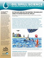
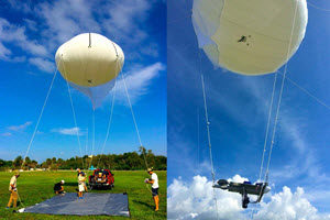
The Sea Grant Oil Spill Outreach Team released a publication on technologies that complement traditional ship, satellite, and mooring-based tools that researchers use to study oil spills, including Deepwater Horizon. These complimentary technologies include Unmanned Surface and Aerial Vehicles (USVs and UAVs), Saildrones, aerial drones, drifters, blimps, balloons, and advanced remote sensing technology.

Read In the air and on the water: Technology used to investigate oil spills to learn about the capabilities of these technologies and how researchers have used them. Included are factors that scientists consider when determining which unmanned vehicle is the best fit for their research.

Read these related Sea Grant publications that give more details on oil spill detection and monitoring technologies: Underwater Vehicles Used to Study Oil Spills and Predicting the Movement of Oil.

Read these related stories describing technologies to study oil spills:

The Sea Grant Oil Spill Outreach Team synthesizes peer-reviewed science for a broad range of general audiences, particularly those who live and work across the Gulf Coast. Sea Grant offers oil-spill related public seminars across the United States. 

Information about upcoming Sea Grant science seminars and recently-held events is available here. To receive email updates about seminars, publications, and the outreach team, click here.

By Nilde Maggie Dannreuther. Contact maggied@ngi.msstate.edu with questions or comments.

************

GoMRI and the Sea Grant programs of the Gulf of Mexico (Florida, Mississippi-Alabama, Louisiana, and Texas) have partnered to create an oil spill science outreach program.

The Gulf of Mexico Research Initiative (GoMRI) is a 10-year independent research program established to study the effect, and the potential associated impact, of hydrocarbon releases on the environment and public health, as well as to develop improved spill mitigation, oil detection, characterization and remediation technologies. An independent and academic 20-member Research Board makes the funding and research direction decisions to ensure the intellectual quality, effectiveness and academic independence of the GoMRI research. All research data, findings and publications will be made publicly available. The program was established through a $500 million financial commitment from BP. For more information, visit http://gulfresearchinitiative.org/.

© Copyright 2010- 2019 Gulf of Mexico Research Initiative (GoMRI) – All Rights Reserved. Redistribution is encouraged with acknowledgement to the Gulf of Mexico Research Initiative (GoMRI). Please credit images and/or videos as done in each article. Questions? Contact web-content editor Nilde “Maggie” Dannreuther, Northern Gulf Institute, Mississippi State University (maggied@ngi.msstate.edu).
Grad Student Ji Helps Improve Tool to Locate Oil Beneath the Ocean Surface

6645a
University of Miami Ph.D. student Chao Ji with the SOSim (Subsurface Oil Simulator) model. (Provided by Chao Ji)

When a marine oil spill occurs, it is vital to quickly determine where and when to dispatch response operations. Visualization and remote sensing techniques help locate oil on surface waters but have limitations in locating subsurface oil, such as oil that lingers in the water column or settles to the bottom. During Deepwater Horizon, researchers developed for the NOAA Response and Restoration’s Emergency Response Division an open-source predictive model that infers where submerged oil is and predicts where it will go using near real-time field sampling data. This model, called the inferential Subsurface Oil Simulator (SOSim) model, could assess sunken oil on relatively flat bay bottoms and continental shelves but only for a single complete discharge of oil.

Chao Ji is helping to develop a next-generation SOSim model that integrates reconnaissance, flow field, and bathymetric data to address a continuous spill situation and various seafloor topography. “The model’s output is a 3D map showing the probability of finding submerged oil in different locations,” she explained. “The updated SOSim model can provide a sampling plan that tells emergency responders where they can get a submerged oil sample in the event of a future spill.”

Chao is a Ph.D. student with the University of Miami’s Department of Civil, Architecture, and Environmental Engineering and a GoMRI Scholar with the project Inferential/Parametric Forecasting of Subsurface Oil Trajectory Integrating Limited Reconnaissance Data with Flow Field Information for Emergency Response.

Her Path

6645b
University of Miami Ph.D. students Chao Ji and Mary Jacketti present their research at the University of Miami College of Engineering (UMCoE) Research Day. (Provided by Chao Ji)

Growing up, Chao found great joy in discovering answers to her questions about the world, which sparked her initial interest in science. The pollution of a clean river in her hometown motivated her to conduct research that could help make the world greener. One of Chao’s first efforts toward this goal was designing a zero-energy-consuming toilet that won second prize in the Bill and Melinda Gates Foundation’s Reinvent the Toilet Challenge & Expo in China. “This experience gave me a sense of achievement and encouraged me to believe that I am the ‘right person’ for science and engineering,” said Chao. “When I heard about the tragedy caused by the Bohai Bay oil spill in China and the Deepwater Horizon spill in Gulf of Mexico, I felt a sense of responsibility as an environmental engineer to help clean up the mess.”

Chao completed a water and wastewater science and engineering undergraduate degree at Chongqing University and an environmental engineering master’s degree from the Chinese Academy of Agricultural Sciences. As a master’s student, she gained additional experience operating microscopy equipment through the Visiting Student Research Internship Program at King Abdullah University of Science and Technology in Saudi Arabia. While researching doctoral programs, Chao was fascinated by Dr. James Englehardt’s water quality engineering research at the University of Miami and named him as a preferred advisor on her application. Dr. Englehardt sent her information about his GoMRI-funded project on developing a model to track submerged oil and invited her to join his lab as a graduate researcher.

Her Work

6645c
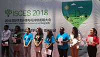
University of Miami Ph.D. student Chao Ji (far right) attends the 2018 International Student Conference on Environment and Sustainability in Shanghai, China as an invited speaker. (Provided by Chao Ji)

Oil that is chemically dispersed in the deep ocean forms small droplets that can become trapped in constant density layers, where the oil’s density is the same as the surrounding water’s density. Because these layers don’t always stay at the same depth, Chao’s research began with enhancing the SOSim model’s capability to predict the location of submerged oil within these moving layers for a continuous oil spill.

Using Bayesian statistical methods, she inferred previously unknown parameters in the oil trajectory model, including average velocity, the horizontal dispersion coefficient, and the mass fraction of oil patches (smaller oil masses that have detached from the initial spilled oil mass). She then used existing Deepwater Horizon data as a case study to validate the model’s ability to predict submerged oil transport. “The model is currently using inputs about the oil’s concentration and location to infer oil patches’ individual velocity and dispersion coefficient, but these parameters will be updated over time as new information is gathered,” she explained.

6645d
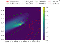
An example of an oil prediction result from the SOSim (Subsurface Oil Simulator) model. The blue dots represent field observations of subsurface oil and orange dots indicate oil location predicted by the SINTEF OSCAR model. The solid green line represents the 95% confidence bound with 4% relative oil concentration. Red and green dashed lines represent the depths of subsurface oil. (Provided by Chao Ji)

Chao is currently developing a sampling plan for oil responders that will help them locate submerged oil during a spill. She is assessing four sampling plans: random sampling, even sampling, adaptive sampling, and the sampling strategy used during Deepwater Horizon response. For her experiments, the simulations from the SINTEF Oil Spill Contingency and Response (OSCAR) model serve as a ‘real’ oil spill dataset. She applies the different sampling plans to the OSCAR dataset and uses the enhanced SOSim model to infer the oil distribution resulting from each sampling approach. She then compares oil distributions from the SOSim model and the OSCAR model to determine which sampling plan approach returns the most accurate submerged oil distribution. “Although real spill observations are limited, we can use OSCAR model outputs as ‘real’ data and compare our predictions with the ‘real’ answer to determine which sampling plan is the most effective in real spill scenarios,” said Chao.

So far, Chao has completed her initial analyses for the sampling plan and will incorporate additional scenarios to determine if the plan changes for various submerged oil distributions. She hopes to further correct the SOSim model’s output and eventually enhance its capability to include oil fate.

Her Learning

Working in Dr. Englehardt’s lab, Chao experienced an atmosphere that encouraged independent and creative problem solving. “During the whole project, Dr. Englehardt asked me to think what scientific contributions will stand the test of time,” she said. “His slogan is ‘do whatever it takes,’ which inspires me to always prepare for the best.” She recalled a situation when applying Bayesian statistics where the model consistently returned strange results. Despite debugging the software dozens of times, she struggled to pinpoint the issues and worried that her project would fail. She continuously referred to her Bayesian materials and discussed various options with Dr. Englehardt until she finally discovered that a function in the model was returning a value smaller than the values the computer could represent. Relieved, she incorporated a new function to resolve the issue and started seeing results that made sense.

The GoMRI program gave Chao the opportunity to learn from and work with top international oil spill researchers, exposing her to new fields, methods, and tools. She and her colleagues presented their research at the 2019 Gulf of Mexico Oil Spill and Ecosystem Science Conference and the 2019 AMOP Technical Seminar on Environmental Contamination and Response, where they received valuable feedback and advice from fellow researchers. The team also gave two international presentations for colleagues associated with Oil Spill Response Limited, an industry-funded oil spill response cooperative. “Before my Ph.D. research, I had no idea about subsurface oil modeling,” said Chao. “So far, I have learned the current research theories and techniques and developed an open-source application written in Python. The GoMRI project helped me develop skills to create new theoretical methods and to translate the theoretical models [for real use] in software applications.”

Chao plans to apply her oil spill and data science knowledge to other pollution issues, hopefully in academia where she can inspire students the way that she was with science and engineering. “There’s a saying: I know nothing except the fact of my ignorance,” joked Chao. “I will keep updating my knowledge and skills and hopefully create something that can withstand the test of time.” She believes that curiosity is a very important part of scientific research.

Praise for Chao

Dr. Englehardt praised Chao’s team-player attitude, explaining that she works so closely with her colleagues that their individual research can be difficult to differentiate. He describes her as someone who is eager to explore new approaches, challenge conventional wisdom, and come up with innovative solutions. “[Our team] has come to know and love her ever-cheerful and unselfish nature,” he said. “We look forward to watching her career successes in the future.”

The GoMRI community embraces bright and dedicated students like Chao Ji and their important contributions. The GoMRI Scholars Program recognizes graduate students whose work focuses on GoMRI-funded projects and builds community for the next generation of ocean science professionals.

By Stephanie Ellis and Nilde Maggie Dannreuther. Contact sellis@ngi.msstate.edu for questions or comments.

************

The Gulf of Mexico Research Initiative (GoMRI) is a 10-year independent research program established to study the effect, and the potential associated impact, of hydrocarbon releases on the environment and public health, as well as to develop improved spill mitigation, oil detection, characterization and remediation technologies. An independent and academic 20-member Research Board makes the funding and research direction decisions to ensure the intellectual quality, effectiveness and academic independence of the GoMRI research. All research data, findings and publications will be made publicly available. The program was established through a $500 million financial commitment from BP. For more information, visit http://gulfresearchinitiative.org/.

© Copyright 2010-2019 Gulf of Mexico Research Initiative (GoMRI) – All Rights Reserved. Redistribution is encouraged with acknowledgement to the Gulf of Mexico Research Initiative (GoMRI). Please credit images and/or videos as done in each article. Questions? Contact web-content editor Nilde “Maggie” Dannreuther, Northern Gulf Institute, Mississippi State University (maggied@ngi.msstate.edu).
Grad Student Montas Assesses Oil Spill Health Risks to Children During Beach Play

6627a
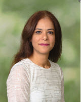
University of Miami graduate student Larissa Montas. (Photo provided by Larissa Montas)

The Deepwater Horizon incident affected more than 1,700 km of Gulf of Mexico coastline. Chemical compounds from the oil spill posed a risk to human health, especially children whose play behaviors often bring them in direct contact with sand and water. To better understand these risks, researchers are quantifying how children play at the beach and combining those data with the different types and levels of oil spill compounds that reached shorelines.

Larissa Montas is developing an algorithm to predict the concentrations and distributions of oil compounds along beaches. Her novel algorithm will contribute to a larger risk assessment platform that assesses cumulative and aggregate risks to children’s health from oil spill compounds. These assessments can help inform future spill response decisions, including beach closures.

Larissa is a Ph.D. student with the University of Miami’s Civil, Architectural, and Environmental Engineering Department and a GoMRI Scholar with Beach Exposure And Child HEalth Study (BEACHES).

Her Path

6627b
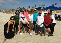
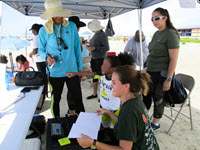
The Beach Exposure and Child Health Study (BEACHES) research team. (L-R) Rosalia Guerrero (research scientist), Dr. Helena Solo-Gabriele (Principal Investigator), Lindsey Clark (master’s student), Dr. Alesia Ferguson (Co-Principal Investigator), Dr. Maribeth Gidley (research scientist), Pauline Williams (community volunteer), Lonnie Jones (community volunteer), Larissa Montas (Ph.D. student), Devon Brown, Graham Reid (community volunteer), Tanu (Uppal) Altomare (Ph.D. student), Hanna Perone (master’s student), and Kyra Rattler (undergraduate student). (Photo provided by Larissa Montas) University of Miami Ph.D. student Larissa Montas (left, blue shirt) helps collect information about children’s beach play behavior. The team videotaped children pressing their hand on a sand tray and used a digital scale to record the hand press and determine how much sand adhered to the hands. They also traced each child’s hand on paper and photographed it to measure hand surface area. Here, Montas holds the video camera while University of Miami MD/MPH student Hanna Perone (foreground) holds a hand trace and University of Houston undergraduate student Leslie Rojas assists a child participant. (Photo provided by Larissa Montas)

Larissa describes science as her “first love” and can’t recall a time when she wasn’t involved with science in some way. Growing up in a seaside town, she created strong ties to the beach. The more she learned about beach ecosystems, the more her curiosity about environmental science deepened. Later, she completed undergraduate degrees in civil and environmental engineering and a master’s degree in environmental engineering at the University of Miami. While applying to doctoral programs, Larissa received an email from one of her previous professors, Dr. Helena Solo-Gabriele, advertising a graduate research opportunity with her lab. Larissa applied and joined Dr. Solo-Gabriele’s team investigating children’s health risks to oil spill compounds in beach environments.

“I am deeply interested in exploring the integrated relationship between the environment and human health, so our team’s research was a perfect match to my interests,” said Larissa. “Children’s environmental health is a topic close to my heart, as children are more vulnerable to environmental health issues.”

Her Work

Following Deepwater Horizon, responders and researchers collected tens of thousands of seawater, sediment, and atmospheric samples. The first phase of Larissa’s research was to sort this historical data. Using the General NOAA Operational Modeling Environment (GNOME)’s predicted timing of oil spill impacts, she categorized the data by time and space: impacted sites prior to oil impact, impacted sites after oil impact, and unimpacted sites. She also assisted efforts led by Dr. Alesia Ferguson to video record (with guardian permission) children’s beach play activities and patterns to characterize children’s interactions with sand and other potential sources of oil contamination. She is currently developing an algorithm that will utilize a fate and transport model’s outputs for future predictions of concentrations of individual toxic oil compounds that might reach nearshore waters and sand.

The second phase of Larissa’s research focuses on analyzing oil compounds associated with Deepwater Horizon that were identified as toxic. Using an oil spill fate and transport model, she tracks how long it will take each compound to reach the beach environment. Then, she incorporates existing data about the compound’s physical and chemical properties to predict how much it should be degraded when it reaches the nearshore environment. “Some of the oil compounds won’t get there at all because they will be completely degraded or become airborne before arrival,” explained Larissa. “But, most of them will, and we need to know how much and what health risks are associated with those concentrations.” She uses her results to generate concentration-frequency distributions, a type of histogram that represents how often a measured concentration falls within a certain range in sand/marsh sediment, water, and tar. She then compares concentration ratios of the different compounds to the original source oil to identify changes in the oil’s overall composition by the time it reaches the beach environment.

6627c
University of Miami Ph.D. student Larissa Montas (left, blue shirt) helps collect information about children’s beach play behavior. The team videotaped children pressing their hand on a sand tray and used a digital scale to record the hand press and determine how much sand adhered to the hands. They also traced each child’s hand on paper and photographed it to measure hand surface area. Here, Montas holds the video camera while University of Miami MD/MPH student Hanna Perone (foreground) holds a hand trace and University of Houston undergraduate student Leslie Rojas assists a child participant. (Photo provided by Larissa Montas)

The third phase of Larissa’s research uses atmospheric remote sensing to estimate the impacts of toxic airborne compounds associated with Deepwater Horizon on beach environments. She assists Dr. Naresh Kumar to assess changes in remotely-sensed parameters immediately before and after the spill, collocated with meteorological conditions and adjusted using region specific regression. Using this approach, researchers can develop beach-specific concentrations of airborne compounds for future oil spill exposure studies.

Larissa’s research will contribute to an assessment platform providing health risk information for children swimming or playing at oil-impacted beaches. “Children’s behavioral patterns make them more vulnerable than adults, and they have more-intimate contact with the sand due to play activities such as burying themselves in the sand,” said Larissa. “Our risk assessment platform aims to help improve estimations about children’s exposures and risks to toxic oil compounds and inform decision makers and first responders about toxic compound concentrations when an oil slick approaches the nearshore environment.”

Her Learning

Working with Dr. Solo-Gabriele taught Larissa that the rigorous scientific process can also be an exciting, creative, and collaborative process. One of Larissa’s favorite memories was assisting with fieldwork that quantified children’s beach play activities. The team worked from early morning to late evening collecting data on over 100 children playing at four beaches in Florida and Texas. “The whole BEACHES team came together, and the PIs worked hard side-by-side with the students,” said Larissa. “It was collaboration at its best and gave me the opportunity to learn about the work that Co-PIs Dr. Alicia Ferguson and Dr. Kristi Mena are leading.”

Larissa’s journey has shown her that exploring different fields and seeking guidance from mentors are important goals for students considering a scientific career. “Students’ motivations are as varied as they are as individuals,” she said. “A good way to start is to take initiative and volunteer for a project that matches your interests. Many professors like giving advice. Don’t be afraid to seek out mentors who can help you understand where to take that first step.”

After graduating, Larissa wants to continue interdisciplinary research investigating environmental contaminants and human health.

Praise for Larissa

Dr. Solo-Gabriele said that Larissa was at the top of her list when recruiting graduate students for her GoMRI project. She described Larissa as having “an engineering mind,” praising her methodical approach to research and detailed-oriented personality. She explained that Larissa’s laboratory experience gave her an advantage when analyzing the complex chemical composition of oil in air, water, and sediments. “She understands the details of the analytical techniques and the difficulties that may occur when trying to compare the results from different laboratories,” said Dr. Solo-Gabriele. “Larissa has submitted a peer-reviewed journal article [based on her research] that provides insight to the natural background concentrations of oil spill compounds, which is useful for identifying the excess risks associated with oil spill impacts along coastal regions.”

The GoMRI community embraces bright and dedicated students like Larissa Montas and their important contributions. The GoMRI Scholars Program recognizes graduate students whose work focuses on GoMRI-funded projects and builds community for the next generation of ocean science professionals.

By Stephanie Ellis and Nilde Maggie Dannreuther. Contact sellis@ngi.msstate.edu for questions or comments.

************

The Gulf of Mexico Research Initiative (GoMRI) is a 10-year independent research program established to study the effect, and the potential associated impact, of hydrocarbon releases on the environment and public health, as well as to develop improved spill mitigation, oil detection, characterization and remediation technologies. An independent and academic 20-member Research Board makes the funding and research direction decisions to ensure the intellectual quality, effectiveness and academic independence of the GoMRI research. All research data, findings and publications will be made publicly available. The program was established through a $500 million financial commitment from BP. For more information, visit http://gulfresearchinitiative.org/.

© Copyright 2010-2019 Gulf of Mexico Research Initiative (GoMRI) – All Rights Reserved. Redistribution is encouraged with acknowledgement to the Gulf of Mexico Research Initiative (GoMRI). Please credit images and/or videos as done in each article. Questions? Contact web-content editor Nilde “Maggie” Dannreuther, Northern Gulf Institute, Mississippi State University (maggied@ngi.msstate.edu).
How Grad Student Bodner Uses Theoretical Math to Add Turbulence to Transport Predictions

6595a
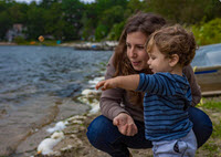
Abigail Bodner, a Ph.D student at Brown University, observes surface waves in Plymouth, Massachusetts with her son Micah. (Photo by Eyal Guzi)

Predicting where oil will go can be one of the most challenging aspects of marine oil spill response. Following Deepwater Horizon, research showed that strong currents capable of transporting oil often appear along ocean fronts (the interface between river like-water masses that have different temperatures, salinities, or densities). However, our limited understanding about ocean front formation and the influence of turbulence, upper ocean mixing, and submesoscale currents (which can cause floating material to cluster and then spread out) inhibits the accuracy of ocean transport prediction models. Abigail Bodner uses mathematical theory and large eddy simulation (LES) models to improve our understanding about how different turbulence and mixing processes affect the behavior and development of ocean fronts.

Abigail is a Ph.D. student with Brown University’s Department of Earth, Environmental, and Planetary Sciences and a GoMRI Scholar with the Consortium for Advanced Research on Transport of Hydrocarbons in the Environment III (CARTHE-III).

Her Path

6595b
Ph.D. student Abigail Bodner created this visualization depicting a theoretical ocean front with an along-front current (associated with surface transport) and cross-front circulation (bringing light water over dense). Red indicates a less buoyant front; blue indicates a more buoyant front. The front is shown to become infinitely thin, which is the theoretical prediction if turbulence is not included. (Provided by Abigail Bodner)

Abigail grew up in Israel, where she taught and tutored high school math before pursuing theoretical mathematics at Tel Aviv University. Although she enjoyed her studies, she felt like something was missing. She added earth sciences as a second major and fell in love with atmospheric and oceanic fluid dynamics, which allowed her to use mathematical tools to describe natural phenomena. She completed an atmospheric dynamics master’s degree at Tel Aviv University, where she researched how large-scale atmospheric circulation patterns can cause blocking events associated with temperature fluxes for certain topographies.

Although her master’s research focused heavily on theoretical models, its applications extended to pressing environmental concerns such as heat waves and harsh cold winters. Abigail felt motivated to find a physical oceanography doctoral program that would allow her to combine theory and modeling for research addressing environmental impacts. A professor working with Dr. Baylor Fox-Kemper at Brown University recommended that Abigail contact Fox-Kemper related to his research adapting LES modeling for float, tracer, and surfactant applications.

6595c
Abigail Bodner, a Ph.D. student at Brown University, attended the 2017 summer school course “Fundamental Aspects of Turbulent Flows in Climate Dynamics” at the L’École de Physique des Houches in Les Houches, France. (Photo by Bar Guzi)

“After contacting Dr. Fox-Kemper, he responded within minutes, and we set up a Skype meeting where he told me all about the Gulf of Mexico Research Initiative,” Abigail said. “I was eager to be part of a larger research community working hard to help protect Gulf of Mexico ecosystems and coastal communities from environmental disasters.” She joined Dr. Fox-Kemper’s research group as a Ph.D. student, while also working towards a second master’s degree in applied mathematics.

Her Work

Abigail’s research started with paper, a pencil, and mathematical theory. She knew that previous research established a numerical theory that describes general ocean front dynamics but also knew that it lacked turbulence parameters. She modified the theory to include her hand-written equations that account for submesoscale (typically 102 – 104 meters in length and lasting hours to days in time scales)    turbulence and then consulted a numerical computer program to solve the higher-level equations. As she used numerical methods to resolve the modified theoretical equations, she noticed an interesting pattern: turbulence from vertical mixing processes appeared to strengthen the front, while turbulence from horizontal mixing processes appeared to weaken it.

6595d
Ph.D. student Abigail Bodner (center) and Research Assistant Laura Messier (right) helps undergraduate student Daniel Gates (left) measure Narraganset Bay water properties during a Save the Bay cruise for Brown University’s Summer@Brown course “Studying the Ocean from the Classroom to the Bay”. (Photo by Jenna Pearson)

“It’s important to note that whether this pattern is true or not in a more realistic environment isn’t clear because the theory is very idealized. Factors like waves, wind, and cooling and heating can all be very chaotic, and in order to apply them cleanly in the theory you have to simplify them,” explained Abigail. “By distinguishing them into horizontal and vertical processes, we’re able to quantify their roles in affecting the front. But, if we really want to understand what they are doing, then we need a model like the LES that can simulate each of these processes.”

Abigail is validating her modified theory using a LES developed by Dr. Fox-Kemper and his collaborators (Dr. Jim McWilliams, University of California Los Angeles; Dr. Peter Sullivan, National Center for Atmospheric Research; and Dr. Luke Van Roekel, Los Alamos National Laboratory). She incorporates as many missing parameters as possible into the simulation and compares its results with the results of her modified theory.

Abigail explained that, while LES can help validate her numerical theory, her theory can also help researchers understand the LES results. “My theoretical equation can give us a road map of how to interpret these large eddy simulations. It can help us understand what is happening with the vertical and horizontal processes by stripping away their complexity and presenting them in a more-simplified world,” she said. “If we look at the LES’s more-complicated scenarios but still have in mind what we know happens under simpler conditions, it can provide clarity and help us be more focused when we analyze these complex simulations.”

6595e
Ph.D. student Abigail Bodner teaches students about climate models during Brown University’s Summer@Brown course “Studying the Ocean from the Classroom to the Bay”. (Photo by Jenna Pearson)

Abigail plans to implement her theory into global climate models as an improved submesoscale parameterization that contributes to more accurate climate model predictions. Climate models use submesoscales to help determine the depth of the ocean mixed layer (the uppermost ocean layer), which helps define how the atmosphere and ocean will interact. Abigail explained that her two-year-old son is her greatest source of motivation to help enhance climate models. “Looking forward at climate predictions, it is hard to imagine what kind of world my son and future generations will have,” she said. “Being part of climate research is exciting, but it also comes with a sense of obligation to improve our current understanding of the climate system, including climate theory and predictions.”

Her Learning

Dr. Fox-Kemper has been a constant support and motivator for Abigail and has helped her strengthen her writing and communication skills. She further honed these skills teaching oceanography and climate science courses through Brown University’s Summer@Brown program.

6595f
Ph.D. student Abigail Bodner (front, left) and the Fox-Kemper research group at Brown University celebrate former graduate student Qing Li’s successful thesis defense. (Provided by Abigail Bodner)

Working with Dr. Fox-Kemper taught Abigail that she must dig deep to gain a more complete understanding of a scenario’s underlying physics while also connecting with bigger picture questions, existing literature, and community interests. Abigail’s experiences helped her gain a deeper appreciation for the scientific and peer-review processes involved in publishing. “[In research], you don’t always end up doing what you set out to do, but the result will probably be more interesting than anyone could have anticipated. It is exciting and confusing, which is part of what makes it so great,” said Abigail. “It is inspiring to be part of a community that cares deeply about the science as well as the coastal communities and ecosystems, which is what brings the GoMRI community together.”

Her Future

Abigail hopes to find a postdoc position that includes teaching and research where she can connect science to people’s lives, especially research related to sea level rise and its effects on coastal communities. She encourages students considering a scientific career not to feel intimidated by unfamiliar terminology. “It’s important to remember that, although it may be a slow learning curve, eventually you will learn how to use these terms yourself,” she said. “Have confidence in yourself, and don’t be afraid to ask for help. Most everyone will be excited to discuss their work with new students. You just need to work up the courage to ask. No question is a dumb question!”

Praise for Abigail

Dr. Fox-Kemper praised Abigail’s sharp mathematical mind. He recalled that initially she was more comfortable manipulating equations than interpreting data but quickly grew into an astute data analyst. “She is very quick to appreciate the significance of subtleties between different approaches to solving problems and has developed some new methods to address problems that have stumped theoreticians for decades – as well as finding some new problems of her own!” he said.

Dr. Fox-Kemper expressed admiration for Abigail’s ability to balance family and work, a feat he says was often difficult for him. “She keeps making progress on research and finding time to take opportunities to teach [while also spending time with her family],” he said. “She is a great role model for her kids and for other students thinking about becoming parents.”

The GoMRI community embraces bright and dedicated students like Abigail Bodner and their important contributions. The GoMRI Scholars Program recognizes graduate students whose work focuses on GoMRI-funded projects and builds community for the next generation of ocean science professionals. Visit the CARTHE website to learn more about their work.

By Stephanie Ellis and Nilde Maggie Dannreuther. Contact sellis@ngi.msstate.edu for questions or comments.

************

The Gulf of Mexico Research Initiative (GoMRI) is a 10-year independent research program established to study the effect, and the potential associated impact, of hydrocarbon releases on the environment and public health, as well as to develop improved spill mitigation, oil detection, characterization and remediation technologies. An independent and academic 20-member Research Board makes the funding and research direction decisions to ensure the intellectual quality, effectiveness and academic independence of the GoMRI research. All research data, findings and publications will be made publicly available. The program was established through a $500 million financial commitment from BP. For more information, visit https://gulfresearchinitiative.org/.

© Copyright 2010-2019 Gulf of Mexico Research Initiative (GoMRI) – All Rights Reserved. Redistribution is encouraged with acknowledgement to the Gulf of Mexico Research Initiative (GoMRI). Please credit images and/or videos as done in each article. Questions? Contact web-content editor Nilde “Maggie” Dannreuther, Northern Gulf Institute, Mississippi State University (maggied@ngi.msstate.edu).
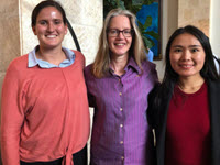
How Grad Student Lu Uses Statistics to Monitor Reef Fish Populations

6580a
Xuetao Lu (R) and his advisor Dr. Steven Saul, College of Integrative Sciences and Arts at Arizona State University (Polytechnic Campus) discuss his statistical research progress on the spatial analysis of Gulf of Mexico reef fish. (Provided by Xuetao Lu)

Authorities closed large portions of the Gulf of Mexico following Deepwater Horizon to minimize oil contamination of fish and seafood products. Changes in commercial and recreational fisher behavior during the closure may have caused biases in the 2010 fisheries data used to assess fish populations and establish annual quotas and catch limits.

Xuetao Lu is developing a novel modeling approach that uses statistics and computer science techniques to predict the spatial distribution of fish species. His work is part of a larger effort to expand an existing West Florida Shelf simulation model to include more fish species and fishing fleets and increase its simulated range across the Gulf. The expanded model will help researchers predict the spatial patterns of fleets and marine species under various scenarios, including oil spill events.

Xuetao is a Ph.D. student with the Arizona State University Tempe’s Statistics program and a GoMRI Scholar with the project Avoiding Surprises: Understanding the Impact of the Deepwater Horizon Oil Spill on the Decision-Making Behaviors of Fishers and How This Affects the Assessment and Management of Commercially Important Fish Species in the Gulf of Mexico Using an Agent-Based Model.

His Path

6580b
Xuetao Lu presents his statistical methods for the spatial analysis of Gulf of Mexico reef fish abundance at the 2018 Gulf of Mexico Oil Spill and Ecosystem Science Conference in New Orleans, Louisiana. (Provided by Xuetao Lu)

Xuetao’s favorite pastime as a teenager was playing maze games, searching for the best route as well as the correct one. While working towards his systems engineering undergraduate degree at the National University of Defense Technology in China, he realized that his fascination with mazes stemmed from a passion for understanding complex systems. “I’m fascinated by the beauty of statistics, which is the origin of many methodologies for working with complex systems,” he said. “My strong sense of curiosity led me to pursue a doctoral degree in statistics.”

Later, Xuetao was searching for graduate research opportunities, and a friend recommended that he look into Dr. Steven Saul’s research investigating quantitative approaches to Gulf of Mexico natural resource management. The team’s focus on how fisheries closures and oil pollution may have affected resource management following Deepwater Horizon excited Xuetao and made him eager to see his statistical research inform policy development and resource management decision-making. He applied for a doctoral research position in Dr. Saul’s lab and joined his team in 2017.

His Work

6580c
A flyer describes Xuetao Lu’s presentation at the Science and Mathematics Colloquium Series, Arizona State University College of Integrative Sciences and Arts. (Provided by Xuetao Lu)

Xuetao’s ultimate goal is to develop spatial distributions of fish abundance by species, which the team will use in their model simulations of fish abundance and biomass locations. His approach utilizes bottom longline survey data (for deep water species) and video survey data (for shallow water species) collected by the National Marine Fisheries Service (NMFS). NMFS conducts independent video surveys each year to measure fish abundance; however, low detection rates generate data that is zero inflated, meaning that zero or near-zero fish appear in each sample. As a result, it is difficult for researchers calculating spatial distribution to utilize this valuable data.

Xuetao addressed this challenge by developing statistical models based on empirical maximum likelihood analysis, a technique that estimates how many fish live in an area despite low detection rates. Then, he developed a random smoothing method that uses variance and credibility factors to identify and eliminate uncertainty within the data and generate high-quality data without high uncertainty. The random smoothing method also converted the maximum estimate number of fish into the maximum estimate density of fish, which researchers can use to determine spatial distribution.

Xuetao combined the improved data with habitat information (such as depth, sediment type, or rugosity) gathered from oil company surveys so that his model could determine how different habitat features affect fish’s spatial distribution and how this relationship can predict spatial distribution in unsampled areas. The model utilized and integrated the results of thirty-three machine learning models designed to handle non-linear problems such as the relationship between habitat and spatial distribution. Finally, Xuetao ran his results through a hierarchical Bayesian model combined with the Gaussian process to correct a prediction bias that did not account for pollution and overfishing.

Comparing traditional linear model results and non-linear model predictions, Xuetao found that his non-linear model provided a more accurate and reasonable ecological overview and offered higher-resolution patterns than traditional linear predictions. His next step is to expand his non-linear model to analyze spatial distribution over time, which will help researchers track long-term distribution changes.

His Learning

Xuetao views Dr. Saul as a role model and mentor who taught him important research techniques to break down complex systems, including asking simple but meaningful questions. “Most importantly, Dr. Saul taught me how to improve my communication skills, how to collaborate with others, and how to build up my own networking,” he said. He applied these communication skills at the 2018 and 2019 Gulf of Mexico Oil Spill and Ecosystem Science conferences, where he presented his research. “I appreciate these opportunities to engage and communicate with scientists from the GoMRI science community,” he said. “The most exciting moments were when I got feedback and suggestions from other experienced researchers. The peer recognition inspired and encouraged me to keep walking forward.”

His Future

Xuetao looks forward to using his statistics background in a wide range of scientific and technological applications, especially as a university postdoc or faculty member. “As celebrated mathematician and statistician John W. Tukey said, the best thing about being a statistician is getting to play in everyone’s backyard. That makes being a statistician so much fun!” said Xuetao. “My advice? Interest is the best teacher. Find the field that you are most interested in – the sooner the better!”

Praise for Xuetao

Dr. Saul praised Xuetao’s hardworking personality and ability to work independently or in a group. He highlighted Xuetao’s communication skills, particularly his clear delivery and ability to distill complex information to an understandable level for various audiences and his intelligent and creative approaches to the team’s research. “Xuetao is able to independently distill a difficult quantitative problem down into its components and creatively apply statistical theory to solve the problem,” said Dr. Saul. “His innovative contributions and deep knowledge of mathematical and statistical theory play a critical role in the success of our project.” He emphasized that Xuetao’s methodologies represent important contributions toward a novel approach for understanding and computing the spatiotemporal abundance of living marine resources. “Xuetao is an emerging early career mathematician and statistician, who will be successful in whichever endeavor he pursues. I very much look forward to continued collaborations with him,” concluded Dr. Saul.

The GoMRI community embraces bright and dedicated students like Xuetao Lu and their important contributions. The GoMRI Scholars Program recognizes graduate students whose work focuses on GoMRI-funded projects and builds community for the next generation of ocean science professionals. Visit the [consortia website] to learn more about their work.

By Stephanie Ellis and Nilde Maggie Dannreuther. Contact sellis@ngi.msstate.edu for questions or comments.

************

The Gulf of Mexico Research Initiative (GoMRI) is a 10-year independent research program established to study the effect, and the potential associated impact, of hydrocarbon releases on the environment and public health, as well as to develop improved spill mitigation, oil detection, characterization and remediation technologies. An independent and academic 20-member Research Board makes the funding and research direction decisions to ensure the intellectual quality, effectiveness and academic independence of the GoMRI research. All research data, findings and publications will be made publicly available. The program was established through a $500 million financial commitment from BP. For more information, visit https://gulfresearchinitiative.org/.

© Copyright 2010-2019 Gulf of Mexico Research Initiative (GoMRI) – All Rights Reserved. Redistribution is encouraged with acknowledgement to the Gulf of Mexico Research Initiative (GoMRI). Please credit images and/or videos as done in each article. Questions? Contact web-content editor Nilde “Maggie” Dannreuther, Northern Gulf Institute, Mississippi State University (maggied@ngi.msstate.edu).
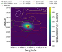
Podcast: The Loop Podcast [English + Español]

loop-logo-final_smallThe Loop podcast takes a deep dive into the Gulf of Mexico with the researchers studying the processes, mechanisms, and impacts of oil spills.

Researchers from the Center for Integrated Modeling and Analysis of Gulf Ecosystems (C-IMAGE) discuss their studies with David Levin of Mind Open Media. C-IMAGE is an international research group studying mud, microbes and mammals after two mega spills, Deepwater Horizon and Ixtoc I. The goal of C-IMAGE is to advance understanding of the fundamental processes and mechanisms of marine blowouts and their consequences, ensuring that society is better-prepared to mitigate future events.

Episode 1: Overview of C-IMAGE
C-IMAGE PI Dr. Steven Murawski talks to David Levin about C-IMAGE’s research goals and the importance of integration when tackling large scale impacts. This episode is available in English and Spanish. (Transcript: English, Español)

Español:

Episode 2: The Mud and the Blood
C-IMAGE PIs Steven Murawski and David Hollander talk to David Levin aboard the R/V Weatherbird II in August 2012 about looking for Deepwater Horizon‘s impacts on Gulf of Mexico mud and fish. This episode is available in English and Spanish. (Transcript: English, Español)

Español:

Episode 3: The “Not-So-Visible” Impacts of the Deepwater Horizon Oil Spill on the Gulf of Mexico
Three years after the BP oil well disaster, scientists are struggling to understand the effects on the Gulf ecosystem. David Levin reports on the oil’s impact on the tiny creatures that form the base of the food chain. (Transcript: English)

Episode 4: Fitting the Gulf of Mexico Inside a Computer: How to Build an Ecosystem Model
David Levin talks with C-IMAGE members Cameron Ainsworth, Jason Lenes, Michelle Masi, and Brian Smith about building an ecosystem model of the Gulf of Mexico to describe how oil spills impact marine life. (Transcript: English, Español)

Episode 5: The Pressure is On!
David Levin talks with C-IMAGE PI Steven Murawski and scientists from the Technical University of Hamburg at Harburg Michael Schluter and Karen Malone about their ongoing experiments examining oil and gas droplets under high pressure to learn more about the Deepwater Horizon oil spill. (Transcript: English, Español)

Episode 6: Oil – It’s What’s for Dinner…
C-IMAGE scientists want to know more about how oil-eating microorganisms behave in the cold deep ocean to learn more about what happened to the oil from the Deepwater Horizon blowout. High-pressure experiments underway at our high pressure facility at the Hamburg University of Technology focus on how these microbes use oil and what happens to them in the process. Results from these studies may lead to a new way to clean up spills by eliminating its most poisonous ingredients. (Transcript: English, Español)

Episode 7: The Ixtoc Spill – Reflections
The Deepwater Horizon oil spill happened just a few years ago, but it might be possible to predict its impact on the Gulf by studying another major spill, one that happened in 1979. “These are two of the largest spills in the world’s history as far as blowouts go, and they were both in the Gulf of Mexico.” Wes Tunnell is a marine biologist who is looking at the aftermath of both spills. It’s almost like he’s looking at the same crime scene, separated by more than three decades. How? Give a listen. Mind Open Media producer David Levin talks to Wes Tunnell and John Farrington about their experiences during the 1979 Ixtoc spill and the applications to new blowouts thirty years late. This episode is available in English and Spanish. (Transcript: English, Español)

Español:

Episode 8: In the Mud in Mexico
“We were of the mind that with studying the Deepwater Horizon in the northern Gulf we weren’t getting a full Gulf of Mexico perspective.” Geochemist David Hollander is traveling with an international team of scientists aboard a Mexican research vessel. Over the last few years, his team has studied the effects of the 2010 Deepwater Horizon spill. But today, they’re looking back at a spill that happened 35 years ago and what they learn on this trip might help them understand the future of the Gulf. Mind Open Media producer David Levin talks to David Hollander, Joel Ortega Ortiz, Isabel Romero, Adriana Gaytán-Caballero, and Travis Washburn about their experiences on the RV Justo Sierra in the southern Gulf of Mexico during the research on the Ixtoc spill. (Transcript: English, Español)

Episode 9: Forensic Oceanography
Listen to learn how scientists reanalyzed remotely sensed data taken in the late 1970s to study the Ixtoc 1 oil spill. Dr. Chuanmin Hu and his graduate student Shaojie Sun use the Landsat and Coastal Zone Color Scanner (CZCS) data to develop “treasure maps” of oil from the IXTOC-1 spill to steer field studies. Listen in to find out how they did it. This episode is available in English and Spanish. (Transcript: English, Español)

Español:

Episode 10: The Risks for Fish
What happened to the fish in the days and weeks after the Deepwater Horizon oil spill? With a suite of exposure studies, C-IMAGE researchers are monitoring fish health after oil exposure in order to find out. Dr. Dana Wetzel and Kevan Main of Mote Marine Laboratory give fish a small does of oil through either their food, water, or the sea floor sediments, then analyze how their bodies recover. (Transcript: English, Español)

Episode 11: The Cuban Connection: Spills, Science Diplomacy
C-IMAGE collaborated with researchers from the University of Havana for the first join U.S.-Cuban expedition in over 50 years. (Transcript: English)

Episode 12: MTS TechSurge
When research and industry can communicate effectively when responding to an oil spill, both the environment and oil industry benefit from shared knowledge and new technologies. (Transcript: English)

Episode 13: For a Few Dollars More – Costs and Ecosystem Services after Spills
When oil spills are assessed through an economic viewpoint, both environmental and human impacts must be considered to provide a full picture. (Transcript: English)

Episode 14: Modeling Arctic Oil Spills
Understanding the long-term effects of arctic spills like this one could be even more urgent now than ever, as oil exploration makes its way to the North Slope of Alaska (including inside the Arctic National Wildlife Refuge). C-IMAGE has developed a computer model of the entire Gulf ecosystem, so they could test how future spills would affect the region. And now, they’re applying those tools farther north. (Transcript: English)

Episode 15: Asphalt Ecosystems
At the bottom of the Gulf of Mexico, some truly bizarre ecosystems are hiding in the darkness among the asphalt volcanoes and supporting huge colonies of unique life. C-IMAGE has been analyzing these ecosystems and reveals that if chemosynthetic communities are harmed, it could affect other environments as well. The microbes that power those communities don’t just eat chemicals in oil or asphalt—they also eat up a lot of free-floating carbon that would otherwise escape to the rest of the ocean… and eventually, get into the atmosphere, adding to global climate change. (Transcript: English)

Episode 16: Panel Discussion
For the past several years, The Loop covered the work of scientists studying the aftermath of the 2010 Deepwater Horizon oil spill. The research is winding down and this is The Loop‘s last podcast with C-IMAGE! (Transcript: English)

Grad Student Grossi Uses Artificial Intelligence to Map Ocean Flows

6538a
Matt Grossi, meteorology and physical oceanography Ph.D. student with the University of Miami’s Rosenstiel School of Marine and Atmospheric Science (Photo credit: Simge Bilgen).

Our knowledge about ocean transport comes primarily from ocean circulation models that use field observations and theoretical motion equations to simulate ocean dynamics. Ocean models can depict large-scale circulation features accurately, but resolutions high enough to capture all scales of motion entail significant computational time and cost and are challenging or even impossible for most modern supercomputers.

Matt Grossi is developing an alternative approach that uses an artificial neural network algorithm, a type of artificial intelligence, to predict ocean transport based on information it automatically learns from field observations. This type of machine learning is considerably less computationally expensive than conventional circulation models, and Matt believes the network’s ability to digest data for skilled ocean forecasts will have many real-world applications, such as predicting oil dispersion in specific locations.

Matt is a meteorology and physical oceanography Ph.D. student with the University of Miami’s Rosenstiel School of Marine and Atmospheric Science and a GoMRI Scholar with Consortium for Advanced Research on Transport of Hydrocarbons in the Environment III (CARTHE-III).

His Path

6538b
University of Miami Rosenstiel School of Marine and Atmospheric Science researchers (L-R, Laura Bracken, Matt Grossi, Conor Smith, and Mike Rebozo) aboard the R/V Argus during the 2017 Submesoscale Processes and Lagrangian Analysis on the Shelf (SPLASH) experiment. (Photo credit: Laura Bracken)

Matt credits his physical oceanography path to an eighth-grade field trip to Cape Cod, Massachusetts, where his class spent four days learning about the Cape’s geology, fauna, flora, and maritime history. A trip activity asked students to measure the speed and direction of the Cape Cod Canal surface current using a tape measure, a stopwatch, and oranges. “We hadn’t grown up near the ocean, so we had no idea that the relentless spring wind ripping through the canal could make the water appear to flow in the opposite direction of the strong tidal current,” said Matt. “Imagine how surprised we were when we tossed our oranges into the water, waited for them to float past our stopwatch, and observed them floating in the ‘wrong’ direction!”

The experience inspired Matt to pursue an undergraduate degree in physical oceanography and meteorology at the Florida Institute of Technology and then a master’s degree at the University of Delaware’s Ocean Exploration, Remote Sensing, and Biogeography lab. The Deepwater Horizon oil spill occurred while he was finishing his master’s thesis, and his lab provided targeted regional satellite products and glider resources to aid response efforts. He recalls his advisor uploading the latest satellite imagery into their models and remarking that recovery from the spill would take years – he was right. Roughly a decade later, Matt is continuing his education studying the same disaster.

6538c
(L-R) CARTHE researchers Laura Bracken, Matias Alday, Mike Rebozo, Matt Grossi, and Conor Smith prepare to deploy CARTHE drifters from the R/V Argus during the 2017 Submesoscale Processes and Lagrangian Analysis on the Shelf (SPLASH) experiment. (Photo credit: Guillaume Novelli)

After his master’s research, Matt operated regional ocean observation systems at the University of Massachusetts Dartmouth’s School for Marine Science and Technology. Hoping to return to data exploration and research, Matt learned about Dr. Tamay Özgökmen’s GoMRI-funded ocean transport research during a recruitment visit to the University of Miami. Özgökmen described the unprecedented ocean circulation data his team had collected that was waiting to be analyzed, and Matt was excited about the broad research possibilities and the opportunity to help conduct a month-long drifter campaign in the Gulf of Mexico. He joined Özgökmen’s lab as a meteorology and physical oceanography Ph.D. student. “I am excited to engage in cutting-edge research,” said Matt. “There is a growing appreciation for the importance of the world’s ocean in understanding many of the 21st Century’s greatest environmental challenges.”

His Work

Matt is exploring how an artificial neural network (ANN) can improve predictions of ocean transport using information it learns from observational data. Rather than depending on a preexisting machine learning package, he and his colleagues are designing their own network. Unlike ocean circulation models, which use field observations to establish initial conditions and then apply theoretical algorithms to predict what should happen, their network will digest and learn from data depicting what actually happens to buoyant ocean particles.

6538d
Matt Grossi prepares to deploy a CARTHE drifter into Biscayne Bay, Florida. (Photo Credit: CARTHE)

“Instead of forcing selected data into a theoretical ocean model, why not use as much field data as possible and learn what we can from it? Data-driven modeling techniques such as ANNs provide promising ways to do just that,” said Matt. “ANNs look for statistical relationships between different data sets – the more data available, the more the neural network can learn. Once trained, the network can make skilled predictions about cases not seen during training.”

The ANN’s success is dependent on (1) the data’s degree of predictability and (2) the amount of data available. Matt is currently addressing the first criteria through a proof-of-concept study assessing what information the ANN can learn about particle trajectories. He advects simulated particles in various known flow regimes, tracks their trajectories, and trains the ANN to predict where the particles will end up. So far, the group’s ANN has learned to use a particle’s previous trajectory to predict its final destination. “Our ANN’s predictions have struggled in more complicated scenarios, such as interacting scales of motion, but our model is the simplest kind of neural network and there is plenty of room for fine-tuning,” he said. “The preliminary results from these test domains have been optimistically promising, and we are now beginning similar tests using realistic oceanic flows produced by an ocean circulation model.”

6538e
Matt Grossi explains ocean observation, marine technology, and CARTHE research to visiting high school students during an outreach event at the University of Miami Rosenstiel School of Marine and Atmospheric Science. (Photo credit: Laura Bracken)

Matt’s next research step will address the second criteria concerning the amount of data available to train the ANN. While global observational ocean data are sparse, he hopes that regional observation systems and targeted field experiments will provide enough information to begin assessing machine learning’s applications for oceanography. CARTHE’s Gulf of Mexico field expeditions (the Grand Lagrangian Deployment or GLAD, the Surfzone Coastal Oil Pathways Experiment or SCOPE, the Submesoscale Processes and Lagrangian Analysis on the Shelf or SPLASH experiment, and the Lagrangian Submesoscale Experiment or LASER) represent the largest coordinated field campaigns to-date that assess interactions between mesoscale and submesoscale ocean dynamics. Matt plans to use the campaigns’ unprecedented quantities of data to assess how much oceanographic data the ANN requires to produce an accurate simulation.

While it is too early to say exactly how ocean forecasting will implement machine learning algorithms, Matt envisions a more complete picture of ocean dynamics using a network of ANNs trained for different regions and seasons. “It may sound complicated, but this is the essence of artificial intelligence: multiple machine learning algorithms working on different parts of a complex problem to achieve a common goal,” said Matt. “It’s just like people: a trained individual can only accomplish so much, but a team of trained individuals working together is always more productive.”

His Learning

6538f
(L-R) CARTHE researchers Matt Grossi, Simge Bilgen, Laura Bracken, Sharon Chinchilla, and John Lodise prepare for a BayDrift deployment at the University of Miami Rosenstiel School of Marine and Atmospheric Science. (Photo credit: CARTHE)

Matt said that working with Dr. Özgökmen taught him to think like a scientist and collaborate on a large research team involving multiple institutions. He was particularly grateful for his experiences working on the 2017 SPLASH experiment. “Being part of an international team of scientists working together to conduct one of the largest coordinated field campaigns to date is undoubtedly a highlight of my career,” he said. “Without the support of GoMRI, none of this would have been possible.”

His Future

Matt hopes to enter a post-doc position that will help prepare him for a research career in government, academia, or the private sector. He encourages students considering a scientific career to take advantage of any available opportunities, even if the focus isn’t related to one’s current research. He explained that opportunities to get involved are almost always available if you reach out and ask, even if they aren’t explicitly advertised. “You never know what will come of it,” said Matt. “My career started with throwing some oranges into the water in eighth grade. Many years later, I’m still throwing things into the water in the name of science, only now they’re bigger, more expensive, and have GPS tracking devices on them. I still don’t know where they’re going to go once we toss them in, but that’s what keeps things exciting – and keeps researchers employed!”

Praise for Matt

Dr. Özgökmen recruited Matt as a Ph.D. student because of his experience collecting and organizing observational data. He explained that he and Matt began considering machine learning algorithms for processing oceanic data around the same time. Matt immediately took some machine learning courses and began developing codes for processing CARTHE data, which Özgökmen expects will be instrumental to their project. Matt’s work will also help their team’s recently awarded Department of Defense Multi University Research Initiative project (with colleagues at Massachusetts Institute of Technology, University of California Los Angeles, Florida State University, and Duke University) centered on using machine learning for ocean submesoscale flows. “Submesoscale flows and machine learning for ocean data are concepts that did not really exist until the 21st Century,” said Özgökmen. “Matt is making great progress and is likely to advance oceanography in quite an exciting and different direction than usual. I hope that a lucrative career is awaiting him in the future.”

The GoMRI community embraces bright and dedicated students like Matt Grossi and their important contributions. The GoMRI Scholars Program recognizes graduate students whose work focuses on GoMRI-funded projects and builds community for the next generation of ocean science professionals. Visit the CARTHE website to learn more about their work.

By Stephanie Ellis and Nilde Maggie Dannreuther. Contact sellis@ngi.msstate.edu for questions or comments.

************

The Gulf of Mexico Research Initiative (GoMRI) is a 10-year independent research program established to study the effect, and the potential associated impact, of hydrocarbon releases on the environment and public health, as well as to develop improved spill mitigation, oil detection, characterization and remediation technologies. An independent and academic 20-member Research Board makes the funding and research direction decisions to ensure the intellectual quality, effectiveness and academic independence of the GoMRI research. All research data, findings and publications will be made publicly available. The program was established through a $500 million financial commitment from BP. For more information, visit https://gulfresearchinitiative.org/.

© Copyright 2010-2019 Gulf of Mexico Research Initiative (GoMRI) – All Rights Reserved. Redistribution is encouraged with acknowledgement to the Gulf of Mexico Research Initiative (GoMRI). Please credit images and/or videos as done in each article. Questions? Contact web-content editor Nilde “Maggie” Dannreuther, Northern Gulf Institute, Mississippi State University (maggied@ngi.msstate.edu).
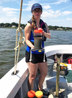
Grad Student Pearson Resolves Statistical Conflict in Submesoscale Ocean Processes

6480a
Jenna conducts a rotating tank experiment to illustrate Ekman dynamics for the Summer@Brown course “Studying the Ocean from Blackboards to Drones.” (Photo by Abigail Bodner)

Ocean models that utilize surface drifter data can provide oil spill responders with important information about the floating oil’s direction and speed as it moves along the ocean surface. However, surface drifters, like the floating material they represent, tend to cluster along strong fronts and eddies. This clustering can result in important consequences for surface drifter turbulence and transport data at smaller scales. Jenna Pearson is investigating the extent that material clustering impacts the accuracy of turbulence calculations and searching for potential factors or processes involved.

Jenna is a Ph.D. student with Brown University’s Department of Earth, Environmental and Planetary Sciences and a GoMRI Scholar with the Consortium for Advanced Research on Transport of Hydrocarbon in the Environment II (CARTHE II).

Her Path

6480b
Jenna (front), Henry Chang (left), and Andrew Smith (right) prepare to launch drift cards and then aerially observe them using a drone during the SPLASH experiment. (Photo by Brodie Pearson)

Jenna developed her scientific interests as an undergraduate student at Northeastern Illinois University. While working as a math tutor, she decided to major in Mathematics after a pre-calculus professor encouraged her to pursue it as a career. She added Earth Science as a second major after serving as an Army National Guard medic in Iraq during her undergraduate studies. “I was only deployed for about a year, but I was a medic for eight years in total,” she said. “I transitioned from being a medic to a math and science major because there were more tools at my disposal to help global populations, rather than just treating a handful of individuals at a time.”

Jenna gained experience using math and science to solve larger problems through summer research programs. She participated in the 2013 Harvard School of Public Health Summer Program in Epidemiology with Dr. Alkes Price, where she used statistical methods to infer consistency across genetic variants associated with increased Type II Diabetes risk. The following year, she spent two summer months with Dr. Bjorn Sandstede at Brown University’s Division of Applied Mathematics, where she modeled microscopic and macroscopic traffic flow. While there, she learned about various tools used for modeling dynamic systems and how to apply data assimilation schemes.

During her summer at Brown University, Jenna met with Dr. Baylor Fox-Kemper who felt that her skillset would fit well with his CARTHE research, and she joined his team as a Ph.D. student in 2015. “The transition to CARTHE-related work was natural because of my desire to look at environmental problems,” said Jenna. “My summer research at Brown involved incorporating Eulerian and Lagrangian data into traffic models, which led me look specifically at the drifters and think critically about the types of statistics we were looking at.”

Her Work

6480c
Jenna conducts an experiment investigating pressure heads and their hydrostatic relation for the Summer@Brown course “Studying the Ocean from Blackboards to Drones.” (Photo by Abigail Bodner)

When examining fluid motion, researchers use a Lagrangian approach (such as drifters) to trace how ocean surface waters flow through an area over time and a Eulerian approach (such as a fixed buoy or weather station) to observe fluid dynamics at a specific location. Jenna initially studied drifters similar to those deployed during CARTHE’s Grand Lagrangian Deployment (GLAD) experiment and Lagrangian Submesoscale Experiment (LASER). She assessed the drifters’ behavior using velocity structure functions to better understand turbulence in a study area. She and her colleagues compared their statistics to those from a Eulerian model and noticed that the drifter-derived Lagrangian functions represented unrealistic conditions compared with other CARTHE research.

Jenna used an algorithm to determine that this disagreement occurred because surface drifters are “biased” at smaller scales when compared to Eulerian calculations, meaning that they don’t sample the velocity field equally at all times. She observed that the convergence of drifters into special flow structures, such as fronts, skews the Lagrangian statistics away from the Eulerian ones. “Previous studies show that drifters tend to cluster in regions of strong frontogenesis or can remain trapped in persistent eddies, leading them to only sample certain portions of the velocity field at a given time,” she explained. “We have found that velocity structure functions are biased below 10 km, but agree at scales above that mark. This means good things for people who would like to know mesoscale statistics, but also means that statistics below 10 km need to be cautiously interpreted.”

Jenna’s team is currently working on an observational study that pairs data from LASER drifters and X-band radar to validate these findings and determine the extent that clustering impacts results. Their preliminary results are consistent with their previous observations. They plan to incorporate more descriptive statistics and probability density functions to determine why bias occurs at smaller scales and how much of the Eulerian-Lagrangian difference can be contributed to this sampling bias. Jenna hopes that her research will help researchers collect and interpret drifter data more accurately, particularly for use in tracking spilled oil and algal blooms.

“A suite of biogeochemical floats is currently being released in various parts of the global ocean. There is then a question as to whether or not we can trust that these drifters represent the entire velocity field or if the statistics we wish to calculate from them may be biased because of their sampling behavior,” said Jenna. “Alongside my assessment of the Eulerian-Lagrangian differences, I am also developing a new theory related to structure functions and spectra that allows us to use biogeochemical data in a similar fashion to conservative tracers like temperature. This will hopefully give a better picture of what is happening in the upper ocean.”

Her Learning

Jenna’s time at the Fox-Kemper lab was a positive experience that helped her grow academically and as an individual. Conducting field work and attending conferences with her colleagues highlighted the deep connection between her interests in public health and ocean health and sparked her desire for future coastal dynamics and ocean biogeochemistry projects. Teaching opportunities during her doctoral research helped her develop a strategic and tested teaching method while learning more about her own field. “I also fine-tuned my music skills by singing and playing guitar in our Fox-Kemper Lab-wide band!” she said.

Her Future

Jenna is applying for post-doc positions and hopes to continue teaching and conducting research as a professor. Before she graduates, she will return to the Summer@Brown Program and teach the course “Studying the Ocean from Blackboard to Drones” to college-bound high school students. She encourages high school students to take diverse science courses and speak with researchers in different fields to get a good sense of what a scientific career path may entail. “We are always learning and questioning our environment, and it can take some time for you to find what makes you get up in the morning,” she said. “Remember: it is your path, and you should define it.”

Praise for Jenna

Dr. Fox-Kemper described Jenna as an incredibly hard-working and determined student and researcher whose work addresses a fundamental paradox of the CARTHE research: that Lagrangian statistics (from drifters) and Eulerian statistics (from gridded models) seemed to disagree at the submesoscale range. He explained that her research was initially difficult to publish, and she received skeptical feedback from reviewers because her results had substantial implications for drifter-based science. Jenna pushed through the obstacles, resulting in a stronger paper and important realizations about removing model uncertainties.

Dr. Fox-Kemper also reflected on her creative and fun-loving nature around the lab, “She’s famous for making science-themed cakes to celebrate defenses and prelims! A recent one involved green-colored goldfish crackers to indicate the effects of hypoxia. She’s a great presence in our lab.”

The GoMRI community embraces bright and dedicated students like Jenna Pearson and their important contributions. The GoMRI Scholars Program recognizes graduate students whose work focuses on GoMRI-funded projects and builds community for the next generation of ocean science professionals. Visit the CARTHE website to learn more about their work.

By Stephanie Ellis and Nilde Maggie Dannreuther. Contact sellis@ngi.msstate.edu for questions or comments.

************

The Gulf of Mexico Research Initiative (GoMRI) is a 10-year independent research program established to study the effect, and the potential associated impact, of hydrocarbon releases on the environment and public health, as well as to develop improved spill mitigation, oil detection, characterization and remediation technologies. An independent and academic 20-member Research Board makes the funding and research direction decisions to ensure the intellectual quality, effectiveness and academic independence of the GoMRI research. All research data, findings and publications will be made publicly available. The program was established through a $500 million financial commitment from BP. For more information, visit https://gulfresearchinitiative.org/.

© Copyright 2010-2019 Gulf of Mexico Research Initiative (GoMRI) – All Rights Reserved. Redistribution is encouraged with acknowledgement to the Gulf of Mexico Research Initiative (GoMRI). Please credit images and/or videos as done in each article. Questions? Contact web-content editor Nilde “Maggie” Dannreuther, Northern Gulf Institute, Mississippi State University (maggied@ngi.msstate.edu).

Grad Student Aiyer Shows How Oil Droplets Evolve Under Deep-water Conditions

6450a
Aditya Aiyer (left) explains the Lagrangian dynamic Smagorinsky model that his team uses in their Large Eddy Simulations. (Provided by Aditya Aiyer)

Oil, gases, and bubbles jet out together during a deep-ocean petroleum blowout, and the oil quickly breaks up into different-sized droplets. Predicting the sizes of these droplets is critical to determine how long it will take the oil to reach the ocean’s surface and the resulting oil slick’s size. Aditya Aiyer is developing a new approach for state-of-the-art models that simulate oil’s behavior as it moves through turbulent flows and track the subsequent different-sized oil droplets’ breakup and coalescence. The improved simulations of the fate and evolution of oil droplets in deepwater plumes can inform decisions about dispersant application.

Aditya is a Ph.D. student with the Johns Hopkins University’s Department of Mechanical Engineering. He is a GoMRI Scholar working on the project Transport and Fate of Oil in the Upper Ocean: Studying and Modeling Multi-Scale Physical Dispersion Mechanisms and Remediation Strategies Using Large Eddy Simulation.

His Path

6450b
Aditya Aiyer explains the basic ideas of his research to a fellow student. (Provided by Aditya Aiyer)

Aditya developed an interest in science from his father, an enthusiastic physics professor who loved to explain the world around him. Seeing his father’s passion inspired Aditya to pursue a bachelor’s degree in mechanical engineering at the Birla Institute of Technology and Science, one of India’s leading private institutions. He became attracted to the practical applications of fluid dynamics while working towards a master’s degree in physics. Looking at everyday things, such as water flowing from a faucet or cream being added to coffee, from a physics perspective fascinated him. Aditya later took a research associate position at the Tata Institute of Fundamental Research to study atmospheric flows and cloud formation, an unsolved problem when conducting climate modeling. Wanting to delve further into unresolved questions in his field, Aditya began exploring Ph.D. programs and joined Dr. Charles Meneveau’s team researching oil spills.

“After my time at Birla Institute of Technology and Science, I wanted to further explore how I could use my knowledge of physics and fluid dynamics to help make an impact on our lives,” said Aditya. “I’m very excited to work with oil spills, as the results of our research could have a tremendous impact on the environment.”

His Work

6450c
Dr. Meneveau (right) discusses the results from an oil droplet simulation with Aditya Aiyer and Genevieve Stark. (Photo by the Johns Hopkins University Department of Mechanical Engineering)

Aditya uses Large Eddy Simulations to investigate the dynamics between oil droplets and turbulent flows. These model outputs allow him to accurately depict turbulent flows and their effects on oil breakup, either as an oil jet (similar to a deep-water blowout) or in a less-turbulent environment. “Traditional models use Reynolds Averaged Navier Stokes Equations, which need a separate model for turbulence. Using the Large Eddy Simulations, we can capture the effects of turbulence directly, making our simulation closer to what is actually happening in a blowout,” said Aditya. The combination of simulations and equations better depicts the concentration of oil droplets and how they change due to breakup, coalescence, and advection.

Aditya and his colleagues use existing data from similar experiments to validate their model. He explained that their model can predict oil concentrations and size distributions at a given location and time during a blowout. The droplet size distribution tells him how many droplets of different sizes have been generated due to breakup and coalescence, allowing him to infer the droplet’s fate. “Larger droplets would move quickly to the surface, while smaller ones would be more influenced by the local turbulence and might remain underwater. We can also evaluate how much of the oil volume would reach the surface and the time it would take them to do so,” explained Aditya. “Such results can be used to build simpler, better models that can give responders an idea of where they should apply dispersants or other chemicals to deal with the spill.” He hopes to expand his team’s simulation models to include other factors that may affect oil fate, such as dispersant application, to better inform responders’ decision making.

His Learning

Working with Meneveau taught Aditya the importance of approaching problems from the foundation up. He learned to approach problems in sections, starting with the issue’s first principles and then continuously incorporating the issue’s more complex aspects until he reaches his goal. Aditya also reflected on his experiences in the GoMRI science community and engaging with other scientists at the Gulf of Mexico Oil Spill and Ecosystem Science Conference, “There are hundreds of people [in the GoMRI community] working on a myriad of topics from the chemistry and physics of the oil all the way to the ecological effects and effects on local aquatic life. It was humbling to see that my research is also playing a small role in saving our environment.”

His Future

Aditya plans to work towards a university faculty position, where he can apply his love for teaching and working in a research environment, or towards conducting research in a federal or industry position. He said that students interested in a scientific career should remember the importance of having strong fundamentals, “Most ideas a scientist comes up with aren’t due to them knowing some esoteric part of the field, but by having very strong basics. The ability to think clearly and make good inferences based on the fundamental principles of your field is a skill I think every student pursuing science must cultivate and make a part of their repertoire.”

Praise for Aditya

Dr. Meneveau praised Aditya’s contributions to his research team, particularly his development of their new approach to the Large Eddy Simulation toolset. “Thanks to Aditya’s work, we are now able to model the evolution of the entire size distribution,” he said. “Aditya has contributed excellent ideas and done careful tests of the approach he has developed. We look forward to applying the model to realistic flow conditions.”

The GoMRI community embraces bright and dedicated students like Aditya Aiyer and their important contributions. The GoMRI Scholars Program recognizes graduate students whose work focuses on GoMRI-funded projects and builds community for the next generation of ocean science professionals.

By Stephanie Ellis and Nilde Maggie Dannreuther. Contact sellis@ngi.msstate.edu for questions or comments.

************

The Gulf of Mexico Research Initiative (GoMRI) is a 10-year independent research program established to study the effect, and the potential associated impact, of hydrocarbon releases on the environment and public health, as well as to develop improved spill mitigation, oil detection, characterization and remediation technologies. An independent and academic 20-member Research Board makes the funding and research direction decisions to ensure the intellectual quality, effectiveness and academic independence of the GoMRI research. All research data, findings and publications will be made publicly available. The program was established through a $500 million financial commitment from BP. For more information, visit https://gulfresearchinitiative.org/.

© Copyright 2010-2018 Gulf of Mexico Research Initiative (GoMRI) – All Rights Reserved. Redistribution is encouraged with acknowledgement to the Gulf of Mexico Research Initiative (GoMRI). Please credit images and/or videos as done in each article. Questions? Contact web-content editor Nilde “Maggie” Dannreuther, Northern Gulf Institute, Mississippi State University (maggied@ngi.msstate.edu).
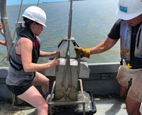
Grad Student O’Brien Analyzes Sediment Movement to Help Predict Oil Transport

6413a
Stephan O’Brien collects water samples at Main Pass, Alabama, for suspended sediment laboratory analyses. (Photo by Brian Dzwonkowski)

Oil spill material that enters the water column may adhere to resuspended seafloor sediments and be transported to other areas. Stephan O’Brien is investigating how physical factors, such as wind and waves, affect the suspension and subsequent transport of sediments in the Mississippi Sound and Bight. “Inorganic matter such as sediment is one of the methods by which oil can be transported,” said Stephan. “By improving our understanding of sediment dynamics, we can provide first responders with information that can help them interpret how moving sediment may affect oil transport.”

Stephan is a Ph.D. student at the University of Southern Mississippi’s Division of Marine Science and a GoMRI Scholar with the Consortium for Oil Spill Exposure Pathways in Coastal River-Dominated Ecosystems (CONCORDE).

His Path

6413b
Stephan assists CONCORDE’s small boat team release surface drifters at Main Pass, Alabama. (Photo by Brian Dzwonkowski)

Stephan’s brother chose a scientific path in high school, sparking Stephan’s interest in science. Schools in Stephan’s home of Trinidad and Tobago follow the British system, where students choose a focus such as arts or sciences when they enter high school. Then they narrow that focus to a more specific field during their final two years before entering university studies. When he was 14, Stephan followed his brother’s example and chose math, physics, chemistry, and biology as his primary focuses and later narrowed his scope to math and physics.

As an undergraduate at the University of the West Indies, Stephan discovered his interest in hydrography after taking two hydrography classes. Later, he applied to the University of Southern Mississippi and started studies in their Hydrographic Science master’s program. His final master’s project was planned to be a survey of Bay St. Louis, Mississippi, in summer 2010. However, his intended survey region was closed following the Deepwater Horizon oil spill, and Stephan moved his survey to Pearl River, Mississippi.

6413c
Stephan presents his work at CONCORDE’s Citizen Scientist Program with the Vietnamese fishing community. (Photo by Jessie Kastler)

Stephan returned to Trinidad and Tobago to teach at the University of the West Indies. While there, he realized that his island was suffering from coastal erosion. This realization inspired him to return to the University of Southern Mississippi as a Ph.D. student to research sediment movement. While working with his advisor Dr. Jerry Wiggert, their team became a part of the CONCORDE research group investigating sediment movement and its relationship to oil transport. “There is a lot of erosion that occurs along the eastern coast of our island country because of the wave action,” said Stephan. “Just being aware of that problem helped with the decision of what I’d like to do for my Ph.D.”

His Work

Focusing on the Mississippi Sound and Mississippi Bight, he analyzes NASA’s remote sensing reflectance data () and uses an algorithm to estimate surface sediment concentrations. He filters surface water samples collected at the same time and location to quantify suspended sediment concentrations and uses an in situ optical back-scatter instrument called a Laser In-Situ Scattering and Transmissiometry (LISST) to measure particle sizes.

6413d
CONCORDE researchers at the 2017 Gulf of Mexico Oil Spill and Ecosystem Science Conference. (Photo by Jessie Kastler)

Stephan uses the in situ suspended sediment concentrations to ground truth the accuracy of a numerical model (Coupled-Ocean-Atmosphere-Wave-Sediment transport model) that characterizes how water masses move within the study domain. Particle sizes can be varied in the model and forcing factors such as wind or wave action can be varied and/or removed from the simulation. This allows Stephan to analyze how each forcing factor changes over time and how each environmental factor contributes to the direction and volume of sediment transported within each sediment size class. “The numerical model is similar to a weather forecast,” he explained. “While weather forecasts use measurements to describe weather patterns over time, this numerical model uses water column and atmospheric measurements to describe how different physical factors affect ocean current movements and, as a result, how much and in which direction sediment will be transported.”

Stephan’s preliminary observations show elevated in situ sediment and increased salinity in Spring 2016, suggesting a link between shoreward advection from the continental shelf and subsequent sediment resuspension. However, Stephan’s model results suggest that the environmental factors driving sediment resuspension and transport in Spring 2016 originated from Lake Borgne and moved east to the Mississippi Bight rather than originating from the continental shelf as initially hypothesized.

His Learning

Stephan considers himself a “scientist-in-training,” and his work with researchers from different backgrounds has helped him learn other research techniques. During the consortium’s spring 2016 cruise, he conducted research alongside Naval Research Laboratory scientists, who showed him how to operate an optical sensor. “Although it was not the same optical instrument I was using to collect my samples, getting to know the details about the sensor helped me get a better understanding of the measurements I was taking in the Sound,” he said.

His Future

Stephan hopes to find a post-doc position with a strong focus on sediment transport, perhaps in Holland or Germany, to gain additional research experience before returning home. He hopes to apply his research skills and experience towards addressing Trinidad’s and Tobago’s coastal erosion problem with Trinidadian government agencies.

His suggestion to students who are interested in science is to speak with other researchers/scientists to get a better understanding of what their fields entail. They should consider gaining some experience through internships or volunteer positions to get a better understanding of actual scientific jobs. “Science is so broad – once you get experience, you can see the different scientific avenues available,” he said.

Praise for Stephan

Wiggert believes that Stephan’s personality and temperament are best captured by the concept of “quiet competence.” He praised Stephan’s diligent, self-motivated, and hard-working approach to his research, which helped Stephan develop a diverse set of observational, programming, and data management skills during his dissertation work. Wiggert also praised Stephan’s determination to share his science, explaining that he has been extremely active in presenting his research findings at scientific meetings and participating in community outreach.

The GoMRI community embraces bright and dedicated students like Stephan O’Brien and their important contributions. The GoMRI Scholars Program recognizes graduate students whose work focuses on GoMRI-funded projects and builds community for the next generation of ocean science professionals. Visit the CONCORDE website to learn more about their work.

************

The Gulf of Mexico Research Initiative (GoMRI) is a 10-year independent research program established to study the effect, and the potential associated impact, of hydrocarbon releases on the environment and public health, as well as to develop improved spill mitigation, oil detection, characterization and remediation technologies. An independent and academic 20-member Research Board makes the funding and research direction decisions to ensure the intellectual quality, effectiveness and academic independence of the GoMRI research. All research data, findings and publications will be made publicly available. The program was established through a $500 million financial commitment from BP. For more information, visit https://gulfresearchinitiative.org/.

© Copyright 2010-2018 Gulf of Mexico Research Initiative (GoMRI) – All Rights Reserved. Redistribution is encouraged with acknowledgement to the Gulf of Mexico Research Initiative (GoMRI). Please credit images and/or videos as done in each article. Questions? Contact web-content editor Nilde “Maggie” Dannreuther, Northern Gulf Institute, Mississippi State University (maggied@ngi.msstate.edu).
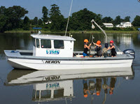
Smithsonian Presents Interactive Story Map to Learn Where Deepwater Horizon Oil Went

6367
A satellite image of the Gulf of Mexico showing the oil slick on the surface of the water. Image: NASA

The Smithsonian’s Ocean Portal published an interactive tool featuring maps and graphics showing where Deepwater Horizon oil traveled. The story map also includes locations for where responders applied chemical dispersants on the Gulf’s surface and other sources where oil enters the Gulf, such as offshore oil and gas platforms and natural seeps.

Try out the story map Where Did the Oil Go in the Gulf of Mexico?  Ocean Portal developed this research-based tool using data from the Gulf of Mexico Research Initiative Information and Data Cooperative (GRIIDC), the National Oceanic and Atmospheric Administration (NOAA), the Environmental Response Management Applications (ERMA), the Bureau of Ocean Energy Management (BOEM), and others.

Learn more about the oil spill and how it traveled:

************

GoMRI and the Smithsonian have a partnership to enhance oil spill science content on the Ocean Portal website.

This research was made possible in part by a grant from BP/The Gulf of Mexico Research Initiative (GoMRI) to the Ecosystem Impacts of Oil and Gas Inputs to the Gulf 2 (ECOGIG 2) consortium, the Florida Institute of Technology, and to the Center for the Integrated Modeling and Analysis of Gulf Ecosystems II (C-IMAGE II).

The GoMRI is a 10-year independent research program established to study the effect, and the potential associated impact, of hydrocarbon releases on the environment and public health, as well as to develop improved spill mitigation, oil detection, characterization and remediation technologies.  An independent and academic 20-member Research Board makes the funding and research direction decisions to ensure the intellectual quality, effectiveness and academic independence of the GoMRI research.  All research data, findings and publications will be made publicly available.  The program was established through a $500 million financial commitment from BP.  For more information, visit https://gulfresearchinitiative.org/.

© Copyright 2010- 2018 Gulf of Mexico Research Initiative (GoMRI) – All Rights Reserved. Redistribution is encouraged with acknowledgement to the Gulf of Mexico Research Initiative (GoMRI). Please credit images and/or videos as done in each article. Questions? Contact web-content editor Nilde “Maggie” Dannreuther, Northern Gulf Institute, Mississippi State University (maggied@ngi.msstate.edu).
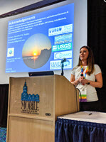
Fact Sheet: Predicting the Movement of Oil

Thumbnail of factsheet

Click Image for Factsheet PDF…

When oil spills occur, one of the first questions is “Where will the oil go?” Pollutants, such as oil, float on the surface and move through and along with the water. Computer models are tools that help predict the path of pollutants. They help minimize oil spill impacts by estimating the landfall and movement of oil. Plans for protecting the environment, society, and the economy require reliable forecasts that predict where oil will spread in the event of a spill.

The Deepwater Horizon (DWH) oil spill was the largest spill in U.S. history. About 172 million gallons of crude oil entered the Gulf of Mexico waters, causing an unprecedented threat to marine life and the environment. Determining the spill’s potential impacts and planning response strategies required getting information unique to the situation because no two oil spills are alike. Each spill occurs in a different location under different circumstances. The type and amount of oil, the proximity of oil to sensitive resources, the season, the weather, and the water currents all combine to make each spill a unique event.  Click the link below for more info…

Link to Factsheet PDF…

This work was made possible in part by a grant from The Gulf of Mexico Research Initiative, and in part by the Sea Grant programs of Texas, Louisiana, Florida and Mississippi-Alabama. The statements, findings, conclusions and recommendations do not necessarily reflect the views of these organizations.

Influence of River Fronts on Oil Spill Transport (GOMRI) – Satellite-Drifters Study

4738In April 2017, GoMRI researchers collaborated on a field experiment focused on better understanding how oil movement and transport is impacted by river fronts. Led by RFP-V investigator Dr. Villy Kourafalou (University of Miami (UM)) and Dr. Tamay Özgökmen (UM and principal investigator of the Consortium for Advanced Research on Transport of Hydrocarbon in the Environment (CARTHE)), the experiment featured satellites, drones, research vessels, and drifters working together to track how leaking oil from the former Taylor Energy Site interacts with the open ocean and the Mississippi River Delta, called the Mississippi-TaylorOcean Convergence Zone. Findings from the experiment are improving scientists’ ability to more accurately track transport and oil thickness near river fronts. The field study was led by WaterMapping LLC, who, with contributions from the University of South Florida and the Norwegian Meteorological Institute, produced a video describing the experiment. Check it out below.

Grad Student Wang Quantifies Ocean Model Uncertainty to Improve Prediction Accuracy

Shitao generates a visualization comparing satellite observational data to model simulations. (Photo by Suzhe Guan)

Shitao generates a visualization comparing satellite observational data to model simulations. (Photo by Suzhe Guan)

Researchers use numerical models to simulate oil spill scenarios and predict where oil will go, but the many factors that affect the oil’s path create uncertainty in the predictions. Shitao Wang quantifies the uncertainty of ocean models to gauge the reliability of oil fate predictions. “It’s like a weather prediction. Instead of saying whether or not it will rain tomorrow, forecasters give you an estimation of how likely it is that it will rain tomorrow,” he explained. “While we can’t say for sure that the oil will transport to a certain place, we can say if there is a 10% or even 80% chance.”

Shitao is a Ph.D. student with the University of Miami’s Rosenstiel School of Marine and Atmospheric Science and a GoMRI Scholar with the Consortium for Advanced Research on Transport of Hydrocarbon in the Environment II (CARTHE II).

His Path

Shitao would often watch the sea in his coastal hometown of Qingdao in northeast China. He developed an interest in studying the ocean and enrolled in the Ocean University of China as a marine technology undergraduate student. While completing his bachelor’s degree, he also pursued his interest in computers and incorporated as many computer science classes as possible into his studies. He also spent time in 2010 as an exchange student in Taiwan at I-Shou University’s electrical and information engineering program. “Studying oceanography, especially the modelling aspect of oceanography, is the natural progression of my personal interest and my academic background,” said Shitao.

He applied to the ocean modelling master’s program at the University of Miami in 2012 and joined Dr. Mohamed Iskandarani, who is conducting CARTHE research that improves material transport predictions. Shitao continues his CARTHE research as a Ph.D. student to reduce the margin of error in oil fate predictions.

His Work

Shitao (middle) helped develop a plan for an interactive citizen science website centered on Tampa Bay, including live Q&A sessions with experts during ongoing disasters like sewage runoff or oil spills. (Provided by C-IMAGE)

Shitao (middle) helped develop a plan for an interactive citizen science website centered on Tampa Bay, including live Q&A sessions with experts during ongoing disasters like sewage runoff or oil spills. (Provided by C-IMAGE)

Uncertainty in ocean models comes from two main sources: the initial conditions (the point at which the model simulation begins) and physical variables such as wind and waves. Shitao uses a technique called ensemble forecasting to quantify uncertainty. He runs the Hybrid Coordinate Ocean Model (HYCOM) under different conditions and analyzes the results to determine the likelihood of certain outcomes, such as for hurricanes or oil spills.

Shitao uses data gathered during the simulation along with Archiving, Validating, and Interpolating Satellite Ocean (AVISO) data to verify and correct the model’s projections. He conducts sensitivity analyses to determine which factors are the principle contributors to the model’s uncertainty. Researchers can use this information to identify which parameters require more attention to improve model output. “This information can inform almost everything related to decision making and helps decision makers assess how they’re going to handle the situation,” he said.

His Learning

Shitao (center right) volunteered at the CARTHE booth during Rock the Ocean’s Tortuga Music Festival in Fort Lauderdale, FL. (Provided by CARTHE)

Shitao (center right) volunteered at the CARTHE booth during Rock the Ocean’s Tortuga Music Festival in Fort Lauderdale, FL. (Provided by CARTHE)

Shitao’s interactions with other researchers have helped connect him to the bigger picture of his research. Iskandarani’s guidance kept him focused on his work’s purpose when he became engrossed in the details of his research. Shitao felt even more deeply connected to his research as he improved his ability to communicate his work to others. CARTHE All-Hands Meetings and annual Gulf of Mexico Oil Spill and Ecosystem conferences gave him opportunities to communicate with prominent researchers in his field. Student activities and outreach programs taught him the skills to communicate with the public. “These activities connect me to the purpose of my work, and my advisor and fellow researchers connect me to the ‘why’ when the ‘what’ and ‘how’ are insurmountable,” Shitao said.


His Future

Shitao plans to join Uber this fall as a data scientist developing algorithms for improved customer service, leveraging his quantitative background and problem solving abilities. He said, “I am excited to help people move conveniently through the city and improve our community and world by making transportation as reliable as running water – everywhere for everyone.”

Shitao advises students pursuing a scientific career to keep their minds focused on the big picture. He explained that he struggled through the beginning of his research because he focused too much on the details. “The purpose of the research is much more important than the minute details because this is the big driver of your career,” he said. “You have to be able to see the purpose before you dive into the details.”

The CARTHE team at the University of Miami taking a short pause from writing papers to celebrate their successful experiments and publications. (Provided by CARTHE)

The CARTHE team at the University of Miami taking a short pause from writing papers to celebrate their successful experiments and publications. (Provided by CARTHE)

Praise for Shitao

Iskandarani said that Shitao is a hard-working and responsible student whose thorough work helped the project make rapid progress quantifying uncertainty in oil plume and ocean model outputs. He noted Shitao’s positive response to criticism as one of his most valuable traits. “Shitao always displayed an open mind about criticism and suggestions, which made his work more rigorous and deepened his understanding of many technical issues,” he said. “In turn, he was very generous with his knowledge and shared with anyone who asked for his help.”

Iskandarani also highlighted Shitao’s friendly and adventurous personality, which over time transformed Shitao’s office into an unofficial meeting place for daily teatimes with his fellow graduate students. He noted that, in contrast to his quieter teatime activities, Shitao is also an avid adventurer and adrenaline seeker. “It worried me to no end when I learned, through a Facebook post, that he went parachuting,” reflected Iskandarani. “I was enormously relieved that he landed safely.”

The GoMRI community embraces bright and dedicated students like Shitao Wang and their important contributions. The GoMRI Scholars Program recognizes graduate students whose work focuses on GoMRI-funded projects and builds community for the next generation of ocean science professionals. Visit the CARTHE website to learn more about their work.

************

The Gulf of Mexico Research Initiative (GoMRI) is a 10-year independent research program established to study the effect, and the potential associated impact, of hydrocarbon releases on the environment and public health, as well as to develop improved spill mitigation, oil detection, characterization and remediation technologies. An independent and academic 20-member Research Board makes the funding and research direction decisions to ensure the intellectual quality, effectiveness and academic independence of the GoMRI research. All research data, findings and publications will be made publicly available. The program was established through a $500 million financial commitment from BP. For more information, visit http://gulfresearchinitiative.org/.

© Copyright 2010- 2017 Gulf of Mexico Research Initiative (GoMRI) – All Rights Reserved. Redistribution is encouraged with acknowledgement to the Gulf of Mexico Research Initiative (GoMRI). Please credit images and/or videos as done in each article. Questions? Contact web-content editor Nilde “Maggie” Dannreuther, Northern Gulf Institute, Mississippi State University (maggied@ngi.msstate.edu).
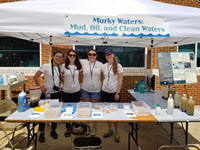
Video: LADC-GEMM Drone Footage of Research Cruise

4545A recent visual and acoustic survey of the northern Gulf of Mexico assessed changes in marine mammal distribution and ambient noise levels following the Deepwater Horizon oil spill. The short clip follows the R/V Pelican as it surveys the area.

Watch the video here.

RFP-V Shay: 3D Gulf Circulation and Biogeochemical Processes – Profiling Float & Ocean Model

The Three-Dimensional Gulf Circulation and Biogeochemical Processes Unveiled by State-of-the-Art Profiling Float Technology and Data Assimilative Ocean Models project is lead by Lynn K. (Nick) Shay, University of Miami.

The overarching goal of this proposed research is to build a rapid response capability that can be deployed in the event of an oil spill. The capability will consist of an integrated observation-prediction system to map the distribution and extent of hydrocarbons in the water column in real time and to quantify hydrocarbon removal and fate including short-term predictions of dispersion induced by the current field and transport of oil to the sea floor through scavenging by marine particles. Specific research objectives are (1) Observe fundamental physical and biogeochemical properties and processes using advanced state of- the-art measurement sensors on new profiling floats; (2) Integrate physical and biogeochemical processes in a coupled model that assimilates real-time data streams in the presence of strong currents; (3) Develop a flexible and carefully evaluated “end-to-end” predictive capability that can be deployed rapidly in case of subsurface oil spills to improve mitigation approaches by emergency responders and policy makers; and, (4) Quantify data and model uncertainties via a robust suite of realistic scenario simulations so that the final forecasted probability has well-understood sources of uncertainty. The prediction system will be evaluated in retrospective assimilation experiments using data from the Deepwater Horizon spill and in forecast experiments that assimilate satellite and float data in real time. Both will demonstrate the system’s capability, and improve our understanding of physical mechanisms and their impacts on the biogeochemistry in the water column.

To address the overarching goal, this group brings together technological development in ocean sensing, and their strategic deployments, modeling and data assimilation techniques, and analyses of data and simulations. The research team members have strong track records in their respective fields as shown on the CVs. The research group includes Dalhousie University, North Carolina State University, Teledyne-Webb Research and the University of Miami. In addition, the team intends to collaborate with the University of Miami’s CARTHE Program, which focuses mainly on measurements of surface processes.

By addressing the complexities of interacting physical and biogeochemical processes through integrated observation and prediction, this research has high potential for scientific as well as societal impacts ranging from possible application of the rapid response capability in the event of a spill and advancement of autonomous observation technology to improved predictions and process understanding. We will combine our collective expertise to develop and implement a rapid response product that is grounded in physical and biogeochemical measurements and their utilization in a coupled modeling framework in the eastern GoM. As part of this effort, we will contribute to training the next generation of scientists and engineers in building and deploying new technology that addresses Research Theme 4. The team members will work closely together to ensure that goals and objectives are met in a timely fashion. Data sets generated by this research will be provided to the GRIIDC group where data will be available to the GoMRI community. This transformative science, made possible through recent advances in autonomous platform and sensor technology, is needed given the complexities that were observed during DwH with subsurface plumes at depth and the southeastern GoM is may be exposed to new risks with possible drilling sites off the Cuba coast in the Straits of Florida. From this broader perspective, our highly experienced team is poised and ready to transcend the boundaries of traditional disciplines in addressing and mitigating present and future risks to our sensitive ecosystems.

Click for access to GoMRI’s YouTube videos of RFP-V Projects…

************

This project was funded by the Gulf of Mexico Research Initiative (GoMRI) in the RFP-V funding program.

The Gulf of Mexico Research Initiative (GoMRI) is a 10-year independent research program established to study the effect, and the potential associated impact, of hydrocarbon releases on the environment and public health, as well as to develop improved spill mitigation, oil detection, characterization and remediation technologies. An independent and academic 20-member Research Board makes the funding and research direction decisions to ensure the intellectual quality, effectiveness and academic independence of the GoMRI research. All research data, findings and publications will be made publicly available. The program was established through a $500 million financial commitment from BP. For more information, visit http://gulfresearchinitiative.org/.


RFP-V Campiglia: Spectroscopy for Specific Isomer Determination of Petroleum Oil Spills

The A Combined Analytical and Synthetic Approach Based on Line Narrowing Spectroscopy for Specific Isomer Determination of Petroleum Oil Spills project is lead by P.I. Andres D. Campiglia, University of Central Florida.

This proposal tackles a different aspect of PAHs analysis as it focuses on detection and characterization of higher-molecular weight PAHs (HMW-PAHs), i.e. PAHs with MW equal or higher than 302 g mol-1. The HMW-PAHs isolated from environmental and combustion-related samples exhibit mutagenic activity and petroleum transformation products from HMW-PAHs persist in the environment longer than their lighter counterparts.

Studies have shown significant sedimentation of HMW-PAHs that may be increased with the addition of dispersants in a coastal setting. Their continued monitoring will ensure that HMW-PAHs present in sediments are not being redistributed and accumulating through the food chain.

When compared to un-substituted PAHs, APAHs comprise a relatively large fraction of the total number and mass of PAHs found in crude oil and crude-contaminated seafood samples. Sulfur is the principal heteroatom in coal, crude oil, tar and their by-products. Thus, to fully understand the environmental implications of the DWH accident, the ideal technique should be able to determine isomers of APAHs and PASHs

The specific research goals are the following: (a) unambiguously determine HMW-PAHs with MW 302 in complex environmental extracts from the Gulf of Mexico using the multidimensional laser excited time-resolved Shpol’skii spectroscopy (LETRSS) technique; (b) synthetize pure standards of MW 302 currently unavailable from commercial sources; and (c) extend the developed approach to the analysis of specific isomers of HMW-PAHs with MW > 302 including alkylated PAHs (APAHs) and sulfur containing PAHs (PASHs).

Click for access to GoMRI’s YouTube videos of RFP-V Projects…

************

This project was funded by the Gulf of Mexico Research Initiative (GoMRI) in the RFP-V funding program.

The Gulf of Mexico Research Initiative (GoMRI) is a 10-year independent research program established to study the effect, and the potential associated impact, of hydrocarbon releases on the environment and public health, as well as to develop improved spill mitigation, oil detection, characterization and remediation technologies. An independent and academic 20-member Research Board makes the funding and research direction decisions to ensure the intellectual quality, effectiveness and academic independence of the GoMRI research. All research data, findings and publications will be made publicly available. The program was established through a $500 million financial commitment from BP. For more information, visit http://gulfresearchinitiative.org/.

Oceanography Highlights Findings from Deepwater Horizon Research

3969

Cover of the September 2016 Oceanography Magazine, Volume 29, Number 3

7th year of the largest coordinated research endeavor around an ocean event.

The 2010 Deepwater Horizon oil spill and subsequent response efforts raised concerns about impacts on the Gulf of Mexico’s ocean and coastal environments. The Gulf of Mexico Research Initiative (GoMRI), in response to the spill, initiated an unprecedented 10-year scientific research program funded by BP. Seven years into the program, we know more than ever before about the Gulf’s complex environment, dynamic processes, and response to stressors.

Oceanography magazine dedicated a special issue to this research, GoMRI: Deepwater Horizon Oil Spill and Ecosystem Science, and below are highlights from 13 papers it featured.*

WHERE OIL WENT

Surface oil covered a cumulative area of 149,000 km2 in the northeastern Gulf. Wind and currents transported surface slicks towards land, affecting approximately 1,800-2,100 km of shoreline, a third of which were moderately to heavily oiled including 1,075 km in Louisiana. Macondo oil was visually evident at the edge of Louisiana marshes and up to 10 m inland.

Subsea oil and gas rose through the water column and formed an underwater oil plume that covered an area of approximately 930 km2 and made direct contact with continental slope sediments. A significant proportion of surface oil returned to the deep seafloor primarily through an extensive marine oil snow sedimentation event known as a “dirty blizzard,” forming a 0.5-1.2 cm thick floc layer.

Cleanup efforts removed oil from 73% of beaches affected by the spill, but residual oil remained as surface residue balls (SRBs), submerged oil mats, and in marsh plants and sediment, and is subject to continued weathering, biodegradation, and possible resuspension.

HOW OIL CHANGED

Crude oils contain thousands of compounds that, upon entering a marine environment, undergo significant compositional changes from weathering processes such as evaporation, dissolution, emulsification, dispersion, sedimentation/flocculation, microbial degradation, and photooxidation.

Most crude oil compounds are readily biodegradable and generally follow a clear degradation pattern: n-alkanes first followed by branched alkanes, lower molecular weight aromatics, higher molecular weight aromatics, and cyclic alkanes. Anaerobic biodegradation is a slower process than aerobic degradation, and crude oil compounds can remain relatively unaltered in reduced sediments and environments for long time periods and may appear as relatively fresh oil compared to surface oil exposed to aerobic conditions.

MICROBIAL RESPONSE AFFECTING OIL FATE

Macondo oil had a relatively low content of persistent resins and asphaltenes, and warm temperatures supported geochemical and biological degradation. The prevalence of oil-degrading bacteria generated a prompt response from the microbial community and subsequent biodegradation. Microbial communities in the plume were different from those in non-plume waters and exhibited a significant enrichment of hydrocarbon-degrading metabolic genes. Aerobic oxidation of short chain alkanes, propane, and butane caused up to 70% of oxygen depletion observed in the oil plume.

Residual oil trapped in Pensacola Beach sands showed a progression of microbial populations linked to hydrocarbon degradation. Early-responder microbes were followed by populations capable of aromatic hydrocarbon decomposition. Microbial abundance in oiled sands was 10-10,000 times that in clean sands in the first four months after oil came ashore.  A typical beach-environment microbial community returned after one year but differed significantly from pre-spill communities.

DEEP OCEAN IMPACTS

Carbon from the spill was likely incorporated into the mesopelagic (200-1,000 m depth) food web through consumption of prey rich in depleted carbon. The nature of microbial communities in the deep sea likely changed. An 80-93% decline in benthic foraminifera was related to reducing conditions and increased polycyclic aromatic hydrocarbons (PAH) concentrations.

Deepsea megafauna had lower diversity and abundance near the spill site relative to regions farther away, though blue marlin, Atlantic sailfish, blackfin tuna, and dolphinfish showed no significant reduction in larval abundance. Bottom-dwelling golden tilefish had the highest concentrations of naphthalene metabolite levels in bile measured in fishes globally. Tunas and jacks collected near the spill site exhibited developmental crude oil cardiotoxicity, suggesting a possible loss of early predator recruits that spawn in open waters. Sperm whale acoustic activity decreased near the spill site by a factor of two and increased farther away, suggesting they relocated.

Hard-bottom communities, including natural and artificial reefs, suffered injuries that were severe and long-lasting. Macrofauna and meiofauna diversity had not recovered after four years, and community structure differences still persist. Deep-sea colonial corals, in particular octocorals near the spill site, showed visible evidence of impact, and flocculent material covering the coral contained chemical fingerprints associated with Macondo oil and DOSS (dioctyl sodium sulfosuccinate). Researchers returned to these coral eight times and observed continued impacts such as tissue death with some coral skeletons secondarily colonized by hydrozoans.

Field measurements showed that planktonic community abundance and species composition returned to pre-spill conditions within a year. Laboratory experiments indicated that zooplankton exposed to sublethal crude oil levels bioaccumulated five PAHs, which could increase their susceptibility to predation and enhance trophic transfer of toxic PAHs.

MARSH IMPACTS

There were immediate negative impacts in moderately to heavily oiled marshes in southeastern Louisiana. The average concentration of total alkanes and PAHs in June 2013 was 20 and 374 times pre-oiled conditions, respectively. Total alkane concentrations were on a trajectory to be near baseline levels by 2015, but this did not occur likely a result of multiple resuspension events from storms.

Some damaged marsh shorelines showed precipitous shoreline erosion at least 2.5 years after oiling due to damaged root systems. Marshes lost due to oiling and shoreline erosion will not return without human intervention. Forty-two months after the spill, heavily oiled marshes showed near-complete plant mortality, and live aboveground biomass was 50% of reference marshes. Decreased living marsh vegetation and population levels of some fauna were obvious for 2-5 years. Meiofauna density was lower along with S. alterniflora grasses in heavily oiled areas.

Fiddler crab average size declined and there were proportion shifts in two species composition. Periwinkle snails density declined, and a slow recovery in abundance and size distribution was related to habitat recovery. Worms, seed shrimp, and mud dragons had not recovered to background levels 48 months post-spill. Killifish showed little evidence of spill impacts. Horse fly abundance declined sharply. Arthropods were suppressed by 50% in 2010 but had largely recovered in 2011. Seaside Sparrow nests on unoiled sites were more likely to fledge than those on oiled sites. Loons varied in frequency with PAHs by year and exhibited reduced body mass as PAH concentrations increased.

These effects are expected to continue – possibly for decades – to some degree, or the marsh ecosystem will reach a new baseline condition in heavily damaged areas.

FISH & SEAFOOD IMPACTS

Commercial, recreational, and subsistence fisheries were closed in fall 2010 in areas where oil was observed and predicted to travel and reopened by April 2011. Impacts on fisheries productivity were relatively short-lived, with landings and their values returning to pre-spill levels or greater for most fishery species. However, long-term effects are yet to be determined. Laboratory studies indicate that early life stages of fish are generally more sensitive to oil and dispersant’s sublethal effects (with some resulting in reduced swimming performance and cardiac function) than adults.

Public health risks from exposure to crude oil residue through seafood or coastal beaches returned to pre-spill levels after the spill dissipated. Seafood from reopened areas was found to be safe for consumption, with PAH levels comparable to those found in common local processed foods. PAH concentrations detected in many seafood samples during and following the spill were at least 2 orders of magnitude below levels of public health concern. DOSS was detected in less than 1% of samples and at levels below public health concern.

Tests on SRBs showed that Vibrio vulnificus were 10 times higher than the surrounding sand and up to 100 times higher than seawater, suggesting that SRBs can act as reservoirs for bacteria including human pathogens. Coquina clams initially showed higher PAH levels relative to the surrounding sand, but levels decreased continuously and were undetectable in sand (one year) and Coquina tissues (two years).

DISPERSANT EFFECTS & FUTURE TECHNOLOGIES

Dispersant increased the oil fraction that spread within the water column and laterally displaced oil that reached the sea surface. Dispersants reduced droplet sizes and rise velocities, resulting in a more than tenfold increase in the downstream length of the surface oil footprint.

Chemical dispersants may be more toxic to some marine organisms than previously thought, and small oil droplets created by dispersant use and directly consumed by marine organisms are often more toxic than crude oil alone. Dispersant effects on microorganisms might be taxa-specific, and some studies suggest that dispersants stimulated biodegradation while others conclude the opposite. Degradation rates of hexadecane and naphthalene were more rapid in the absence of dispersants, as was the overall removal of the water-accommodated oil fraction.

Dispersant applied at the broken riser pipe helped form a deep water oil plume. DOSS was likely transferred to the plume and was later detected in surface sediments, on corals, and within oil-sand patties.

A future option is development of plant-based materials for efficient chemical herding of compact oil slicks into layers that are sufficiently thick to enable oil burning or skimming. Opportunities exist for new dispersants that work in synergy with current dispersants and mitigate some of their disadvantages. Examples include a system containing soybean lecithin and the surfactant Tween 80, substitution of lecithin for DOSS, and using carbon-based particles and silicas to stabilize emulsified droplets. Laboratory research needs to be conducted at concentrations and under conditions relevant to marine environments.

MODELING CAPABILITIES

Model improvements provide a better understanding of droplet formation in the turbulent plume above the wellhead. No model during the spill could predict droplet size distribution, which dictates rise times, dissolution, and biodegradation. Oil spill models now include the ability to simulate the rise of a buoyant oil plume from the seabed to the surface. Consideration of oil’s 3D movement permits the prediction of oil spreading through subsurface plumes. Our understanding of the near-surface oceanic layer and atmospheric boundary layer, including the influences of waves and wind, has also improved.

Oil spill modeling routines will likely be included in Earth system models, linking physical models with marine sediment and biogeochemical components. Advances in coupled nearfield-farfield dynamic modeling together with real-time, seven-day circulation forecasts allow for near-real-time tracking and forecasting of oil dynamics. This is the most promising approach for rapid evaluation of blowout predictions to support first response decisions.

* Overton, E.B., T.L. Wade, J.R. Radović, B.M. Meyer, M.S. Miles, and S.R. Larter. 2016. Chemical composition of Macondo and other crude oils and compositional alterations during oil spillsOceanography 29(3):50–63

Socolofsky, S.A., E.E. Adams, C.B. Paris, and D. Yang. 2016. How do oil, gas, and water interact near a subsea blowout? Oceanography 29(3):64–75

Passow, U., and R.D. Hetland. 2016. What happened to all of the oil? Oceanography 29(3):88–95

Özgökmen, T.M., E.P. Chassignet, C.N. Dawson, D. Dukhovskoy, G. Jacobs, J. Ledwell, O. Garcia-Pineda, I.R. MacDonald, S.L. Morey, M.J. Olascoaga, A.C. Poje, M. Reed, and J. Skancke. 2016. Over what area did the oil and gas spread during the 2010 Deepwater Horizon oil spill? Oceanography 29(3):96–107

John, V., C. Arnosti, J. Field, E. Kujawinski, and A. McCormick. 2016. The role of dispersants in oil spill remediation: Fundamental concepts, rationale for use, fate, and transport issues. Oceanography 29(3):108–117

Passow, U., and K. Ziervogel. 2016. Marine snow sedimented oil released during the Deepwater Horizon spill. Oceanography 29(3):118–125

Tarr, M.A., P. Zito, E.B. Overton, G.M. Olson, P.L. Adhikari, and C.M. Reddy. 2016. Weathering of oil spilled in the marine environment. Oceanography 29(3):126–135

Joye, S.B., S. Kleindienst, J.A. Gilbert, K.M. Handley, P. Weisenhorn, W.A. Overholt, and J.E. Kostka. 2016. Responses of microbial communities to hydrocarbon exposures. Oceanography 29(3):136–149

Rabalais, N.N., and R.E. Turner. 2016. Effects of the Deepwater Horizon oil spill on coastal marshes and associated organisms. Oceanography 29(3):150–159

Murawski, S.A., J.W. Fleeger, W.F. Patterson III, C. Hu, K. Daly, I. Romero, and G.A. Toro-Farmer. 2016. How did the Deepwater Horizon oil spill affect coastal and continental shelf ecosystems of the Gulf of Mexico? Oceanography 29(3):160–173

Buskey, E.J., H.K. White, and A.J. Esbaugh. 2016. Impact of oil spills on marine life in the Gulf of Mexico: Effects on plankton, nekton, and deep-sea benthos. Oceanography 29(3):174–181

Fisher, C.R., P.A. Montagna, and T.T. Sutton. 2016. How did the Deepwater Horizon oil spill impact deep-sea ecosystems? Oceanography 29(3):182–195

Dickey, R., and M. Huettel. 2016. Seafood and beach safety in the aftermath of the Deepwater Horizon oil spill. Oceanography 29(3):196–203

************

The Gulf of Mexico Research Initiative (GoMRI) is a 10-year independent research program established to study the effect, and the potential associated impact, of hydrocarbon releases on the environment and public health, as well as to develop improved spill mitigation, oil detection, characterization and remediation technologies. An independent and academic 20-member Research Board makes the funding and research direction decisions to ensure the intellectual quality, effectiveness and academic independence of the GoMRI research. All research data, findings and publications will be made publicly available. The program was established through a $500 million financial commitment from BP. For more information, visit http://gulfresearchinitiative.org/.

© Copyright 2010- 2017 Gulf of Mexico Research Initiative (GoMRI) – All Rights Reserved. Redistribution is encouraged with acknowledgement to the Gulf of Mexico Research Initiative (GoMRI). Please credit images and/or videos as done in each article. Questions? Contact web-content editor Nilde “Maggie” Dannreuther, Northern Gulf Institute, Mississippi State University (maggied@ngi.msstate.edu).
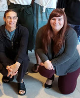
Fact Sheet: ACER Tool Talk Series Highlights SCAT Maps

4059

A SCAT map of a portion of the Chandeleur Islands which are the focus of ACER’ research. Credit: https://gomex.erma.noaa.gov/erma.html

A Shoreline Cleanup and Assessment Technique (SCAT) map indicates the degree of oiling at a geographic location. SCAT teams survey shorelines to collect important data that will help them analyze the amount of necessary cleanup, choose cleanup techniques, and monitor clean up effectiveness.

Read the full story here.

Grad Student Sun Uses Sun Glint to Assess Oil Spills

 Shaojie presents his research on sun glint requirements for oil film detection at the 2016 Gulf of Mexico Oil Spill & Ecosystem Conference in Tampa, Florida. (Photo by Chuanmin Hu)

Shaojie presents his research on sun glint requirements for oil film detection at the 2016 Gulf of Mexico Oil Spill & Ecosystem Conference in Tampa, Florida. (Photo by Chuanmin Hu)

Those who have ever photographed the ocean on a sunny day have likely noticed how the reflected sunlight made the water gleam, often distorting the image. Shaojie Sun has quantified this phenomenon, called “sun glint,” to help address a longstanding limitation in scientists’ ability to assess oil seeps and spills using satellite imagery.

Shaojie is a marine science Ph.D. student at the University of South Florida (USF) and a GoMRI Scholar with the C-IMAGE consortium. He describes his journey from coastal China to coastal Florida to aid marine conservation efforts.

His Path

Shaojie (far right) sets off for a three-day research cruise in the Florida Keys with colleagues from the University of Massachusetts – Boston and Florida International University, March 2016. (Photo by Chuanmin Hu)

Shaojie (far right) sets off for a three-day research cruise in the Florida Keys with colleagues from the University of Massachusetts – Boston and Florida International University, March 2016. (Photo by Chuanmin Hu)

The son of a fisherman, Shaojie grew up only a ten-minute walk from the seashore. His childhood memories of sailors’ stories and eating fresh seafood inspired him to dedicate his life to protecting the sea for the creatures who live there and the people who earn their livings from it.

Shaojie completed an undergraduate degree in Geographical Information Systems (GIS) at Shandong University of Science and Technology in Qingdao, China, in 2010. A highlight of his undergraduate work was his internship at the Chinese State Oceanic Administration’s First Institute of Oceanography. There, he used the programming language he learned in college to process remote sensing images of coastline islands. He explained, “The details of the high-resolution remote sensing imagery attracted me, and I knew what I had learned could help monitor and improve our marine environment.”

Shaojie’s master’s research at Nanjing University used remote sensing techniques to monitor water quality following a cyanobacteria bloom in China’s Taihu Lake, which impacted over five million people’s drinking water and generated increased attention to water pollution in freshwater and marine environments. While completing this study, the large 2011 oil spill in China’s largest inland sea, Bohai – which consisted of three separate leak events over a two-month period – inspired him to pursue oil spill research. “Considering the Deepwater Horizon oil spill in 2010, I began to think deeply about what we can do, as the marine pollution [events] continued one after another and would not stop in the near future,” he said.

Shaojie completed his master’s degree in GIS and cartography in 2013, feeling strongly that remote sensing would play an important role in combating future marine pollution such as oil spills. He contacted USF’s Dr. Chuanmin Hu, whose papers on optical remote sensing applications he had often cited, about joining his remote oil spill detection research with C-IMAGE as a Ph.D. student and entered the project later that year.

His Work

Oil spill footprint map for the Ixtoc I and Deepwater Horizon oil spills. The Ixtoc I oil spill footprint was generated from satellite observations by Shaojie, and the Deepwater Horizon oil spill footprint was based on NOAA data. (Photo provided by Shaojie Sun)

Oil spill footprint map for the Ixtoc I and Deepwater Horizon oil spills. The Ixtoc I oil spill footprint was generated from satellite observations by Shaojie, and the Deepwater Horizon oil spill footprint was based on NOAA data. (Photo provided by Shaojie Sun)

Remote sensing tools can be used to detect the oil’s presence in water but historically struggle to quantify its volume. Previous studies demonstrated that optical imagery could use sun glint effectively to detect oil, yet scientists had not quantified the exact sun glint threshold for the technology to work consistently, and very thin slicks could only be observed at optimal view angles and wind conditions. However, optical remote sensing is a technique that utilizes reflected solar radiation to find surface oil and employs spectral responses to estimate the amount present. “Remote sensing is now serving and will serve as a more and more important part in monitoring and predicting environmental disasters in marine environments.” Shaojie explained, “Volume quantification has been a real challenge to the remote sensing community for decades, but optical remote sensing has shown promising results.”

Shaojie compared multi-sensor data to calculate the sun glint requirement for finding natural oil slicks using the Moderate-resolution Imaging Spectroradiometer (MODIS) and Visible Infrared Imaging Radiometer Suite (VIIRS). He applied the findings using archived Coastal Zone Color Scanner (CZCS) and Landsat/Multispectral Scanner (MSS) data to document the 1979 Ixtoc I oil spill’s footprint and trajectory. “To my knowledge, this is the first time that such information was objectively derived from synoptic measurements enabled by optical remote sensing. The results were used to plan the sediment core sampling locations during a C-IMAGE cruise survey of the Ixtoc I site,” said Shaojie.
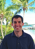
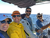
His Learning

Shaojie (right 2nd) and other USF College of Marine Science students share their research about Ocean Color with the public at the St. Petersburg Science Festival. (Photo by Chuanmin Hu)

Shaojie (right 2nd) and other USF College of Marine Science students share their research about Ocean Color with the public at the St. Petersburg Science Festival. (Photo by Chuanmin Hu)

“Since remote sensing is interdisciplinary and has connections to most of the oceanographic disciplines, I have a lot of collaborations with researchers in USF’s College of Marine Science and the C-IMAGE community,” Shaojie said. He explained that physical modelers compare their modelling results with the Ixtoc I oil spill coverage map he generated. In turn, he uses their data to validate results from his work. Shaojie also benefited from C-IMAGE researcher Wes Tunnell’s western Gulf field missions during and after the Ixtoc spill, as data from that time period is limited. “The accordance of satellite observations with field records makes the published satellite results more persuasive,” said Shaojie, adding that he gains many other intangible advantages from sharing ideas with fellow researchers.

His Future

Shaojie plans to complete his comprehensive exam this fall and earn his Ph.D. by summer 2018. His long-term plan is to seek a research position in a university or a research institute. “As offshore oil exploration has increased and continues to increase, oil spills are inevitable,” he said. “I hope I will develop some cutting-edge technology for better detection and quantification and for helping decision makers on mitigation efforts and policy implementation.”

Praise for Shaojie

Shaojie’s advisor Chuanmin Hu said Shaojie first came to his attention when he co-authored a manuscript submitted to the journal Applied Optics. Hu, an associate editor, found Shaojie’s optical experiments on particle size characterization impressive. “I was right,” said Hu. “Since his enrollment in fall 2013, Shaojie’s performance has been outstanding in both classwork and oil spill research.” Hu explained that Shaojie has already fulfilled all course requirements, and is now fully dedicated to his dissertation on remote sensing of ocean oil spills, which Hu called an important and challenging research topic.

Hu discussed Shaojie’s remarkable progress on several publications, “One of these filled the knowledge gap about the footprint and trajectory of the 1979 Ixtoc oil spill in the Gulf of Mexico, and another one made cutting-edge progress to define the threshold of remote detection of thin oil films.” He noted proudly that NASA recently awarded Shaojie a fellowship to continue his research on the challenge of quantifying oil volume via optical remote sensing, a difficult problem that must be solved to help direct mitigation efforts. “Shaojie is smart and hard working,” said Hu. “He is always friendly to others, willing to help, and easy to work with in a team. I am very proud of him.”

The GoMRI community embraces bright and dedicated students like Shaojie Sun and their important contributions. The GoMRI Scholars Program recognizes graduate students whose work focuses on GoMRI-funded projects and builds community for the next generation of ocean science professionals. Visit the C-IMAGE website to learn more about their work.

************

The Gulf of Mexico Research Initiative (GoMRI) is a 10-year independent research program established to study the effect, and the potential associated impact, of hydrocarbon releases on the environment and public health, as well as to develop improved spill mitigation, oil detection, characterization and remediation technologies. An independent and academic 20-member Research Board makes the funding and research direction decisions to ensure the intellectual quality, effectiveness and academic independence of the GoMRI research. All research data, findings and publications will be made publicly available. The program was established through a $500 million financial commitment from BP. For more information, visit http://gulfresearchinitiative.org/.

Investigating How Complex Deepwater Topography Influences Oil Dispersion

3207a

The project’s glider missions will involve two gliders – one equipped to measure turbulence – patrolling between two moorings (stars) for 1-2 months. A 12×12 grid of High Resolution Profiler (HRP3) stations will also collect CTD and oceanic velocity data for two weeks. Three field programs will be conducted, one occurring each year of the grant. Moorings (black squares), tracer injection (green dots), an initial sampling (red dots) from the previous study are also shown. (Image by the WHOI Advanced Engineering Lab)

The active environment of the Gulf of Mexico’s continental slope contains diverse currents that are difficult to simulate and predict.

We know that turbulence is an essential mechanism for hydrocarbon transport and subsurface oil plume dispersion, but we still have much to learn about the complex processes behind this area’s diverse currents.

The Gulf of Mexico Research Initiative recently awarded Dr. Kurt Polzin a grant to study turbulent ocean mixing over the continental slope and its relationship to oil and contaminant dispersion.

His team hopes to quantify the area’s turbulent processes and assess their spatial and temporal variability in response to various environmental and topographical factors.

“Our project is motivated by results from a previous tracer release experiment funded by GoMRI,” explained Polzin. “Tracer data collected from the Gulf of Mexico continental slope at approximately the depth of theDeepwater Horizon blowout revealed unusually intense vertical turbulent mixing. However, none of the simultaneously collected acoustic and oceanographic data could justify the pattern of tracer concentration.”

3207b

Initial (solid black) and four-month mean boundary layer (blue) and interior layer (red) vertical profiles taken from the initial tracer release. Concentration refers to the concentration of tracer compounds at a specified height. The large tails of the boundary profile indicates greater mixing at the boundary layer. (Ledwell, et. al., 2016; Provided by Kurt Polzin)

The team will directly observe turbulent mixing using an integrated, multi-platform field effort. State-of-the-art turbulence platforms and sensor systems will provide a four-dimensional characterization of turbulent mixing that spans the entire water column.

The researchers will conduct a two-week spatial survey and several two-month glider surveys focusing on two regions with distinct topographic structures.

Using measurements from over 144 stations, the team will quantify topographical patterns and local environmental and hydrographic variables. Gliders will capture the features of dynamic deepwater currents identified in the study area.

The scientists hope their research will expand our understanding of vertical turbulent dispersion and help improve the representation of mixing processes in modern plume dispersal models. They hypothesize that the enhanced turbulence resulted from nonlinear phenomena such as hydraulic effects and sporadic flows over the continental slope’s complex topography.

“There is much about these processes that we don’t understand,” said Polzin. “There are meaty science questions here, as rotation is a fundamental oceanic issue but atmospheric research deals almost completely with non-rotating approximations.”

This clip (above) depicts a 3D visualization of the tracer that sparked Polzin’s current project as it moved through the northern Gulf’s complex deepwater topography. The tracer and its accompanying RAFOS float (whose path is marked by the smaller blue and black dots) were injected at about 1100 meters depth above the 1250 m contour (thin blue lines). When Hurricane Isaac (large black dots appearing at 0:12) passed rapidly through the moored array (thick vertical black lines), it caused the float to move upslope, downslope, and westward more rapidly and chaotically, transporting it over a ridge as well as into the seafloor (puffs of smoke). (Video by Kurt Polzin and Jack Cook)The project’s researchers are Kurt Polzin and John Toole at the Woods Hole Oceanographic Institute, Steven DiMarco at the Texas A&M University Department of Oceanography, and Zhankun Wang at the Texas A&M University Geochemical and Environmental Research Group.

************

The Gulf of Mexico Research Initiative (GoMRI) is a 10-year independent research program established to study the effect, and the potential associated impact, of hydrocarbon releases on the environment and public health, as well as to develop improved spill mitigation, oil detection, characterization and remediation technologies. An independent and academic 20-member Research Board makes the funding and research direction decisions to ensure the intellectual quality, effectiveness and academic independence of the GoMRI research. All research data, findings and publications will be made publicly available. The program was established through a $500 million financial commitment from BP. For more information, visit http://gulfresearchinitiative.org/.

Grad Student Tang Studies Whale Populations’ Oil Spill Recovery

3019a

ingting Tang presents her research on whale population recovery at the 2016 Gulf of Mexico Oil Spill & Ecosystem conference in Tampa. (Photo provided by Tang)

When disaster strikes, responders look at how creatures in its path may be impacted to mitigate damage.

Tingting Tang takes the process one step further, using mathematical models to predict how long recovery may take. The creatures that Tingting focuses on are some of the Gulf of Mexico’s largest predators and most charismatic animals, beaked and sperm whales.

Working towards her Ph.D. in Mathematics at the University of Louisiana at Lafayette (UL Lafayette), Tingting is a GoMRI Scholar with the LADC-GEMM consortium. She describes how her love of math led her to study some of the world’s largest creatures.

Her path

Tingting, a native of China, had never been to the United States before pursuing graduate studies in Lafayette. “When I was a child, I had no idea that later in my life I would be studying marine mammals in the Gulf of Mexico,’ she recalled.

3019b

Sperm whales photographed by Franco Banfi (Copyright, Franco Banfi, all rights reserved. Image provided here as fair use for education purposes and to acquaint new viewers with Banfi’s work)

Always up for a challenge, Tingting found math appealing because it was the most difficult subject in school; however, as she grew older, she became captivated with it and its ‘simple beauty.’ Later she learned that math could address questions about her country’s large population. Tingting explained, “The idea of studying population structures became more attractive to me as I learned about powerful tools in mathematics.”

This interest led her to seek advanced math programs, and she earned degrees in applied mathematics and computer science from the East China University of Technology and Science in 2012. She took a big step away from home, enrolling in the UL Lafayette mathematics graduate program and then earning a Master’s degree with a concentration in applied mathematics.

UL mathematics and physics departments had ongoing studies on Gulf marine mammal populations that inspired Tingting to initially focus her research on disease epidemics. Her advisor Dr.Azmy Ackleh was impressed with her work and encouraged Tingting to join him and the LADC-GEMM team assessingDeepwater Horizon oil spill impacts on marine mammals. “I was very excited to be on the project,” said Tingting. “This was a great opportunity to apply what I have learned to a timely and interesting real world problem.”

Her work

3019c

The LADC-GEMM team for the 2015 Gulf of Mexico recovery cruise. From left to right: Douglas Dugas, Natalia Sidorovskaia, Tad Berkey (Captain), Sean Griffin, Tingting Tang, Kun Lee. Top right Bradley Lingsch and Carl Richter, bottom right Elizabeth Kusel and Sakib Mahmud. (Photo by Douglas Dugas)

Tingting described her daily research routine, “I often find myself losing track of time trying to solve a problem arising from modeling or debugging a program.” Yet, she feels that every day is an adventure, “I learn something new, which is my favorite part of being a research student.”

Her work has two parts:  estimating the number of whales and assessing environmental impacts on them. Tingting analyzes population density trends of beaked whales using data collected near the spill site in 2007, 2010, and 2015 by LADC-GEMM’s acousticians, led by Dr. Natalia Sidorovskaia. Tingting uses this data to develop statistical and mathematical models and obtain population density estimates.

Tingting assesses environmental impacts on marine mammals with a life-stage matrix population model to analyze changes in sperm whale population dynamics. Her study uses a mathematical model based on a five-stage life cycle that divides the female population into calves, juveniles, mature females, mothers, and post-breeders. A potential impact of the oil spill on the sperm whale population could be reflected in reduced adult female vital rates. Tingting uses the model to describe the population dynamics and derive recovery probability and time under different impact levels. For example, if the adult female survival rate is reduced by 1% for 20 years due to a certain event, how long would it take for the whale population to recover to pre-event levels? What if the reduction is 3% and lasts for 30 years?   The stage-structured population model can help provide insights into questions like these.

3019d

The LADC-GEMM team memebrs during the 2016 Gulf of Mexico Oil Spill and Ecosystem Science Conference. From left to right: Hal Caswell, Chris Tiemann, Azmy Ackleh, Dave Mellinger, Chris pierpoint, Stan Kuczaj, Natalia Sidorovskaia, Danielle Greenhow, Tingting Tang, Kun Li, Ross Chiquet. (Photo provided by Tingting Tang)

Previous research by LADC-GEMM indicates that sperm whales relocated to sites farther away from the spill. Tingting’s preliminary findings on beaked whales, however, suggest that they remained in the area, though she is not certain what specific factor(s) prompted the different migratory behavior of beaked and sperm whales.  She learned that both whale populations are fragile and particularly sensitive to changes in adult female vital rates. Even slight changes in adult females’ mortality or reproduction rates can result in population decline. Tingting completed analysis of the 2007 and 2010 acoustic data and hopes to analyze the 2015 data after others process it. Doing so will give her a longer timeline of the whales’ density trends so she can understand whether whales have returned to pre-spill numbers and predict their future populations.

Her learning

Tingting credits her advisor Dr. Ackleh with mentoring her towards her goals and teaching important research techniques, including exhaustive literature searches to refine her methodology. She also joined a LADC-GEMM research cruise in October of 2015 to recover equipment deployed in an earlier trip. She observed field-work processes, assisted in equipment recovery, and learned details of how data is collected. She feels very fortunate to work on such a large-scale project as a graduate student, particularly one with so many talented people. “I am truly thankful for the opportunity to join the GoMRI science community,” she added.

She participated in the 2016 Gulf of Mexico Oil Spill and Ecosystem Science conference, “I was very excited but nervous standing by my poster,” Tingting said. “But as the poster attracted more people with questions and interest in our findings, I felt proud and accomplished explaining our methodology.” She is looking forward to presenting more results in the coming year.

Her future

Tingting plans to complete her Ph.D. in the summer of 2017. She hopes to secure a postdoc position, continue her population dynamics studies, and build a solid resume of published research. Her dream is to land a tenure-track position at a research institution, “I hope one day I can be as good as a researcher as my advisor Dr. Ackleh.”

Tingting would love for all aspiring scientists to embrace the beauty of mathematics as a research tool. She says that the right tools coupled with the right attitude can bring success in science. “For students considering science as a career, I would say endurance, persistence, and hard work will not fail you.”

Praise for Tingting

Describing Tingting as hardworking and smart, Dr. Ackleh said, “What distinguishes her from other students is her leadership skills.” He has watched her, even as a young Master’s student, lead meetings that involved older students further along in their research. She helped the team attend this year’s Gulf of Mexico Oil Spill & Ecosystem Science conference, organizing travel, working with a postdoc on the presentation poster, and driving a group to Tampa.

Tingting joined Ackleh as an author on an earlier article funded by the National Science Foundation regarding disease epidemics, and they are preparing a manuscript for publication. Ackleh said that Tingting was a main driver of that paper, contributing as much as anyone else on the project. She is also a co-author with Ackleh and other LADC-GEMM team members on a recently-submitted paper about their research using stochastic modeling to analyze effects of environmental stressors on sperm whales.

The GoMRI community embraces bright and dedicated students like Tinting Tang and their important contributions. The GoMRI Scholars Program recognizes graduate students whose work focuses on GoMRI-funded projects and builds community for the next generation of ocean science professionals. Visit the LADC-GEMM website to learn more about their work.

************

This research was made possible in part by a grant from The Gulf of Mexico Research Initiative (GoMRI). The GoMRI is a 10-year independent research program established to study the effect, and the potential associated impact, of hydrocarbon releases on the environment and public health, as well as to develop improved spill mitigation, oil detection, characterization and remediation technologies. An independent and academic 20-member Research Board makes the funding and research direction decisions to ensure the intellectual quality, effectiveness and academic independence of the GoMRI research. All research data, findings and publications will be made publicly available. The program was established through a $500 million financial commitment from BP. For more information, visit http://gulfresearchinitiative.org/

LASER Focus Advances Knowledge of How Gulf of Mexico Water Moves

2758a_sm

(Click to enlarge) CARTHE drifter trajectories in the Gulf of Mexico superimposed on AVISO surface currents. Red squares mark drifters positions on 9 March 2016 and the tails are 14 days long. (Credit: Edward Ryan and Tamay Ozgokmen from the University of Miami)

The Consortium for Advanced Research on Transport of Hydrocarbon in the Environment (CARTHE) conducts unprecedented experiment to improve oil fate models.

Predictions for decisions – our world relies on them, from daily weather to annual financial forecasts. Predictions, though, are only as good as the information that goes into making them. And those predictions carry even more weight when they involve human safety in situations like storm tracking, search and rescue, and pollution monitoring.

The Gulf Coast experienced such a situation during the Deepwater Horizon oil spill. Answers to where was the oil going, how much was involved, and when would it arrive would influence many decisions. Responders used the best available resources for decision-making, but the blowout’s magnitude and depth was a first for the Gulf and the need for improved transport modeling became apparent.

2758b

A 3-D printer created small-scale drifter prototypes (photo: Novelli). Top right: Cedric Guigand and Guillaume Novelli hold the 1st production-grade assembled drifter after they and Charles Cousin conducted two years of R&D (photo: Ozgokmen). Bottom right: Full and half-scale drifters side by side. The surface ring provides buoyancy; its open design and narrow neck prevent wind from lifting or tilting the drifter. (Photo: Novelli)

The CARTHE group, 75 researchers and staff representing 26 institutions, recently carried out a month-long experiment in the Gulf of Mexico named the LAgrangian Submesoscale ExpeRiment or LASER. Their goal: make quantum leaps in improved ocean transport predictions. Years of planning, designing, and testing preceded this highly-orchestrated event that went beyond previous scales and scope.

Using two research vessels, three planes, and cutting-edge technology, the LASER team acquired troves of ocean data from hundreds of survey miles; 1,000 biodegradable drifters; 8,000 high-resolution photos; 10,000 biodegradable drift cards; and 500,000 infrared images. This monumental effort is already paying off big dividends with nearly ten million data transmissions to date, providing information that prediction models can use now.

“We produced a wonderful dataset.  I don’t think anything quite like this has been done before.” Professor Eric D’Asaro, Applied Physics Laboratory and School of Oceanography, University of Washington and LASER’s Scientific Lead and Chief Scientist on MV Walton Smith

SOME BACKGROUND

2758c

The team conducted thousands of drifter tests and experiments in the SUSTAIN wind-wave tank. L: Cedric Guigand tests a drifter. Top Right: The tank’s wind-generating machine. The difficult and creative work resulted in significantly improved drifters with a patent application. (Photos: Ozgokmen)

The theories driving CARTHE research are that the accurate prediction of an oil spill’s first mile of transport is critical for accurately predicting its last mile and that surface transport is strongly influenced by what’s happening just below the sea surface and where air and water meet.

CARTHE’s first experiment, the Grand LAgrangian Deployment or GLAD, was the largest oceanic surface drifter deployment to date and demonstrated the importance of observing surface currents for accurate transport predictions. The 317 GLAD drifters rapidly spread in the first few hours and days, then continued more slowly afterwards. GLAD data improved operational circulation models, but they needed more detailed observations on the physical processes driving surface dispersion.  So LASER picked up where GLAD left off, collecting high-resolution data that measures complex upper-ocean processes driving the initial quick burst and longer-term dispersion. LASER data will complement the GLAD data and provide better understanding about seasonal variability and its influence on water transport.

NOVEL TACTICS AND TECHNOLOGY FOR OCEANOGRAPHIC STUDIES

2758d

The aerostat team conducts field tests to check the winch, lines, and the camera platform. Dan Carlson led the development of the aerostat and its imaging platform that carried a 50 mega-pixel Canon DSLR camera. (Photos: Ozgokmen)

The LASER team went back to the drawing board to advance ocean transport predictions. They spent more than two years researching and developing a new generation drifter that addressed limitations of the GLAD drifter design. The new drifter had to be biodegradable, light weight, compact, cost efficient, easily produced and assembled, and could float and track currents in high winds and waves.

An operational version emerged after experiments in the SUSTAIN wind-wave tank facility and in nearby Biscayne Bay. These ‘roving detectives’ equipped with satellite trackers can transmit data for several months without leaving behind thousands of plastic skeletons (drifters are 99.9% biodegradable due to their tiny GPS board). Researchers also designed autonomous 3-D Lagrangian floats that measure vertical velocities a few meters below the sea surface. These floats and drifters provide data to advance knowledge about surface and water column transport.

2758e

Top Left: Forrest Glenn Middle School students paint drift cards. Bottom Left: West Miami Middle School students display their painted drift cards. R: Test drift cards in Biscayne Bay. (Photos by CARTHE)

Complementing the drifters were bamboo drift cards, which local middle-school students helped color for visual identification using non-toxic paint.  Researchers used these drift cards to measure dispersion by waves, winds and ocean currents at scales of 1 meter-100 meters and seconds-hours.  The cards thin design (~1 millimeter) allowed researchers to capture the top-most surface velocity needed for oil dispersion studies. Since the cards could not be fitted with tracking devices, the team developed a Ship-Tethered Aerostat Remote Sensing System (STARSS) – a helium-filled balloon carrying a high resolution camera and positioning system – to provide spatial context and real-time observations of drift card dispersion and surface features.

2758f

L: Crews load the towed CTD on the Walton Smith. Top Right: Eric D’Asaro (L) helps situate one of the solar-and-wave-powered gliders which travels 14 days at 1 m/s. Bottom Right: Brian Haus and team set up the X-Band Radar tower that takes 1 m resolution wave measurements in a 3 km radius. (Photos: D’Asaro and Ozgokmen)

LASER incorporated aircraft surveys, ship measurements, and real-time assimilative models to guide drifter deployments under cloudy conditions and identify quickly-evolving features. Two dual-engine Partanavia p86 planes from the University of California, Los Angeles (UCLA) and Scripps Institution of Oceanography operated high-resolution thermal and hyperspectral imagers that geo-rectify images. The NASA Jet Propulsion Laboratory (JPL) provided a high-resolution AirSWOT, an airborne version of a new altimeter sensor to be installed on satellites in 2020. The JPL-CARTHE collaboration provided ground truthing for NASA sensor measurements and additional detailed mapping capability for LASER.

Shipboard surveys provided fine-scale real-time data on air-sea flux, density, temperature, salinity, velocity, wind, and waves. Instruments included an Acoustic Doppler Current Profiler; a Rockland Scientific Profiler; a towed conductivity, temperature, and depth (CTD) system (freeing the crew from making numerous, single-point casts); an X-band wave radar tower; meteorological buoys; and robotic wave gliders.  The University of Miami Coupled Atmosphere-Wave-Ocean Model and the Navy Coastal Ocean model assimilated incoming data. The modelling team made available the resulting high-resolution forecasts of weather, waves, and circulations in real time through a central website to aide LASER deployment decisions.

LASER BY LAND, SEA, AND AIR

2758g

L: Autonomous 3D Lagrangian floats, ready for vessel loading, measure vertical velocities in the turbulent mixed layer (photo: Ozgokmen). R: Surface drifters in a container ready to launch. (Photo: Novelli)

“I was excited about LASER, but sobered by the magnitude of what we needed to accomplish.” Eric D’Asaro on transitioning from planning to execution

It took almost three days to load ten tons of equipment on the R/V Walton Smith and U/V Masco VIII.  Teams manned forklifts and loaded containers with drifters, cards, gliders, and the aerostat.  They welded winches, bolted down the wave radar tower, and tested connections for data exchange and communications. Modelers ran forecasts while the Walton Smith sailed from Miami to join the Masco VIII in Key West. Crews battened down the hatches and waited out a storm, then set sail together on January 18 with threatening skies and rough seas as their constant companions for the next month.

2758h

L: The Masco VIII tows the aerostat as it images drift cards (credit Dan Carlson). Top right: The crew rescues the aerostat from being dislodged by wind (provided by CARTHE). Bottom right: Crews deploy drifters in rough seas across from the Walton Smith. (Photo: Novelli)

Intense storms set the crews’ timing and pace. Everyone braced for demanding work, assembling and staging drifters and communicating constantly as they organized day and night shifts to work during fair weather windows. The UCLA plane generated sea-surface-temperature (SST) maps for the first deployment site where the crews worked speedily as weather deteriorated, deploying 300+ drifters in five hours and surveying the area. Then they headed for safe harbor in Gulfport, MS.

A variety of adjustments had to be made while at sea. The teams identified islands near the mouth of the Mississippi River to wait out storms and quickly return to work. The Masco VIII crew constructed a hammock to keep the aerostat out of water pooling on deck.  The UCLA plane conducted 6+ hours of aerial surveys, identifying frontal features and producing nearly instantaneous maps of the 10km x 10km region where crews deployed drifters, gliders, and drift cards. The Masco VIII team imaged the drift cards with the aerostat for six hours.  The Walton Smith team surveyed a freshwater front’s leading edge, releasing drifters and a glider for continued data gathering.

2758i

Top left: Jeroen Molemaker prepares the UCLA plane. Bottom left: Aerial view of LASER operations. R: Aerial surveys found strong frontal features. (Photos: Ozgokmen)

Crews were on their way to the next site but had to return to island shelter as a forth storm passed. Long hours and rough conditions began taking a toll: equipment malfunctions caused the aerostat to tear, the planes’ imaging equipment needed repairs, the Masco VIII’s internet stopped, and the Walton Smith’s water filtering pump broke requiring strict water rations. But everyone rallied. UCLA, Scripps, and the NASA/JPL aircraft jointly surveyed drifters, final deployment sites, and fronts. Making up lost time, three pilots took shifts on the UCLA plane and conducted a 110-hour around-the-clock mission.

“The aerial observation crew’s determination and the maps they produced injected Red Bull into LASER, giving the team tremendous focus to capture some of our most valuable data.”Professor Tamay Ozgokmen, Rosenstiel School of Marine and Atmospheric Science, University of Miami and CARTHE Director

2758j_sm

(Click to enlarge) Some of the LASER operational team, L to R: Ming Shao, Angelique C. Haza, Karthrine Howe, Hanjing Dai, Laurent Grare, Alexander Soloviev, Guillaume Novelli, Tamay Ozgokmen, Eric D’Asaro, Cedric Guigand, Maristella Berta, John Kluge, Sharon Chinchilla, Nathan Laxague, Andrey Shcherbina, Chris MacKay, and Michael Ohmart. (Photo provided by CARTHE)

Over a 14-hour period, teams deployed one drifter every six minutes and released drift cards tracking them and a nearby front with the aerostat for nearly seven hours. They deployed gliders, buoys, and took shipboard measurements and imagery of air-sea fluxes, density, and surface and subsurface structures. Again, they scurried for shelter from yet another storm, but their priority work – capturing small-scale ocean processes that had never been measured – was done.

The Masco VIII steamed home to Key West while the Walton Smith crew found and inspected 18 drifters for damage. Aerial observations located 100+ drifters converging near the Deepwater Horizon site, so the Walton Smith crew released the 3D Lagrangian floats to measure vertical velocities there. They also completed a 24-hour moving-vessel-profiler survey and then headed to Miami.  Safely home on February 15, they celebrated their successful month-long field campaign, happy to hear that over four million drifter position transmissions had already been received.

WHAT’S NEXT?

2758k

The RV Walton Smith steaming to the Desoto Canyon in the Gulf of Mexico. (Photo: Novelli)

A period of introspection and data analysis follows. LASER’s millions of datapoints and images presents organization challenges and requires automated methods for quality control and analysis. Preliminary evaluation shows that the innovative approach of high-resolution SST and drifter data revealed small scale ocean structures not previously observed. LASER’s wealth of information can be leveraged for years to come as its data is made available in the Gulf of Mexico Research Initiative Information and Data Cooperative (GRIIDC) system.

“LASER pushed the boundaries of ocean observations, furthering our understanding about the processes that govern upper-ocean transport. Lessons learned from LASER will help us do an even better job in the next experiment.” Jeroen Molemaker, University of California at Los Angeles and LASER’s Aerial Observations Chief Scientist

CARTHE’s next experiment, Submesoscale Processes and Lagrangian Analysis on the Shelf or SPLASH, will build upon their previous Surfzone Coastal Oil Pathway Experiment or SCOPE that measured processes influencing the last mile of oil transport. Their subsurface plume research is combining laboratory and numerical modeling to understand how hydrocarbons move through the water column.

Advancing ocean science wasn’t the only thing LASER accomplished – it provided field experience and professional development for graduate students and young scientists, using a bigger-picture interdisciplinary approach to investigate ocean processes.

Scientists will use data from GLAD, SCOPE, LASER, and SPLASH to construct a more complete picture of transport pathways and physical processes near the Deepwater Horizon site and continental shelf regions. This information will assist in reconstructing flows above and below the sea surface, allowing for improved retrospective analysis of spills and transport predictions in future emergencies.  CARTHE’s research has far-reaching applications with new scientific insights that can inform navigation, energy production, climate science, hurricane predictions, search and rescue, and beach safety.

************

This research was made possible in part by a grant from the Gulf of Mexico Research Initiative (GoMRI) to theConsortium for Advanced Research on Transport of Hydrocarbon in the Environment (CARTHE).

The GoMRI is a 10-year independent research program established to study the effect, and the potential associated impact, of hydrocarbon releases on the environment and public health, as well as to develop improved spill mitigation, oil detection, characterization and remediation technologies.  An independent and academic 20-member Research Board makes the funding and research direction decisions to ensure the intellectual quality, effectiveness and academic independence of the GoMRI research.  All research data, findings and publications will be made publicly available.  The program was established through a $500 million financial commitment from BP.

Grad Student Pinales Designs “Smart” Oil-Spill Detection Tool

2534_a

Juan demonstrates Synthetic Aperture Radar (SAR) data from the Deepwater Horizon incident. (Provided by Juan Pinales)

Juan Pinales is working on a computational modelling system that will aid oil spill monitoring efforts. He combines Synthetic Aperture Radar (SAR) data and oceanographic conditions recorded during the Deepwater Horizon incident to improve surface oil detection using a semi-automated machine learning method known as artificial neural networking.

This method will help the system’s computations “learn” to interpret new slick scenarios and identify sea surface oil more accurately as new data is entered and processed.

Juan is pursuing his Ph.D. in applied marine physics at the University of Miami’s (UM) Rosenstiel School of Marine and Atmospheric Science and is a GoMRI scholar working on the project Monitoring of Oil Spill and Seepage Using Satellite Radars. He explains how a lifetime fascination with making things work led him to this research.

His Path

2534_b

Juan’s research requires many hours analyzing imagery to improve computational modeling calculations. (Provided by Juan Pinales)

As a child in the Dominican Republic, Juan chose class projects that allowed him to flex his creative muscles. He enjoyed science courses that applied theoretical knowledge to solve problems. “I loved to create and produce things, especially from an engineering perspective,” said Juan, “and I always wanted to work with computers.”

Juan’s family moved to New York while he was in high school, and he later enrolled in the materials and engineering science program at the State University of New York, Stony Brook. He enjoyed the chance to use materials to solve problems and created the Rumble Aide, an obstacle detection device for the blind, as his senior design project.

Juan briefly worked in industrial HVAC design after graduation, turning engineering schematics into three-dimensional products. The economic downturn sent him back to school as an Earth and Atmospheric Sciences graduate student (City College of New York) and a GED tutor (Bramson ORT College in Brooklyn), a role that honed his public speaking skills and raised his academic confidence. He continued mentoring younger students in the Summer High School Internship Program (CREST-SHIP), helping them learn STEM-related remote sensing applications and data analysis software, including QGIS and MATLAB.

While at the City College of New York, Juan received a graduate fellowship from the NOAA-Cooperative Remote Sensing & Technology (NOAA-CREST) program to monitor changes in Alaska’s freeze-thaw cycle using active and passive remote sensing instruments. This research taught him to incorporate SAR technology into his work. Wanting to continue this practice during his Ph.D. studies, Juan contacted Dr. Hans Graber, director of UM’s Center for Southeastern Tropical Advanced Remote Sensing (CSTARS) program, and joined Graber’s GoMRI-funded oil spill monitoring project.

His Work

SAR technology yields a complex, high-resolution map of the water’s surface, with oil slicks appearing noticeably darker than areas with no oil. Juan is creating an algorithm to help the modeling program correctly interpret the dark zones it sees. His goal is to have a product that needs minimal human input during a future spill.

Artificial neural networks are machine learning systems inspired by the human brain that can be trained with each new scenario. Juan analyzes SAR data using daily images and those from previous oil spills. He then updates the model’s program code to apply previous information to current scenarios, adding related inputs to teach the algorithm to differentiate between oil and things that look like oil but are not.

“The system is designed to recognize certain elements within an image. Things like wind fields can change the texture,” Juan explained. “The system is trained to recognize certain patterns and match those patterns to a desired output. Once the detection system is trained, the algorithm processes data and produces oil spill candidates.”

Juan presented an initial version of his project at the 2015 Gulf of Mexico Oil Spill and Ecosystem Science Conference in Houston, but says much work remains to be done. He communicates weekly with Dr. Graber and his CSTARS collaborators, John Hargrove and Michael Caruso, regarding his program’s progress. He’s currently working to reduce the time between data acquisition and output to aid responders in decision making and improve the system’s ability to distinguish natural seeps and certain weather conditions (low wind, surface roughness) from oil spills.

His Learning

Juan, though already familiar with field and satellite data, said that Dr. Graber had taken his understanding to a new level. “I am humbled that I have the opportunity to be here with people of this caliber,” he said of the UM research team working on the GoMRI project.

Juan did not know about ocean remote sensing techniques prior to attending UM. Working closely with marine field researchers has helped Juan to incorporate their methods into his project. “I’m engaging myself in different avenues so I can become a better researcher,” Juan explained, adding, “Every year I get better, and the algorithms perform better as a result.”

His Future

Juan’s focus is on improving his SAR oil-spill detection algorithm, preparing a draft of his first peer-reviewed paper, and finishing his Ph.D. program in 2018. He’s keeping his career options open, although he’s leaning towards a government or industry position.

“It can be difficult to see science as a viable path for a career,” said Juan. “But science has a lot of different applications. You can do things that are both important and relatable, things that shape government policy or change the market. You can have real world impact.”

Praise for Juan

Juan’s application caught Hans Graber’s eye because he had attended Graber’s alma mater, City College of New York. Familiar with the program, he knew that Juan would have the background to move into the challenging world of oil spill detection.

Graber recalled that during the Deepwater Horizon spill his team collected satellite data in real time from 21 sensors. Response teams were reacting in hindsight, never able to get ahead of the problem. He said Juan’s project could change that in a future spill. “Juan is a very enterprising and creative person,” said Graber. “He’s using a neural network, creating an algorithm with multiple sensors in mind.”

Graber compared Juan’s program to the human mind when it looks at a picture, saying most people would be able to look at an image of a forest and pick out the pine trees from the palmettos immediately even though their leaves are the same color. Graber explained that Juan’s algorithm, programmed to quickly make differentiations, will allow those monitoring our seas to immediately recognize emerging surface oil. “Juan’s project is very valuable,” Graber concluded, saying it would greatly decrease the environmental impacts of future spills.

The GoMRI community embraces bright and dedicated students like Juan Pinales and their important contributions. The GoMRI Scholars Program recognizes graduate students whose work focuses on GoMRI-funded projects and builds community for the next generation of ocean science professionals.

************

This research was made possible in part by a grant from The Gulf of Mexico Research Initiative (GoMRI). The GoMRI is a 10-year independent research program established to study the effect, and the potential associated impact, of hydrocarbon releases on the environment and public health, as well as to develop improved spill mitigation, oil detection, characterization and remediation technologies. An independent and academic 20-member Research Board makes the funding and research direction decisions to ensure the intellectual quality, effectiveness and academic independence of the GoMRI research. All research data, findings and publications will be made publicly available. The program was established through a $500 million financial commitment from BP. For more information, visit http://gulfresearchinitiative.org/.

Software: Deep-C Helps Develop Open-Source Ocean Modelling Software

opendrift_2040A new, open source software for modeling the trajectories and fate of particles (Lagrangian Elements) drifting in the ocean, or even in the atmosphere, has been developed a the Norwegian Meteorological Institute in cooperation with the Institute of Marine Research. The software, known as OpenDrift, is a generic framework written in Python. It is openly available at https://github.com/knutfrode/opendrift/.
The development of OpenDrift has been supported, in part, by the Deep-C Consortium — a long-term, interdisciplinary study investigating the environmental consequences of petroleum hydrocarbon release in the deep Gulf of Mexico on living marine resources and ecosystem health. Deep-C focuses on the geomorphologic, hydrologic, and biogeochemical settings that influence the distribution and fate of the oil and dispersants released during the Deepwater Horizon accident, and is using the resulting data for model studies that support improved responses to possible future incidents. This research was made possible in part by a grant from the Gulf of Mexico Research Initiative (GoMRI) to the Deep-C Consortium.

Click here for detailed information.

Curriculum: Gulf of Mexico Multidisciplinary High School Curriculum

Deep-C High School Curriculum Now Available Online

A team of scientists and education staff developed a user-friendly curriculum to help students make connections between the theoretical nature of science and real world applications.

This education tool uses application-based science conducted by the Deep-C Consortium to improve Gulf of Mexico literacy and addresses issues such as environmental disasters, their impacts on ocean ecosystems, and nature’s recovery mechanisms.

The materials and lesson plans contained in this 144-page book align with Ocean Literacy Principles and Florida’s Next Generation Sunshine State Standards. The curriculum has five modules, each representing the main research areas of the Deep-C Consortium: geomorphology, geochemistry, ecology, physical oceanography, and modeling. Each module includes five cumulative lessons, background information on the topic, relevant supplementary reading materials, a glossary, and an assessment.

For a downloadable PDF version of the curriculum, click here. For more information, click here.

How Grad Student Chen Navigates the Whirlpool of Oil Transport

Bicheng at Pennsylvania State University works on the coding for simulations involving oil plumes. (Provided by Bicheng Chen)

Bicheng at Pennsylvania State University works on the coding for simulations involving oil plumes. (Provided by Bicheng Chen)

Bicheng Chen is dedicated to seeking the physical explanations behind everyday phenomena. His research on ocean turbulence and numerical modeling led him to investigate the interactions among wind, waves, and turbulence and their effect on oil transport and dispersion.

Bicheng is a meteorology Ph.D. student at Pennsylvania State University and a GoMRI Scholar with the project Large Eddy Simulation of Turbulent Dispersion of Oil in the Ocean Surface Layers: Development, Testing and Applications of Subgrid-Scale Parameterizations. He discussed his research and reflected on his academic journey.

His Path

Bicheng’s childhood dream of becoming a scientist began by watching spacecraft on television and grew after his first middle school physics class. He explained his fascination, “Physics is one of the only ways we can describe the phenomena we observe in our world.” Bicheng completed a physics undergraduate degree at Peking University and joined their atmospheric physics masters’ program, where he developed an interest in fluid mechanics and numerical modeling.

After completing his master’s degree, Bicheng contacted Dr. Marcelo Chamecki, a Penn State University meteorology professor, hoping to join his team researching turbulence – the continuous change in magnitude and direction of a fluid’s flow. Chamecki, working with Johns Hopkins University’s Charles Meneveau, had a research position available to track and predict oil dispersion in the ocean mixed layer. Bicheng happily joined Chamecki’s lab as a Ph.D. student, “Life in academia is very exciting,” he said. “My understanding of fluid dynamics and numerical modeling has been growing rapidly.”

His Work

 Bicheng (right) discusses his research with a colleague. A new technique that he is using to track oil plumes is visible on the monitor behind them. (Provided by Bicheng Chen)

Bicheng (right) discusses his research with a colleague. A new technique that he is using to track oil plumes is visible on the monitor behind them. (Provided by Bicheng Chen)

Turbulence can cause vertical mixing of oil that forms a continuous plume, which helps disperse oil into the water column for microbial consumption. However, wind-wave interactions can also create Langmuir circulations, which are counter-rotating vortexes near the ocean surface that can affect the vertical mixing of oil. Langmuir circulations converge strong forces on the water’s surface and below that push small oil droplets into deeper waters and constrain large droplets at the surface.

Bicheng uses large-eddy simulations to examine oil plume evolution and the flow of the mixed ocean layer under varying wind speeds, wave characteristics, and oil droplet sizes. These simulations help him to visualize swell waves and see their effect on oil dispersion. “As this project evolves, I feel we are able to better understand the physical processes governing oil slick transportation and dilution in the ocean mixed layer,” he said. He hopes that his findings can help improve large-scale models used to predict oil transport and develop contingency plans.

His Learning


Bicheng displays a poster detailing his research at Pennsylvania State University. Bicheng and his advisor Dr. Marcelo Chamecki created this poster, which was presented at the 2015 Gulf of Mexico Oil Spill and Ecosystem Science Conference. (Provided by Bicheng Chen)

Bicheng displays a poster detailing his research at Pennsylvania State University. Bicheng and his advisor Dr. Marcelo Chamecki created this poster, which was presented at the 2015 Gulf of Mexico Oil Spill and Ecosystem Science Conference. (Provided by Bicheng Chen)

Bicheng is honored to conduct research alongside experts in his field. In addition to working with his advisor, Bicheng communicates frequently with Meneveau and Di Yang (University of Houston), “Our team members have a profound understanding of fluid mechanics, and our weekly teleconferences have contributed immensely to my learning experience.” He has enjoyed meeting with scientists in other disciplines at the annual Gulf of Mexico Oil Spill and Ecosystem Science Conference. He said it was exciting to see many different research fields brought together by the Deepwater Horizon oil spill. He added, “I especially enjoyed explaining my work to other scientists who are interested in addressing the same problem from a different perspective.”

Bicheng is thankful that his parents have always encouraged him to pursue his dream and supported his decisions, even when those took him far from his home in China. He explained that when his father was a young man, he had an opportunity to further his academic career but could not pursue it because his parents wanted him close to home. “When my time came, my father did not hold me back. Instead, he wanted me to go as far as I could,” says Bicheng.

His Future

Bicheng plans to pursue a post-doc position after he completes his Ph.D. and hopes to teach. He remarked that wherever his future takes him, he wants to continue learning new things and expand his knowledge of his field.

Praise for Bicheng


 A figure from Bicheng’s poster. The figure depicts vertical velocity near the ocean surface (left column), instantaneous oil surface concentration (middle column), time-averaged oil surface concentration (right column), and the direction of wind stress and swell (arrows). It suggests that the angle between wind and swell has profound effects on the orientation and strength of Langmuir circulations (red/blue bands in left column), which causes different patterns in instantaneous surface plumes. (Provided by Bicheng Chen)

A figure from Bicheng’s poster. The figure depicts vertical velocity near the ocean surface (left column), instantaneous oil surface concentration (middle column), time-averaged oil surface concentration (right column), and the direction of wind stress and swell (arrows). It suggests that the angle between wind and swell has profound effects on the orientation and strength of Langmuir circulations (red/blue bands in left column), which causes different patterns in instantaneous surface plumes. (Provided by Bicheng Chen)

Meneveau, the project’s principle investigator, described Bicheng as a great asset. He praised his “can do” attitude and explained that his most impressive quality is his ability not only to conduct large simulations but also to extract insights and meaningful knowledge from them. “He showed results and then told us what they meant,” said Meneveau. “We were always able to have our discussions at a deep, conceptual level and concentrate on the physics rather than getting hung up on the technical details.”Chamecki said that Bicheng’s great personality and creative work have surpassed expectations, explaining that few graduate students can contribute to their project like he has. Chamecki recalled lamenting to Bicheng about the limitations of their numerical algorithm. “Bicheng had an idea to make the code run more quickly and it developed into an entirely new line of investigation that became an integral part of our project,” Chamecki explained. Looking back at Bicheng’s contributions, Chamecki believes that he has a successful science career ahead of him.

The GoMRI community embraces bright and dedicated students like Bicheng Chen and their important contributions. The GoMRI Scholars Program recognizes graduate students whose work focuses on GoMRI-funded projects and builds community for the next generation of ocean science professionals.

Learn more about this research on the Atmospheric Boundary Layer and Turbulence Research Group (Penn State) and Turbulence Research Group(Johns Hopkins) websites.

This research was made possible in part by a grant from BP/The Gulf of Mexico Research Initiative (GoMRI) to the Large Eddy Simulation of Turbulent Dispersion of Oil in the Ocean Surface Layers: Development, Testing and Applications of Subgrid-Scale Parameterizations. The GoMRI is a 10-year independent research program established to study the effect, and the potential associated impact, of hydrocarbon releases on the environment and public health, as well as to develop improved spill mitigation, oil detection, characterization and remediation technologies. An independent and academic 20-member Research Board makes the funding and research direction decisions to ensure the intellectual quality, effectiveness and academic independence of the GoMRI research. All research data, findings and publications will be made publicly available. The program was established through a $500 million financial commitment from BP. For more information, visit http://gulfresearchinitiative.org/.

Grad Student Smith Keeps Surface Currents and Disaster Response on His Radar

Conor (left) and University of Miami marine specialist Mark Graham (right) prepare to deploy a CTD to measure salinity and temperature profiles near the Deepwater Horizon site. Data from these measurements provide insight into the movement of the ocean surface. (Photo credit: Nathan Laxague)

Conor (left) and University of Miami marine specialist Mark Graham (right) prepare to deploy a CTD to measure salinity and temperature profiles near the Deepwater Horizon site. Data from these measurements provide insight into the movement of the ocean surface. (Photo credit: Nathan Laxague)

After the Deepwater Horizon oil spill, many Gulf residents wanted to know where the oil was going and how fast it would get there. Conor Smith is improving the accuracy and turn-around time of satellite-derived surface current velocity estimates for better ocean transport information.

Conor is working toward a method that accurately interprets these velocities using information contained solely within synthetic aperture radar (SAR) satellite imagery. Currently, he combines ocean drifter data and a numerical model to account for wave motion with SAR data to estimate current velocity. His goal is that SAR-based speed estimates will be accurate enough so that there is no need for labor-intensive drifter data and developing and validating a near-shore numerical model. Conor says that doing so “will be useful to oil spill mitigation, as it will provide a rapid assessment of the surface current movements that transport pollutants.”

Conor is an applied marine physics Ph.D. student at the University of Miami (UM) Rosenstiel School of Marine & Atmospheric Science and a GoMRI Scholar with CARTHE. He shares the personal influences and intellectual experiences of a life lived on the water.

His Path

Conor (left) and University of Miami marine specialist Mark Graham (right) prepare to deploy a CTD to measure salinity and temperature profiles near the Deepwater Horizon site. Data from these measurements provide insight into the movement of the ocean surface. (Photo credit: Nathan Laxague)

Conor (left) and University of Miami marine specialist Mark Graham (right) prepare to deploy a CTD to measure salinity and temperature profiles near the Deepwater Horizon site. Data from these measurements provide insight into the movement of the ocean surface. (Photo credit: Nathan Laxague)

Conor grew up near Chicago, where sailing on Lake Michigan with his family kept him close to the water. Before entering high school, his world changed in a big way. Conor’s parents homeschooled him and his brother for a year while the family sailed the Great Lakes and waters in Canada, the east coast, and the Bahamas. On that trip, Conor experienced wind-sea interactions first-hand while transiting locks, lakes, rivers, bays, channels, and island passes. He says that those experiences made him “fall in love” with marine sciences.

While completing his undergraduate physics degree at the College of Charleston in South Carolina, Conor toured UM. There, he met one of his future advisors, Ad Reniers, an associate professor of applied marine physics and lead investigator ofCARTHE’s SCOPE expedition. Conor was accepted to the UM Rosenstiel School graduate program working under Reniers and SAR-specialist professor Roland Romeiser. Conor credits his family’s support, a childhood near the water, hard work, and good luck with fueling his journey into oil spill research.

His Work

Aboard the Ibis, Conor (center) and fellow students Nathan Laxague (left) and Matt Gough (right) prepare CODE-style drifters to be released at a specific location. (Photo credit: Bruce Lipphardt)

Aboard the Ibis, Conor (center) and fellow students Nathan Laxague (left) and Matt Gough (right) prepare CODE-style drifters to be released at a specific location. (Photo credit: Bruce Lipphardt)

Understanding how the ocean moves under an oil-covered surface is important to predicting where oil will travel. Conor tracks the speed of ocean surface currents using TerraSAR-X, an Earth observation satellite, which he says is similar to police radar guns. Police radar calculates car speed by emitting an electronic pulse that bounces off of the vehicle and returns to the instrument. “The satellite I work with uses the same principals to measure the line-of-sight speed of the ocean surface,” he explains. However, the circular motion of surface waves complicates current velocity calculations. To account for this motion, he checks the satellite’s speed estimates against drifter data paired with the Delft3D numerical model.

Conor conducts most of his research using conditions at the mouth of the Columbia River on the west coast. His calculations must be accurate and efficient under different circumstances, and this river inlet provides a dynamic range of ocean-surface water conditions that is perfect for comprehensive methods tests. Conor plans additional testing near Destin, Florida.

Conor has gained extensive experience with ocean surface drifters through his active involvement in two CARTHE experiments, the Grand Lagrangian Deployment (GLAD) and the Surfzone Coastal Oil Pathways Experiment (SCOPE). In these experiments, scientists released GPS-enabled drifters into the Gulf, collecting surface flow information that enhanced ocean current models and advanced our fundamental understanding of the ocean. Conor also applied his work to a real emergency response, the July 2013Hercules gas blowout. In three days, he and fellow CARTHE Ph.D. studentNathan Laxague formed an emergency drifter deployment plan, prepared the drifters, traveled from Miami to Louisiana, and launched drifters near the blowout site. “Had there been a contaminant of some sort released, our drifters would have provided one-of-a-kind data to predict the transport of it in the ocean,” said Conor. He talks more about this event in this video.

His Learning

 srcset=

Conor (right) and Ad Reniers (left) inspect and prepare a camera rig to capture unique views of the first drifter deployment as fellow student Matt Gough looks on. (Photo credit: David Nadeau)” width=”300″ height=”415″> >Conor (right) and Ad Reniers (left) inspect and prepare a camera rig to capture unique views of the first drifter deployment as fellow student Matt Gough looks on. (Photo credit: David Nadeau)

One of Conor’s most memorable experiences was witnessing the collaborative efforts of many scientists during the GLAD experiment. Though he was initially overwhelmed by the experiment’s extensive preparations, which included building drifters, developing deployment and weather plans, and coordinating the ship’s assets and crew, he and the team worked together and successfully completed the tasks. “Working towards a common goal with a tight-knit group of people who were passionate for their research was inspiring,” he reflects. “It was both fun and thrilling to be part of a diverse team that required the coordination of so many assets. I felt appreciated for my own contributions to the group, and I learned how to better work as a team.”

Conor’s experience during the Hercules blowout response helped him see his research in a different light: “As the crippled and damaged Hercules rig came into view, I truly realized the importance of our mission and the efforts felt worthwhile.”

His Future

After completing his Ph.D., Conor wants to work in the development and deployment of ecofriendly power sources. He is particularly interested in hydroelectric turbines to be deployed in ocean currents or tidal waters. “Growing up on a sailboat taught me a lot about sustainable living. We lived comfortably using electrical power produced by a wind turbine mounted to our boat,” he explains.

Praise for Conor

Conor (far right), Mark Graham (right), and Texas A&M – Corpus Christi environmental scientist Derek Bogucki (left) lower an optical turbulence sensor overboard to sample micro variations in temperature near the ocean surface. (Photo credit: David Nadeau)

Conor (far right), Mark Graham (right), and Texas A&M – Corpus Christi environmental scientist Derek Bogucki (left) lower an optical turbulence sensor overboard to sample micro variations in temperature near the ocean surface. (Photo credit: David Nadeau)

Dr. Reniers reflected on the unique skills and can-do attitude that have made Conor “a pleasure to work with and a real asset” to the team. “Conor is not your typical graduate student,” said Reniers. “He has exceptional field skills. You can tell him to take care of a drifter deployment somewhere in the Gulf of Mexico and he not only preps the instruments but also devises a plan for getting the vessel ready and conducting the deployment.” Reniers cited Conor’s quick and creative problem solving as one of his most important and distinctive traits, “Whenever some logistical obstacle prevents us from doing the experiment, he comes up with a quick and effective solution. He’s the MacGyver of the Seas.”

The GoMRI community embraces bright and dedicated students like Conor Smith and their important contributions. The GoMRI Scholars Program recognizes graduate students whose work focuses on GoMRI-funded projects and builds community for the next generation of ocean science professionals.

Visit the CARTHE website to learn more about their work.

************

This research was made possible in part by a grant from BP/The Gulf of Mexico Research Initiative (GoMRI) to the Consortium for Advanced Research on Transport of Hydrocarbon in the Environment (CARTHE). The GoMRI is a 10-year independent research program established to study the effect, and the potential associated impact, of hydrocarbon releases on the environment and public health, as well as to develop improved spill mitigation, oil detection, characterization and remediation technologies. An independent and academic 20-member Research Board makes the funding and research direction decisions to ensure the intellectual quality, effectiveness and academic independence of the GoMRI research. All research data, findings and publications will be made publicly available. The program was established through a $500 million financial commitment from BP. For more information, visit http://gulfresearchinitiative.org/.

Grad Student Laxague is Making Waves Using Sea-surface Ripples to Detect Oil

Nathan stands proudly in front of the data acquisitions system he set up inside the Surface Physics Experimental Catamaran (SPEC) during the 2013 Surfzone-Coastal Oil Pathways Experiment (SCOPE) in Destin, FL. (Photo credit: Tamay Özgökmen)

Nathan stands proudly in front of the data acquisitions system he set up inside the Surface Physics Experimental Catamaran (SPEC) during the 2013 Surfzone-Coastal Oil Pathways Experiment (SCOPE) in Destin, FL. (Photo credit: Tamay Özgökmen)

Nathan Laxague studies a small-scale subject matter that has potentially large-scale applications. Capillary waves – or ripples – on the ocean surface can indicate the presence of a film or oil slick on the water’s surface, making them “an important link in the chain of oil spill response.”

Nathan is a physics Ph.D. student at the University of Miami and a GoMRI Scholar with CARTHE. He describes how his involvement in collaborative interdisciplinary research has changed his perception of the scientific process and the way it is communicated.

His Path

Nathan has always loved both language and science, and his desire to “combine communication and science in a useful and empowering way” sparked his interest in research and teaching. His parents’ language arts backgrounds introduced him to eloquent communication, while his participation in Audubon camps near his seaside home of Scarborough, Maine, involved him in environmental sciences. When he entered college, Nathan chose a science major, feeling that would give him more professional fulfillment, and pursued language arts as a hobby. He completed a physics degree at the University of Miami and then set out to find his place in the scientific world.

Nathan reviews salt-water tank images as producer Ali Habashi films footage for a CARTHE video detailing how field data and interconnected modeling can come together to improve our understanding of the surface currents that influence the fate of Gulf pollutants. (Photo credit: Tamay Özgökmen)

Nathan reviews salt-water tank images as producer Ali Habashi films footage for a CARTHE video detailing how field data and interconnected modeling can come together to improve our understanding of the surface currents that influence the fate of Gulf pollutants. (Photo credit: Tamay Özgökmen)

Nathan wanted something more tangible from his studies than laboratory work, so he focused on applied sciences graduate programs. After sending out emails exploring possibilities, Nathan was happy when the Division of Applied Marine Physics chairman Dr. Brian Haus requested a copy of his résumé. “If I had contacted Dr. Haus the year after or the year before, you’d be talking to someone else right now,” Nathan says, “It was definitely a case of right place, right time.” Dr. Haus had recently started a project with CARTHE investigating coastal surface currents to improve oil transport predictions, which Nathan thought was a perfect match for his physics background and fieldwork interest.

His Work

Nathan studies the interaction between the atmosphere and the ocean, specifically wind and waves. His focus is on using capillary waves, sometimes called ripples or cat’s paw ripples, to identify potential oil slicks. Satellites are very sensitive to the presence of short-scale surface waves. These waves’ absence leads to distinct dark regions in the satellite radar imagery, which can affect operational spill response. When these short-scale waves exhibit less energy than expected, then it is likely that something on the surface is preventing wave formation. Nathan explains how surface oil could do that, “If you blow on water in a greasy pan, it’s much tougher to get ripples than in a pan of clean water; the presence of oil knocks out these capillary waves.”

Nathan programs the Aquadopp acoustic current sensor for data collection during a drifter test in Biscayne Bay. The drifters being evaluated included those used in the GLAD and SCOPE experiments and an experimental design to be used in future research. (Photo credit: Tamay Özgökmen)

Nathan programs the Aquadopp acoustic current sensor for data collection during a drifter test in Biscayne Bay. The drifters being evaluated included those used in the GLAD and SCOPE experiments and an experimental design to be used in future research. (Photo credit: Tamay Özgökmen)

Because wind can easily interfere with satellite measurements of short-scale waves, Nathan’s research aims to enhance the remote sensing of these waves. However, collecting in situ data on mere ripples is not easy. Traditional sensors, such as gauges and lasers, are useful for measuring larger waves but disturb the surface too much to efficiently measure capillaries. Instead, Nathan uses a small camera that is able to sense short-scale wave slopes without distorting their structure. Because the application was new, Nathan’s first responsibility was making it work, “Dr. Haus pointed to the camera and said, ‘read this paper and learn how to replicate their method with that camera.’” Nathan was successful, and now he and his colleagues conduct fieldwork without disturbing the water’s surface, a process he describes as “a unique blend of in situ and remote sensing.”

Nathan’s participation in CARTHE’s first major field experiment, the Grand Lagrangian Deployment (GLAD), helped him understand how his work fit into a much larger scientific endeavor. GLAD used hundreds of drifters to track ocean surface currents around the Deepwater Horizon site. Nathan initially felt that collection of wave data was merely a “barnacle on the hull” of this history-making experiment, but he came to understand that all parts of their observational fieldwork were important to CARTHE research, “I felt like I was part of something enormous.” Nathan made a unique contribution using his language-arts skills to create an engaging, real-time narrative for the GLAD blog.

Nathan played a key part in CARTHE’s second major field experiment, the Surfzone Coastal Oil Pathways Experiment (SCOPE), that used drifters, dye, and drones to track and measure forces that move waterborne objects or contaminants onshore. Nathan planned and executed his own experiment – including wiring the research vessel’s cabin, setting up the instruments, and programming the computer for data collection – which afforded him a great deal of responsibility and autonomy for a graduate student.

His Learning

Nathan solders customized expanded battery packs into SPOT GPS units aboard R/V F.G. Walton Smith to compensate for the extended transmission time required by the GLAD experiment. (Photo credit: Tamay Özgökmen)

Nathan solders customized expanded battery packs into SPOT GPS units aboard R/V F.G. Walton Smith to compensate for the extended transmission time required by the GLAD experiment. (Photo credit: Tamay Özgökmen)

When bringing together experts from many different fields, one can expect some difficulty avoiding a “Tower of Babel” scenario. However, Nathan explains that CARTHE members “go with the flow – pun intended – and that turns into some wonderful research collaborations. For example, I’d sit down during breaks and, by just casually chatting with people about their research, I’d make more progress on my own work than I’d made in a month! I’ve had some of my greatest breakthroughs this way.”

Nathan has also made some keen observations about professor-student interactions. “To undergrads, professors act more like lawyers: they never ask a question they can’t answer. Once you become a graduate student, that changes. You’re both discovering the science together.” Nathan believes treating students as colleagues prepares them for future networking. “Engaging your students is the best way to get them to collaborate outside of your bubble,” he says. “Experienced scientists aren’t afraid to contact a professor they know across the country, but for a twenty-something it’s a big deal.”

Nathan also gained a new perspective on collaboration and scientists’ adaptability by observing the immediate multi-consortia response to the Hercules rig blowout. He and fellow grad student Conor Smith led CARTHE’s drifter deployment for the Hercules response. Initially, Nathan had associated research with months and even years of planning. However, seeing such rapid response changed that. “Fast response isn’t typical for a scientist,” explains Nathan. “We started planning on Tuesday afternoon and by Saturday morning we were out on the water collecting data. For a scientist, that’s pretty good!”

His Future

Nathan stands next to the new Surge-Structure-Atmosphere Interaction (SUSTAIN) wind-wave tank at the Rosenstiel School of Marine and Atmospheric Science (RSMAS). The enclosed acrylic tank (measuring 2m x 6m x 18m) has twelve independent wave paddles and a fan capable of delivering Category 5-equivalent wind speeds, making it the most complete wind-wave tank in the world. While the tank is still undergoing minor construction, Nathan says that it will play a key role in his future research. (Photo credit: Tamay Özgökmen)

Nathan stands next to the new Surge-Structure-Atmosphere Interaction (SUSTAIN) wind-wave tank at the Rosenstiel School of Marine and Atmospheric Science (RSMAS). The enclosed acrylic tank (measuring 2m x 6m x 18m) has twelve independent wave paddles and a fan capable of delivering Category 5-equivalent wind speeds, making it the most complete wind-wave tank in the world. While the tank is still undergoing minor construction, Nathan says that it will play a key role in his future research. (Photo credit: Tamay Özgökmen)

Nathan is about half-way through his graduate work and wants to remain in academia either as a professor, his preference, or as a post-doc researcher. He would like to work in areas that combine disciplines, such as applied physics studying marine environments, and to “teach those who want to learn.”

Praise for Nathan

Dr. Haus describes Nathan as “an innovative and productive researcher.” Looking back on Nathan’s time with CARTHE, he says that watching Nathan collaborate and make connections with his fellow students has been an exciting experience. He also reflected on Nathan’s enthusiasm and creativity, saying, “I am often surprised by his ability to rapidly implement my suggestions and to take a small idea and grow it well beyond expectations. Nathan’s imaging work is opening up many avenues for fundamental air-sea interaction research.”

The GoMRI community embraces bright and dedicated students like Nathan Laxague and their important contributions. The GoMRI Scholars Program recognizes graduate students whose work focuses on GoMRI-funded projects and builds community for the next generation of ocean science professionals.

Visit the CARTHE website to learn more about their work.

This research was made possible in part by a grant from BP/The Gulf of Mexico Research Initiative (GoMRI) to theConsortium for Advanced Research on Transport of Hydrocarbon in the Environment (CARTHE). The GoMRI is a 10-year independent research program established to study the effect, and the potential associated impact, of hydrocarbon releases on the environment and public health, as well as to develop improved spill mitigation, oil detection, characterization and remediation technologies. An independent and academic 20-member Research Board makes the funding and research direction decisions to ensure the intellectual quality, effectiveness and academic independence of the GoMRI research. All research data, findings and publications will be made publicly available. The program was established through a $500 million financial commitment from BP. For more information, visit http://gulfresearchinitiative.org/.

Grad Student Christiansen’s Preemptive Research Enhances Galveston Bay Spill Response

Dave Christiansen (left) and Garrett Kehoe (right) pose with their beloved but shambling boat trailer, which lost two of its four wheels during a data collection trip from Austin to Galveston Bay. (Photo credit: Matt Rayson)

Dave Christiansen (left) and Garrett Kehoe (right) pose with their beloved but shambling boat trailer, which lost two of its four wheels during a data collection trip from Austin to Galveston Bay. (Photo credit: Matt Rayson)

David Christiansen is dedicated to investigating water movement and using those findings to improve local water systems.

He got his start monitoring Galveston Bay’s complex flow patterns as a precautionary oil spill measure. Dave’s hard work has taught him innovative problem-solving and has been applied to real-world oil spill response.

Dave was an Engineering master’s student at the University of Texas at Austin and a GoMRI scholar with GISR. Now a municipal water systems planner, he reflects on his graduate research challenges and the recent applications that made it all worthwhile.

His Path

In high school, Dave took as many math classes as possible, partly because he actually enjoyed them but also because his “mom wouldn’t have it any other way.” After starting college, Dave realized the Computer Graphics Technology program didn’t allow him to use his passion for math enough. Feeling that civil engineering was a better match, Dave switched his major after just one semester at Purdue.

There, he discovered an interest in hydrological engineering, which concerns the flow and transportation of water, and became a research intern under Dr. Cary Troy, who studies environmental fluid mechanics in the Great Lakes. Dave enjoyed the work so much that he began considering graduate research. “With input from Dr. Troy, I emailed professors at various universities about my interest and somewhat-limited experience in the field. My main goal was conducting fieldwork and collecting data.”

Dave received a response from environmental and water resources engineer Dr. Ben R. Hodges with the University of Texas at Austin, who believed Dave was perfect for his GISR research creating more accurate Gulf of Mexico oil transport models. A single visit convinced Dave that studying the circulation of Gulf Coast bays was for him. He moved to Austin in January 2012 and began his master’s research collecting water velocity data.

His Work

Dave Christiansen navigates as Abby Tomasek documents their course and passing ships in Galveston Bay. The choppy water forced them to take extra care waterproofing electronic equipment. The pink towel covers a homemade waterproof laptop case, vented by the tubes seen wrapping around the windshield. (Photo credit: Garrett Kehoe)

Dave Christiansen navigates as Abby Tomasek documents their course and passing ships in Galveston Bay. The choppy water forced them to take extra care waterproofing electronic equipment. The pink towel covers a homemade waterproof laptop case, vented by the tubes seen wrapping around the windshield. (Photo credit: Garrett Kehoe)

Understanding how water moves can help predict the path and speed of spilled oil. To track the circulation patterns of Galveston Bay, Dave measured water velocity using an acoustic Doppler current profiler (ADCP), which bounces sonar pulses off of suspended microscopic particles in the water column and uses the Doppler Effect – the change in a wave’s frequency based on the proximity of the wave source and the observer – to measure their velocity. The GISR team aimed to describe the flow of the entire Bay, a massive goal that Dave called “absolutely petrifying.” However, when reviewing the collected data, he noticed an interesting flow pattern near a dredge spoil island adjacent to the Houston Shipping Channel and made it the focus of his master’s thesis. “I spent as much time fixing our data-collection boat as I did collecting the data itself,” he jokes. “But, in the end, we collected great data that helped calibrate Stanford’s Galveston Bay oil spill model in anticipation of future spills.”

That “future spill” became a reality in March 2014, when a punctured oil barge released about 168,000 gallons of oil into Galveston Bay. This spill demonstrated to Dave how important research like his can be, “Oil spills negatively affect many people and wildlife. If we can decrease that damage by improving response, then we are doing a great service.” Dave’s work initially involved collecting data from multiple bays along the Texas and Louisiana Gulf Coast; however, a lack of resources forced the team to focus solely on Galveston Bay.

His Learning

Conducting fieldwork taught Dave that although difficulties can be frustrating, they also make completing the task that much more satisfying and have made him a quick-thinker. “Equipment malfunctions happen with fieldwork, and when you’re on a small boat mid-bay, there aren’t many tools at your disposal,” says Dave. “But, I think any engineer would say those situations are the most interesting. We all secretly, or not-so-secretly, want to be MacGyver and be able to resolve unexpected complications under stressful conditions without the proper tools.”

Being a member of the GISR research group has allowed Dave to learn from other scientists. At the 2013 Gulf of Mexico Oil Spill and Ecosystem Science Conference, Dave heard discussions between the world’s top oceanographic modeling and data collection researchers, “I heard a lot of new terms that I wrote down and Googled later. I simply became more aware of the research other people were doing, which was very enlightening.”

Dave’s experiences have made him appreciate the people in his life even more. “I’m thankful for my professors, Dr. Troy and Dr. Hodges, for introducing me to such an interesting field and for my wife and family, who have been so supportive throughout my learning experience. GoMRI and GISR mean a lot to me for funding my research.”

His Future

Dave has since graduated with a Master’s of Science in Engineering. He currently lives in Austin and works for Freese and Nichols, Inc., a 500-employee civil engineering consulting firm where he conducts master planning for municipalities’ water distribution and wastewater collection systems. Dave believes that the dwindling water supply in Texas is a problem that must be addressed with innovative engineering very soon, a problem he wants to help solve.

Praise for David

Dr. Hodges praises Dave’s dedication and persistence in the face of setbacks. Much of Dave’s time was spent gathering velocity via ADCP, a challenging yet essential task that often meant transecting the shipping channel for hours under some very tough conditions. Hodges said, “Dave was amazingly resilient and showed great ingenuity when things went wrong, persevering despite instrument failures and software glitches.” He also praised Dave’s “excellent” job conducting and teaching fieldwork. “It was great having a graduate student that I could just hand a field project to, say ‘go do it,’ and know it would get done.”

The GoMRI community embraces bright and dedicated students like David Christiansen and their important contributions. The GoMRI Scholars Program recognizes graduate students whose work focuses on GoMRI-funded projects and builds community for the next generation of ocean science professionals.

Visit the GISR website to learn more about their work.

************

This research was made possible in part by a grant from BP/The Gulf of Mexico Research Initiative (GoMRI) to the Gulf Integrated Spill Research Consortium (GISR). The GoMRI is a 10-year independent research program established to study the effect, and the potential associated impact, of hydrocarbon releases on the environment and public health, as well as to develop improved spill mitigation, oil detection, characterization and remediation technologies. An independent and academic 20-member Research Board makes the funding and research direction decisions to ensure the intellectual quality, effectiveness and academic independence of the GoMRI research. All research data, findings and publications will be made publicly available. The program was established through a $500 million financial commitment from BP. For more information, visit http://gulfresearchinitiative.org/.

Envisat MERIS Full Resolution Level 1B image from 29-4-2010.

Lesson Plan: Monitoring Marine Oil Pollution: Using SAR and Optical Data to Detect and Track Surface Oil

Synthetic aperture radar (SAR) is now commonly used for operational oil spill monitoring. During major spills, SAR data from different satellites give an overview of the areas affected and provide information on the direction in which surface oil is drifting. SAR is also used to monitor illegal discharges from ship traffic or offshore operations. In many areas this has helped to reduce oil pollution.

In regions that are relatively cloud free data from optical sensors such as MERIS and MODIS are increasingly used. Combining SAR and optical data makes detection of small spills more reliable and can provide additional information for use in oil spill response during larger spills.

Click for full activity.

Class Project: Ecosystem Modeling Framework

An Integrated Ecosystem Assessment incorporates human, biotic, and physical interactions of an ecosystem that result from human and natural system disturbance. Image Credit: DISL

An Integrated Ecosystem Assessment incorporates human, biotic, and physical interactions of an ecosystem that result from human and natural system disturbance. Image Credit: DISL

For several years now, a team of scientists from research institutions across the Gulf coast has worked together to develop an Integrated Ecosystem Assessment (IEA) model for the northern Gulf of Mexico. Researchers, including oceanographers, ecosystem modelers, and population ecologists came together shortly after the Deepwater Horizon oil spill to set up the framework for examining the ecological impacts of the disaster.

Classroom Activity: Ecosystems
Scientists study ecosystems by learning about their living and non-living components and how they are connected to one another. In this lesson, students will discover what an ecosystem is and explore one, either in person or virtually, to better understand all of the components.

Ecosystem Modeling Framework – PDF 1MB