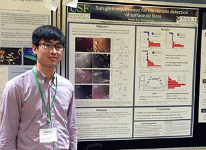
Shaojie presents his research on sun glint requirements for oil film detection at the 2016 Gulf of Mexico Oil Spill & Ecosystem Conference in Tampa, Florida. (Photo by Chuanmin Hu)
Those who have ever photographed the ocean on a sunny day have likely noticed how the reflected sunlight made the water gleam, often distorting the image. Shaojie Sun has quantified this phenomenon, called “sun glint,” to help address a longstanding limitation in scientists’ ability to assess oil seeps and spills using satellite imagery.
Shaojie is a marine science Ph.D. student at the University of South Florida (USF) and a GoMRI Scholar with the C-IMAGE consortium. He describes his journey from coastal China to coastal Florida to aid marine conservation efforts.
His Path

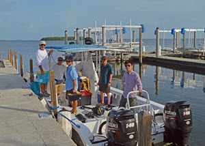
Shaojie (far right) sets off for a three-day research cruise in the Florida Keys with colleagues from the University of Massachusetts – Boston and Florida International University, March 2016. (Photo by Chuanmin Hu)
The son of a fisherman, Shaojie grew up only a ten-minute walk from the seashore. His childhood memories of sailors’ stories and eating fresh seafood inspired him to dedicate his life to protecting the sea for the creatures who live there and the people who earn their livings from it.
Shaojie completed an undergraduate degree in Geographical Information Systems (GIS) at Shandong University of Science and Technology in Qingdao, China, in 2010. A highlight of his undergraduate work was his internship at the Chinese State Oceanic Administration’s First Institute of Oceanography. There, he used the programming language he learned in college to process remote sensing images of coastline islands. He explained, “The details of the high-resolution remote sensing imagery attracted me, and I knew what I had learned could help monitor and improve our marine environment.”
Shaojie’s master’s research at Nanjing University used remote sensing techniques to monitor water quality following a cyanobacteria bloom in China’s Taihu Lake, which impacted over five million people’s drinking water and generated increased attention to water pollution in freshwater and marine environments. While completing this study, the large 2011 oil spill in China’s largest inland sea, Bohai – which consisted of three separate leak events over a two-month period – inspired him to pursue oil spill research. “Considering the Deepwater Horizon oil spill in 2010, I began to think deeply about what we can do, as the marine pollution [events] continued one after another and would not stop in the near future,” he said.
Shaojie completed his master’s degree in GIS and cartography in 2013, feeling strongly that remote sensing would play an important role in combating future marine pollution such as oil spills. He contacted USF’s Dr. Chuanmin Hu, whose papers on optical remote sensing applications he had often cited, about joining his remote oil spill detection research with C-IMAGE as a Ph.D. student and entered the project later that year.
His Work

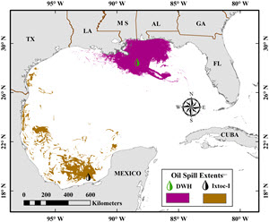
Oil spill footprint map for the Ixtoc I and Deepwater Horizon oil spills. The Ixtoc I oil spill footprint was generated from satellite observations by Shaojie, and the Deepwater Horizon oil spill footprint was based on NOAA data. (Photo provided by Shaojie Sun)
Remote sensing tools can be used to detect the oil’s presence in water but historically struggle to quantify its volume. Previous studies demonstrated that optical imagery could use sun glint effectively to detect oil, yet scientists had not quantified the exact sun glint threshold for the technology to work consistently, and very thin slicks could only be observed at optimal view angles and wind conditions. However, optical remote sensing is a technique that utilizes reflected solar radiation to find surface oil and employs spectral responses to estimate the amount present. “Remote sensing is now serving and will serve as a more and more important part in monitoring and predicting environmental disasters in marine environments.” Shaojie explained, “Volume quantification has been a real challenge to the remote sensing community for decades, but optical remote sensing has shown promising results.”
Shaojie compared multi-sensor data to calculate the sun glint requirement for finding natural oil slicks using the Moderate-resolution Imaging Spectroradiometer (MODIS) and Visible Infrared Imaging Radiometer Suite (VIIRS). He applied the findings using archived Coastal Zone Color Scanner (CZCS) and Landsat/Multispectral Scanner (MSS) data to document the 1979 Ixtoc I oil spill’s footprint and trajectory. “To my knowledge, this is the first time that such information was objectively derived from synoptic measurements enabled by optical remote sensing. The results were used to plan the sediment core sampling locations during a C-IMAGE cruise survey of the Ixtoc I site,” said Shaojie.
His Learning

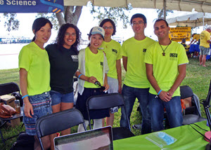
Shaojie (right 2nd) and other USF College of Marine Science students share their research about Ocean Color with the public at the St. Petersburg Science Festival. (Photo by Chuanmin Hu)
“Since remote sensing is interdisciplinary and has connections to most of the oceanographic disciplines, I have a lot of collaborations with researchers in USF’s College of Marine Science and the C-IMAGE community,” Shaojie said. He explained that physical modelers compare their modelling results with the Ixtoc I oil spill coverage map he generated. In turn, he uses their data to validate results from his work. Shaojie also benefited from C-IMAGE researcher Wes Tunnell’s western Gulf field missions during and after the Ixtoc spill, as data from that time period is limited. “The accordance of satellite observations with field records makes the published satellite results more persuasive,” said Shaojie, adding that he gains many other intangible advantages from sharing ideas with fellow researchers.
His Future
Shaojie plans to complete his comprehensive exam this fall and earn his Ph.D. by summer 2018. His long-term plan is to seek a research position in a university or a research institute. “As offshore oil exploration has increased and continues to increase, oil spills are inevitable,” he said. “I hope I will develop some cutting-edge technology for better detection and quantification and for helping decision makers on mitigation efforts and policy implementation.”
Praise for Shaojie
Shaojie’s advisor Chuanmin Hu said Shaojie first came to his attention when he co-authored a manuscript submitted to the journal Applied Optics. Hu, an associate editor, found Shaojie’s optical experiments on particle size characterization impressive. “I was right,” said Hu. “Since his enrollment in fall 2013, Shaojie’s performance has been outstanding in both classwork and oil spill research.” Hu explained that Shaojie has already fulfilled all course requirements, and is now fully dedicated to his dissertation on remote sensing of ocean oil spills, which Hu called an important and challenging research topic.
Hu discussed Shaojie’s remarkable progress on several publications, “One of these filled the knowledge gap about the footprint and trajectory of the 1979 Ixtoc oil spill in the Gulf of Mexico, and another one made cutting-edge progress to define the threshold of remote detection of thin oil films.” He noted proudly that NASA recently awarded Shaojie a fellowship to continue his research on the challenge of quantifying oil volume via optical remote sensing, a difficult problem that must be solved to help direct mitigation efforts. “Shaojie is smart and hard working,” said Hu. “He is always friendly to others, willing to help, and easy to work with in a team. I am very proud of him.”
The GoMRI community embraces bright and dedicated students like Shaojie Sun and their important contributions. The GoMRI Scholars Program recognizes graduate students whose work focuses on GoMRI-funded projects and builds community for the next generation of ocean science professionals. Visit the C-IMAGE website to learn more about their work.
************
The Gulf of Mexico Research Initiative (GoMRI) is a 10-year independent research program established to study the effect, and the potential associated impact, of hydrocarbon releases on the environment and public health, as well as to develop improved spill mitigation, oil detection, characterization and remediation technologies. An independent and academic 20-member Research Board makes the funding and research direction decisions to ensure the intellectual quality, effectiveness and academic independence of the GoMRI research. All research data, findings and publications will be made publicly available. The program was established through a $500 million financial commitment from BP. For more information, visit http://gulfresearchinitiative.org/.
