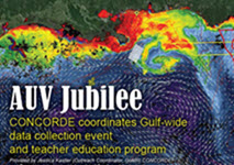
 The AUV Jubilee was a premier event to coordinate autonomous underwater vehicles, known as AUVs or gliders, and other in situ operations in the Gulf of Mexico during July 2015. Called a “big science party,” the name used the term Jubilee to refer to the Gulf Coast phenomenon during which naturally occurring hypoxia pushes fish close to shore, prompting locals to collect seafood with little effort and then celebrate with friends and family.
One goal of the AUV Jubilee was to establish collaboration among scientists across the Gulf to acquire simultaneous ocean observations and leverage separate efforts into creating an integrated data set. A second goal was to provide a technology-rich educational experience for a competitively selected group of teachers who participated in oceanographic sampling and real-time glider operations, followed by curriculum development. The data collection component of the AUV Jubilee was led by the University of Southern Mississippi’s Ocean Weather Laboratory (OWX), while the teacher program was organized through the USM Marine Education Center (MEC). These organizations worked together as part of the GoMRI-funded Consortium for Oil Exposure Pathways in Coastal River-Dominated Ecosystems (CONCORDE).
The OWX hosted a series of daily webinars from July 13-17 to display real-time ocean color and model (HYCOM/NCOM) products, as well as spatial uncertainty estimates. With this system, it is possible to examine the origin and date of river plumes, quantify biomass and physical volume transport, track the movement of bio-optical features, characterize water masses, resolve spatial and temporal variance, and link the bio-physical coupling that ultimately drives ecosystem variability on global scales. During the AUV Jubilee, OWX provided collaborators with this data to expand the collective capacity. Up-to-date locations of various glider and ship/aerial operations facilitated adaptive sampling. During the calls, glider pilots and other participants discussed regional oceanography (i.e., location of river filaments,eddies, high/low chlorophyll regions, surface currents), mission challenges/successes, future way points, data collected (via GCOOS-generated KMZs* with profile data visualized in real time), and comparisons of in situ subsurface features with the surface expression as shown by VIIRS ocean color or model output. In addition to real-time operations, all participants were encouraged to submit data to the National Glider Data Assembly Center (NGDAC), so that the data could be available for assimilation into operational physical circulation models.
The following ten institutions participated: USM (CONCORDE); Rutgers University (CONCORDE); University of South Florida, Mote Marine Lab; Texas A&M; Oregon State University (LADC-GEMM); Skidaway Institute of Oceanography, University of Georgia (ECOGIG); Gulf Coast Ocean Observing System (GCOOS); National Oceanic and Atmospheric Administration (NOAA); Roffer’s Ocean Fishing Forecasting Service, Inc.; Florida Fish and Wildlife Research Institute.
The teacher experience centered on AUV technology and Gulf operations during the week of July 13-17. In addition to interactions with glider pilots during the daily briefings,teachers worked with 28 CONCORDE scientists including senior investigators, post-docs, grad students, and techs. Presentations and land-based demonstrations gave teachers background for a twelve-hour research cruise aboard the R/V Point Sur in the Gulf of Mexico to deploy a glider and use a depth-specific sampler to collect icthyoplankton. During the cruise teachers processed plankton samples and launch the CTD. Glider deployment was postponed because of a steep vertical salinity gradient. This resonated with teachers in how adaptive sampling might avoid loss of expensive instruments. Taken with the differences in plankton samples collected at different depths, the teachers also integrated a strong understanding of the vertical structure of the water column.
These personal lessons were reflected in the educational materials that the teachers began to develop: 1. Gulf of Mexico processes, 2. buoyancy, and 3. ichthyoplankton behaviors and interactions with oil. After piloting and revising the lessons, they will be posted to the CONCORDE website (www.con-corde.org). The group included diverse science teachers from Alabama, Louisiana, Mississippi, Tennessee, and Virginia. They came from coastal and landlocked communities, and represented a mix of schools and student populations—public and private, wealthy and poor. One teacher, flown down for the week at the expense of her public school district, described the state-of-the-art laboratory facilities at her disposal. Another from a poor public district did not even have a sink in her classroom to conduct labs. Research and education groups came together during the daily briefings. During the AUV Jubilee researchers addressed basic teacher questions about nearshore processes and current conditions in the Gulf as well as details of specific technologies and research projects. Uncertain looks teachers gave to the projected map of Gulf current conditions and glider locations at the beginning of the week were replaced just a few days later by awareness, comprehension and reasonable predictions of next moves for the gliders.
CONCORDE, the Consortium for oil spill exposure pathways in Coastal River-Dominated Ecosystems, is a multi-university research team addressing how complex fine-scale structure and processes in coastal waters dominated by pulsed-river plumes control the exposure, impacts, and ecosystem recovery from offshore spills like the Deepwater Horizon release of 2010. CONCORDE is fully funded by a grant from the Gulf of Mexico Research Initiative (GoMRI) RFP-IV.
*KMZ is a file extension for a placemark file used by Google Earth. KM stands for Keyhole Markup language Zipped.