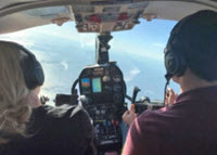
Response decisions during Deepwater Horizon relied on forecasts of where the oil was going and when it would get there. Researchers with the CARTHE consortium have been working to improve the information that goes into making ocean transport forecasts. The group recently completed the last of four field experiments that link the dynamics of deep ocean, shelf, and coastal surface currents, where materials such as oil or debris naturally accumulate, in a way that has never been done before. The aerial observation team (see photo – left) from the University of Brest, France measure sea surface temperature and surface roughness and take visual images of fronts. Their observations assist the ground teams to select exact locations for drifter deployments. The aerial observation team from the University of Brest, France measure sea surface temperature and surface roughness and take visual images of fronts. Their observations assist the ground teams to select exact locations for drifter deployments. Photo provided by CARTHE.
Take a look at the technology that CARTHE researchers use to answer, Where is water going to go in the ocean? Video credit: Waterlust.
Led by chief scientist Jeroen Molemaker, CARTHE conducted a month-long (mid-April to mid-May) experiment named SPLASH (the Submesoscale Processes and Lagrangian Analysis on the Shelf) that involved hundreds of pieces of equipment and nearly as many people. SPLASH took place south of Grand Isle, Louisiana, across the shelf and shelf break, and along bays and inlets west of the Mississippi River Delta. This area has freshwater influx and complex small-scale processes, which heavily influenced where oil did and did not go during the 2010 spill, that are not well understood or represented in forecast models. This is about to change for the better.