Category Archives: CARTHE

This fun and creative lesson plan teaches students how researchers use oceanographic instruments called drifters to study ocean currents and then has them design and build a drifter of their own. The lesson typically spans five class periods (three for building, one for presentation, and one for testing). The lesson plan includes background information, a Read More
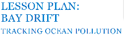
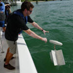
This lesson plan teaches middle and high school students how ocean currents transport debris, spilled oil, and other pollutants through the ocean environment. The lesson uses real data collected during the Biscayne Bay Drift Card Study (Bay Drift), a citizen science study that used Consortium for Advanced Research on Transport of Hydrocarbon in the Environment Read More
Predicting where oil will go can be one of the most challenging aspects of marine oil spill response. Following Deepwater Horizon, research showed that strong currents capable of transporting oil often appear along ocean fronts (the interface between river like-water masses that have different temperatures, salinities, or densities). However, our limited understanding about ocean front Read More
Many factors affect how the ocean moves, and it is especially difficult to know exactly how it will behave in a specific area, as was evident with challenges in predicting oil transport during Deepwater Horizon. The Smithsonian’s Ocean Portal published an article that describes tools scientists use to track currents on and just beneath the Read More
Our knowledge about ocean transport comes primarily from ocean circulation models that use field observations and theoretical motion equations to simulate ocean dynamics. Ocean models can depict large-scale circulation features accurately, but resolutions high enough to capture all scales of motion entail significant computational time and cost and are challenging or even impossible for most Read More
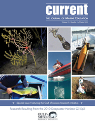
Outreach coordinators from Gulf of Mexico Research Initiative (GoMRI) consortia partnered to produce a special issue of Current: The Journal of Marine Education, published by the National Marine Educators Association (NMEA). The GoMRI-sponsored special issue – titled “Special Issue Featuring the Gulf of Mexico Research Initiative: Research Resulting from the 2010 Deepwater Horizon Oil Spill” Read More
Many ocean forecast models treat the upper 1 meter of the water column, which plays a central role in ocean material transport, as a single layer. However, recent research shows that currents act differently at various depths within this meter. The use of ocean drifters is the oldest way to measure currents, and recent design Read More
Ocean models that utilize surface drifter data can provide oil spill responders with important information about the floating oil’s direction and speed as it moves along the ocean surface. However, surface drifters, like the floating material they represent, tend to cluster along strong fronts and eddies. This clustering can result in important consequences for surface Read More
“Drifting in the Gulf” is an entertaining, educational video about the process of designing new scientific equipment for studying ocean surface currents. Co-created by Consortium for Advanced Research on Transport of Hydrocarbon in the Environment (CARTHE) and Waterlust, the video features the CARTHE drifter designed by University of Miami scientists, who spent two years testing Read More
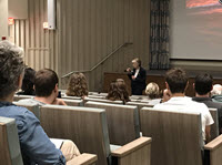
“I was not going to be stopped,” said Dr. Rita Colwell describing how she faced hurdles, many related to being a woman during her 60+ year science career, and blazed paths, including her being the first female director of the National Science Foundation. She spoke earnestly and enthusiastically to faculty, staff, and students gathered for Read More
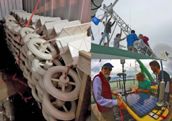
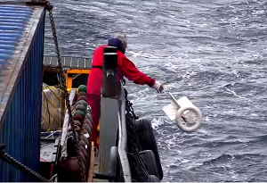
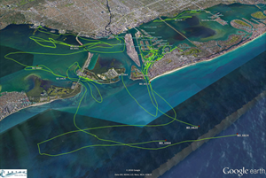
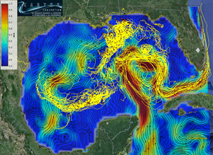
Scientists completed four field experiments in the Gulf of Mexico, linking the dynamics of deep ocean, shelf, and coastal surface currents (where materials such as oil or debris naturally accumulate) in a way that has never been done before. So how did they do that? The team representing 30 universities used 2,000 custom-made, biodegradable, GPS-equipped Read More
In April 2017, GoMRI researchers collaborated on a field experiment focused on better understanding how oil movement and transport is impacted by river fronts. Led by RFP-V investigator Dr. Villy Kourafalou (University of Miami (UM)) and Dr. Tamay Özgökmen (UM and principal investigator of the Consortium for Advanced Research on Transport of Hydrocarbon in the Read More
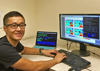
Researchers use numerical models to simulate oil spill scenarios and predict where oil will go, but the many factors that affect the oil’s path create uncertainty in the predictions. Shitao Wang quantifies the uncertainty of ocean models to gauge the reliability of oil fate predictions. “It’s like a weather prediction. Instead of saying whether or not it Read More
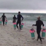
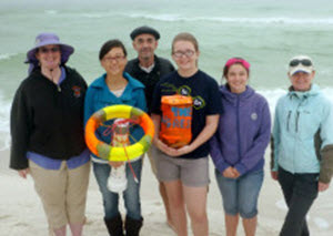
The Bay Drift Project is a citizen-science experiment that uses drift cards to help determine the origins of the trash that washes up on the Vizcaya Museum and Garden’s shoreline. CARTHE Consortium representatives and Vizcaya hosted an event to highlight results from the project’s first year and to prepare drift cards and identify goals for Read More
This video highlights the tools and techniques that modern researchers use to study ocean currents and develop more accurate ocean circulation models. Watch the video here.
Response decisions during Deepwater Horizon relied on forecasts of where the oil was going and when it would get there. Researchers with the CARTHE consortium have been working to improve the information that goes into making ocean transport forecasts. The group recently completed the last of four field experiments that link the dynamics of deep ocean, shelf, Read More
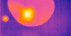
Nova Southeastern University researcher Alexander Soloviev and his team generated a short clip in infrared imagery demonstrating how crude and weathered oil slicks respond to dispersant application. Read the post here! Watch the video!
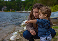
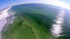
It’s almost like a game of tug-of-war. There are growing numbers of residents, tourists, and industry at one end and the environment where people live, work, and play at the other. When the former increases, the latter is stressed. This scenario plays out all over the world, especially in coastal areas. Biscayne Bay near Miami, Read More
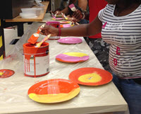
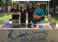
Consortium for Advanced Research on Transport of Hydrocarbon in the Environment (CARTHE) teamed up with Project Give Kids (PGkids) to expose a bright group of foster kids, ranging in age from 1st grade to high school, to the amazing world of marine science. The students started the day with CARTHE outreach manager, Laura Bracken, who Read More
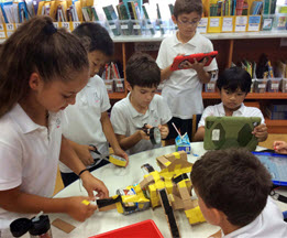
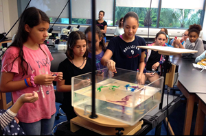
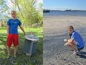
The Dispersion Research on Oil: Physics and Plankton Studies (DROPPS) Consortium had another successful collaboration with the Consortium for Advanced Research on Transport of Hydrocarbon in the Environment (CARTHE) for the UT Summer Science program! We taught 3rd-4th graders about how oil spill scientists sometimes use drift cards to study oil spills to see where Read More
Communicating oil spill research is essential to improve society’s understanding about spills and their ability to respond to and mitigate them. The Gulf of Mexico Research Initiative (GoMRI) has been funding spill-related research since 2010. Here are ten outstanding education products and resources that GoMRI and its science community have developed to share what they Read More
The Consortium for Advanced Research on Transport of Hydrocarbon in the Environment (CARTHE) conducts unprecedented experiment to improve oil fate models. Predictions for decisions – our world relies on them, from daily weather to annual financial forecasts. Predictions, though, are only as good as the information that goes into making them. And those predictions carry Read More
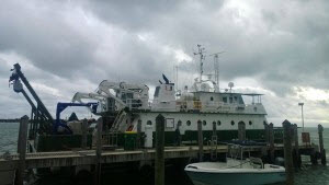
Graduate student Nathan Laxague’s recent posts to the CARTHE blog describe the methods, experiences, and challenges of researchers working on the ongoing LASER expedition. You can read his entries here and here to keep up with the project’s development. Excerpt from the CARTHE Blog: “… Walton Smith is somewhere off the middle Keys, dressed to the nines with fancy Read More
This past Saturday we had the pleasure of participating in the annual Exploring Marine Science Day for 6th-7th grade girls, organized by the University of Miami Rosenstiel School of Marine & Atmospheric Science and the Consortium for Advanced Research on Transport of Hydrocarbon in the Environment (CARTHE). We taught 50 girls from different Miami junior Read More
Bryan Hamilton never planned to be a microbiologist, but when the opportunity arose to study microbes that produce biosurfactant in response to oil exposure, he was drawn in completely. His research investigated the potential connection between these microbes and natural surface slicks and if this connection could help scientists detect oil below the water’s surface. Read More
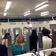
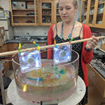
Earlier this month, South Florida teachers attended the Center for the Integrated Modeling and Analysis of the Gulf Ecosystem (CARTHE)-hosted science visualization workshop at the University of Miami, intended to help create improved future resources for sharing science. The workshop featured CARTHE science, NOAA’s global drifter program, RECOVER consortium, University of Miami Rosenstiel School scienitists Read More

Alek stands next to a map of his research area, holding the drift cards he used in his oil spill study in front of a nautical chart of the Salish Sea. (Provided by Alek) Fueled by a passion for science and endangered species, Alek designed and executed a research project that involved scientists from eight Read More

A fourth grade class at Singapore American School found Bob the Drifter and the CARTHE science group while researching ocean science and pollution online. CARTHE’s drifter experiments, GLAD and SCOPE, are helping scientists understand how ocean surface currents move pollutants such as oil. CARTHE’s visually-engaging experiments and their animated, data-gathering mascot “Bob” motivated these young students Read More

One of the most significant outcomes of the Gulf of Mexico Research Initiative (GoMRI) has been the fostering of a multi-disciplinary collaborative academic community ready to put science into practice. Members of the GoMRI community have been cultivating relationships with emergency responders so that science gets to the right people at the right time. These Read More
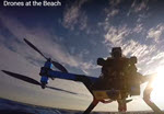
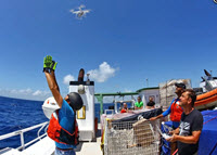
The Gulf of Mexico Research Initiative congratulates the CARTHE research team for their first place award-winning video that teaches Drone Technology for Oil Spill Research. Over 37,000 middle school students across twenty-one countries selected the winning ocean science research videos after a two-month evaluation of the top entries that best explained scientific results and significance. Read More
After the Deepwater Horizon oil spill, many Gulf residents wanted to know where the oil was going and how fast it would get there. Conor Smith is improving the accuracy and turn-around time of satellite-derived surface current velocity estimates for better ocean transport information. Conor is working toward a method that accurately interprets these velocities Read More
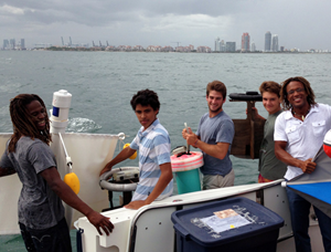
What do the Consortium for Advanced Research on Marine Mammal Health Assessment (CARTHE), the International SeaKeepers Society, and Fleet Miami have in common? Ocean research! Last September, CARTHE researchers from the University of Miami Rosenstiel School partnered with SeaKeepers and Fleet Miami to widen the reach of ocean and oil spill research in the local Read More
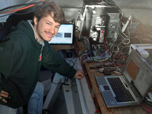
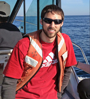
Nathan Laxague studies a small-scale subject matter that has potentially large-scale applications. Capillary waves – or ripples – on the ocean surface can indicate the presence of a film or oil slick on the water’s surface, making them “an important link in the chain of oil spill response.” Nathan is a physics Ph.D. student at Read More
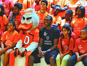
NBA Champion James Jones took the stage for young fans this July, but not to talk about sports. Instead, his goal was to get kids excited about cutting-edge science happening in their home town. Over 40 kids participated in his week-long Crew 22 Training Camp hosted by the University of Miami Rosenstiel School of Marine Read More
Synthetic aperture radar (SAR) is now commonly used for operational oil spill monitoring. During major spills, SAR data from different satellites give an overview of the areas affected and provide information on the direction in which surface oil is drifting. SAR is also used to monitor illegal discharges from ship traffic or offshore operations. In Read More
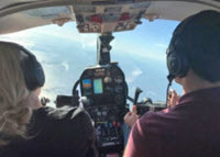
Scientists from the University of Miami have been visiting our area for the last three weeks studying the movements of ocean currents along the coast in order to observe how they carry oil, fish larvae or toxins in the water. On this particular day, 7th grade science students from Episcopal Day School in Pensacola were Read More
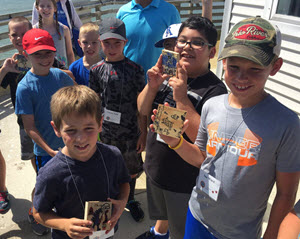
It was a tall order, but high school students rose to the challenge: they integrated physics, engineering, and scientific curiosity and created functional data-gathering drifters. They also became part of a scientific effort to improve predictions of how oil moves through coastal waters and onto shores. In December at Ft. Walton Beach, Florida, scientists deployed Read More
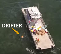
Researchers studying the movement of ocean flows use a variety of tools and technologies to collect accurate data. Drifters are tools that report their location, speed, and in some cases water conditions as they are carried by ocean currents. The data collects by drifters can help improve models that predict the movement of objects or Read More
Scientists conducting GoMRI-funded oil spill research take their mission regarding society seriously: They employ cutting-edge technology to collect and analyze data using rigorous scientific parameters and publish their findings. But there are other ways these researchers define success, like working with students. When young students seek answers to scientific questions and contact them, these scientists Read More